Many Additions and Updates 2019

The Encyclopedia has made substantial improvements in 2019. First, the development of “suggested search terms” with over 100 keywords leading to thousands of articles. The keywords have been reduced to single words to work easily on PC and IOS platforms. Hundreds of links within the Encyclopedia have been added, now totaling 3,000, connecting to additional…

Columbia Falls

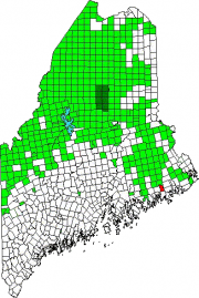
Location Map For Columbia Falls

Year Population 1970 367 1980 517 1990 552 2000 599 2010 560 Geographic Data N. Latitude 44:40:23 W. Longitude 67:42:49 Maine House District 138 Maine Senate District 6 Congress District 2 Area sq. mi. (total) 24.7 Area sq. mi. (land) 24.5 Population/sq.mi. (land) 22.9 County: Washington Total=land+water; Land=land only [kol-UM-bee-ah FALLS] is a town in…

Williamsburg Township

This township is in southern Piscataquis County, just west of Brownville. Originally Williamsburg and Barnard were within Number Six, Range Eight township, and adjoined Brownville on the west.  In 1834 the original township was split when Barnard and Williamsburg each became incorporated towns. In 1939, in the midst of the Great Depression, Williamsburg gave up…

Barnard Township

This is a small, irregular boot-shaped township north of Sebec in Piscataquis County. Barnard Corner is a modest village in the southeast.  The only improved road is a north-south stretch of about four miles with three names: Sebec Village Road (south), Barnard Road (middle) and Austin Road (north). The landscape contains no lakes, ponds, or mountains.…