Stockton Springs

Penobscot Bay from the small museum at Fort Point (2007)

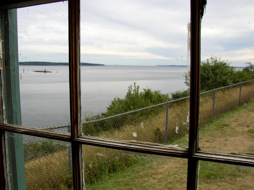
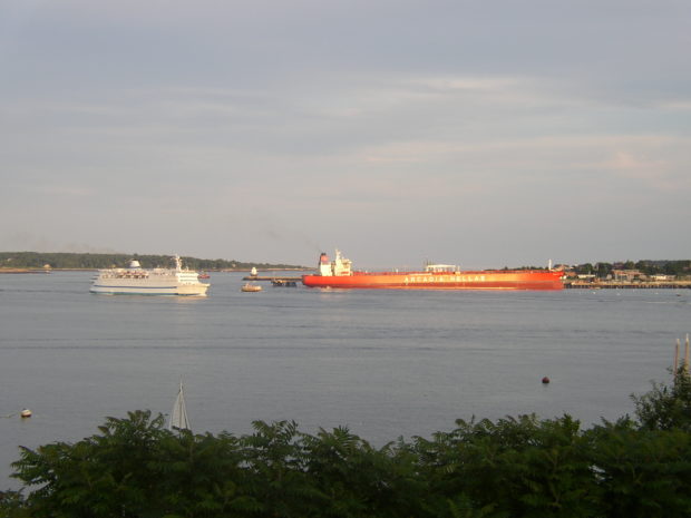
The town lies at the junction of U.S. Routes 1 (east to Bucksport) and 1A (north to Bangor). See photos. Fort Point is a peninsular, just north of Sears Island, that extends almost to the center of Penobscot Bay at its northerly reaches. British Governor Pownall built Fort Pownall there in 1759. Fort Point State Park marks the southern end of Fort Point Cove. Sandy Point Beach is at the northern reach of the cove.

Stockholm

Named for the Swedish capital, the village lies on the Little Madawaska River, just off Maine Route 161 and just north of New Sweden, also part of the Colony. The village, essentially off the main highways, is not “on-the-way” to anywhere. This small community, with a continued significant reliance on agriculture and a declining population, still supports three churches: Catholic, Baptist, and Lutheran.

Topsfield

Location Map for Topsfield

The village is at the intersection of north-south U.S. Route 1 and east-west Maine Route 6. Logging and hunting are major activities in this rural community. Topsfield has substantial resources in the long shoreline of Baskahegan Lake and the two smaller lakes: East Musquash and Farrow.

Steuben

Veterans

This Washington County fishing and summer residential community projects two peninsulas (Dyer Neck and Petit Manan Point) divided by Dyer Bay into coastal waters. See photos. A small section of Penobscot Indian Territory is located at Dyer Harbor on Dyer Neck. The main village lies at the head of Gouldsboro Bay on U.S. Route 1.

Standish

Daniel Marrett House (one of several historic buildings) in Standish, on East Ossippee Trail (2018)

Named in honor of Captain Miles Standish, the military leader of the Plymouth Colony, the town has a very long shoreline on Sebago Lake in its southwest corner, including its Lower Bay. See photos. In the 19th century, the Oxford-Cumberland Canal allowed passage of boats from Harrison to Portland. Steep Falls was a thriving village historically, with its excellent water power on the Saco River and the railroad station in its midst. Both a recreational area and suburb of Portland, the town is served by six Maine highway routes.

Stetson, Charles

Charles Stetson (1801-1863) a U.S. Representative, was born in New Ipswich, New Hampshire on November 2, 1801. He moved with his parents to Hampden in 1802, attended Hampden Academy and was graduated from Yale College in 1823. He studied law, was admitted to the bar and began his practice in Hampden in 1826. He was…

Stetson

Road to Stetson Shores Campground (2014)

Just 20 miles northwest of Bangor and adjacent to Newport, the town is a growing, but still rural community. Settled in 1800, it was soon organized as a plantation for election purposes. The post office opened in 1829. In the 1880’s Stetson was home to three sawmills, a grist mill, Stetson Cheese Factory, and a carriage factory.

State Parks

Camden Harbor (2001)

and other public outdoor recreational areas State Parks Allagash Wilderness Waterway (Aroostook County). A canoe camper’s paradise. This 92-mile corridor of lakes and river is surrounded by a vast commercial forest. If you plan to canoe the Allagash, contact the Maine Bureau of Parks and Lands. Aroostook State Park (Presque Isle). On Echo Lake. Swimming,…

Starks

The New Vineyard Mountains from Route 43 (2003)

A farming town, Starks once boasted a canning factory to which farmers would bring corn, squash, pumpkins, and other produce each fall. See photos. The “corn shop,” as it was known, closed in 1964. The now abandoned Grange Hall was the site of many community dances and socials at least through the 1950’s. The winding Sandy River, the site of several ferry crossings, constitutes the town’s eastern boundary. A small chapel is located near an old cemetery on the River Road.

Stanwood, Cornelia

Stanwood Homestead and Sanctuary Entrance (2013)

(1865-1958), was a well-respected Maine ornithologist. At the age of 48, she found her true calling in life – the study of birds. After floating through one teaching job after another for 17 years, and a nervous breakdown, she remembered her childhood love of the outdoors and of the beautiful birds and their musical songs.…

St. John River

St. John River at Van Buren (2003)

begins, in its Southwest Branch, from Little St. John Lake in the unorganized township of T5 R20 WELS on Maine’s northwestern border with the province of Quebec, Canada. The Northwest Branch is born in Beaver Pond in the northwestern township T12 R17 WELS. This Branch is joined by the Daaquam River flowing from Quebec. The…

St. John

Location Map for St. John

With the St. John River as its northern boundary, the town is located nearly at the end of Maine Route 161, a dead end road that travels west from Fort Kent to serve the small communities along the River. The Plantation has several modest sized lakes, including Wallagrass Lakes (Lakes 1 and 2) in the southeast, Wheelock Lake in the northeast, and Hunnewell Lake in the west. It hosts two lots of Maine Public Reserved Lands totaling 1,167 acres.

Southern Maine Community College

Sign for SMCC (2012)

located in South Portland, is one of several community colleges across the state.  It was formerly know as Southern Maine Technical College, but has expanded its offerings to include additional academic courses. The college has been in existence since the mid-twentieth century and had a student body of over 7,000 in 2012.  Its Mid-coast Campus…

South Portland

A residential community serving the greater Portland area for over a hundred years, the City has developed independent economic resources. See photos. It is part of the Port of Portland and home to a major railroad yard and fuel tank storage facility. The Southern Maine Community College campus includes Fort Preble, named for Commodore Edward Preble.