Dead River TWP
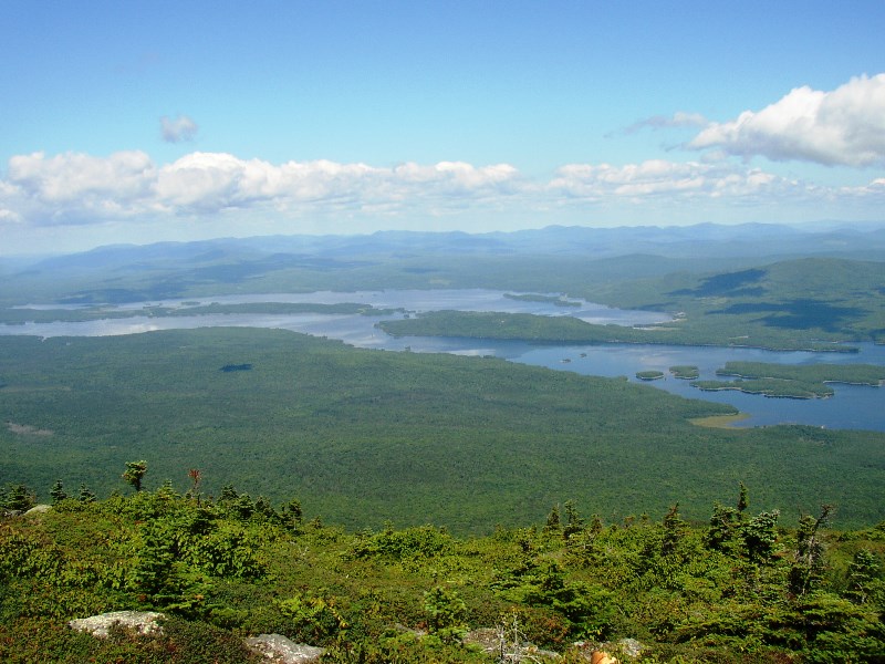
Flagstaff Lake from Bigelow Mountain (2003) The township is immediately west of Carrying Place Town Township, host to the next northerly section of the AT. Little Bigelow Mountain, Myron H. Avery Peak, and West…
"Those seeking cold, hard statistics on Maine communities won't be disappointed." —Bangor Daily News
Flagstaff Lake from Bigelow Mountain (2003) The township is immediately west of Carrying Place Town Township, host to the next northerly section of the AT. Little Bigelow Mountain, Myron H. Avery Peak, and West…
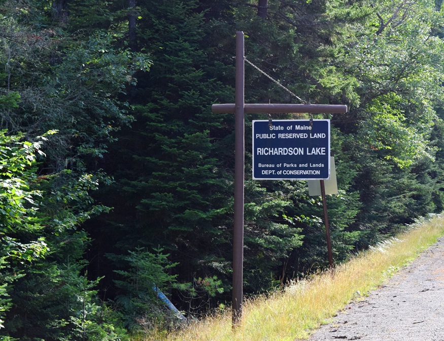
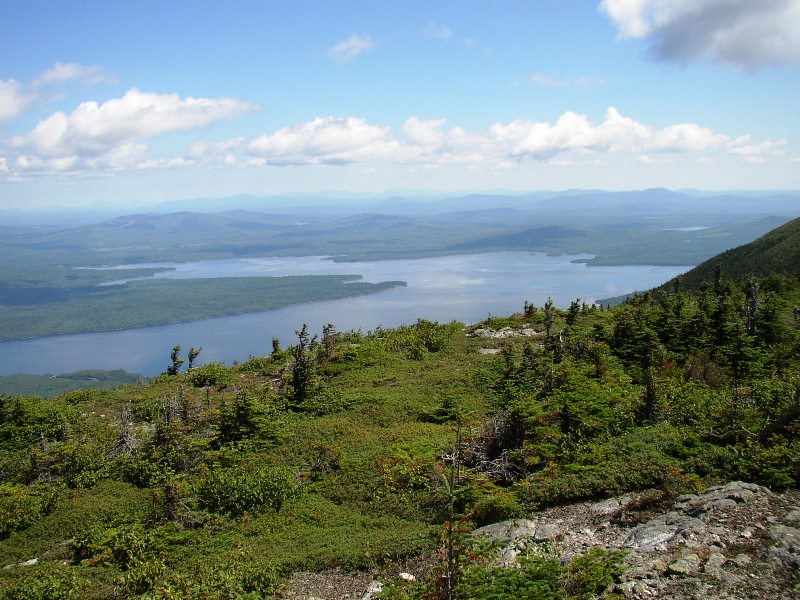
This western Maine township in Oxford County near New Hampshire is just east of Magalloway Plantation. It encompasses Upper Richardson Lake with shore frontage on Mooselookmeguntic Lake. Upper Richardson Public Reserved Land is located north of the small village of Upper Dam. The State of Maine’s lake survey combines data for Upper and Lower…
This is not Cedar Lake (an error) This small Bigelow (Township) in Somerset County township in Somerset County encompasses the northern section of the Bigelow Preserve of Maine Public Reserved Land. With no improved roads, access is from Stratton Village along the Old Dead River Road. One is soon at campsites and a trailerable…
")
This township in Oxford County is the site of Upper Richardson Maine Public Reserved Land and miles of lake shore on Cupsuptic and Mooselookmeguntic lakes. Route 16 cuts a diagonal northeast-southwest swath through the township. West Richardson Pond is…
 N45° 19")
The Chain of Ponds Lake consists of four basins arranged in a straight line that runs northwest to southeast. It covers 700 acres and drains 64.5 square miles. The maximum depth is 106 feet, and the average depth is 24 feet. A 300 foot long, ten foot tall, dam at the outlet of Lower Pond…
Not to be confused with the town of Eagle Lake in Aroostook County, Eagle Lake Township lies to the southwest in Piscataquis County. It too has frontage on another waterbody named Eagle Lake and includes part of the Allagash Wilderness Waterway and a small portion of Chamberlain Lake. A narrow stretch of Maine Public Reserved…
 on Route 11 (2014) N45° 31")
Piscataquis County Line Entering T4 R9 WELS Community This township is in north central Maine in Piscataquis County. It is dominated by Seboeis Lake and the Seboeis Maine Public Reserved Land, which surrounds most of the Lake. Two small settlements, Schoodic and Packards, are in the west of the township along…
 (2008)")
North Maine Woods In addition to be a general term for the forests of northern Maine, North Maine Woods is an organization that manages access to a specific area of mostly privately own land. Land Ownership The complicated historic land ownership in…

Etienne Orson was a settler in the area around 1793. McCauley reports that the name came from a mispronunciation of Etienne. In the township-range system it is T6 R7 NBKP. The U.S. Census reported a single resident in 1870, five in 1900, fifteen in 1910, eighteen in 1920, and fifteen in 1930, the last report…
East of Baxter Park, it is home to Katahdin Woods & Water Recreation Area, Sandbank Campsite, Wassataquoik Public Reserved Land, and Whetstone Falls. West of Stacyville, access is by Swift Brook Road and a network of dirt roads.

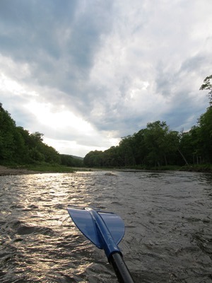
T3 R4 BKP WKR This township hosts the Long Falls Dam on the Dead River. That dam maintains the level of Flagstaff Lake, but required the removal of the village of Flagstaff, which was flooded as a result of its construction.. There was a small natural lake at Flagstaff. In 1950, Central Maine Power Company…
")
is both an unorganized township and a lake created by the Seboomook Dam. Just north of Moosehead Lake, half the township and all of the lake are in Maine Public Reserved Land protective status. The 6,880-acre lake has over 69 miles of shoreline, with the dam at its eastern end where it spills into the…

Located northwest of Caribou, this small community is accessible off State Route 161 that passes through nearby New Sweden. It was part of the “Swedish Colony” established in the 1870’s. The township is bisected with the Little Madawaska River flowing from southwest to northeast. A section of Maine Public Reserved Lands is a 965-acre original public lot, mostly covered by forest, near the southwest shoreline of lower Madawaska Lake.
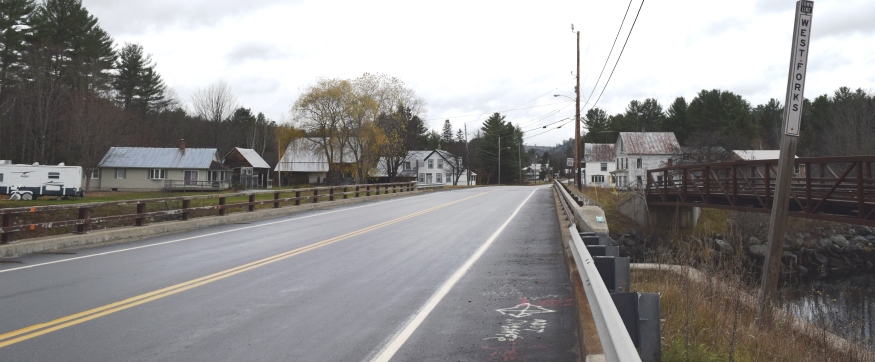
West Forks lies north of the Dead River and west of the Kennebec just above where the two rivers combine at The Forks. See photos. The heavily forested area with a small and dwindling population is bisected by U.S. Route 201 on its way north to Jackman, then to the Province of Quebec.
Three sections of Maine Public Reserved Lands totaling 1,204 acres are located on the west side of U.S. Route 201.
This sparsely populated plantation in Penobscot county is primarily marshlands and streams, with the exception of Tucker Ridge and Pickle Ridge where Tucker Ridge Road and Pickle Ridge Road serve the plantation’s residents. It contains a portion of the Mattawamkeag River System Wildlife Management Area and the “Webster Lot” of Maine’s Public Reserved Land.

With the St. John River as its northern boundary, the town is located nearly at the end of Maine Route 161, a dead end road that travels west from Fort Kent to serve the small communities along the River. The Plantation has several modest sized lakes, including Wallagrass Lakes (Lakes 1 and 2) in the southeast, Wheelock Lake in the northeast, and Hunnewell Lake in the west. It hosts two lots of Maine Public Reserved Lands totaling 1,167 acres.

The small Seboeis village is nearly at the end of the Seboeis Road, which leads north in Howland from the North Howland Road. The village is less than a mile from the shore of South Branch Lake, where there is a boat launch. Seboeis Public Reserved Land of 15,628 acres provides opportunities for boating, camping, fishing, hunting, snowmobiling, and watching wildlife.
 N45° 40")
The village is located on Maine Route 17 near the Mattawamkeag River and on the Wytopitlock stream. Other than Route 17, which runs through the through the western portion north to U.S. Route 2A, the Bancroft Road travels northeast from Wytopitlock to the Bancroft town line. These are the only improved roads. Two lots of Maine Public Reserved Land lie within the plantation: the 996-acre Thompson Deadwater Lot and the 539-acre Central-Wytopitlock Lot.
 N44° 54")
Just south of Rangeley, the plantation’s South Shore Road runs along the south shore of Rangeley Lake and east-west across the northern section of the plantation. Rangeley Lake State Park occupies part of the shore near South Cove. Access to the Bald Mountain Trail is from the park.
")
The town is at the center of the Rangeley Lakes Region with many hotels, campsites, boat launching facilities and recreational opportunities. See photos. The region was the setting for Louise Dickenson Rich’s 1942 book We Took to the Woods. It hosts Hunter Cove nature preserve and Bald Mountain public reserved land.