Topsfield

Location Map for Topsfield

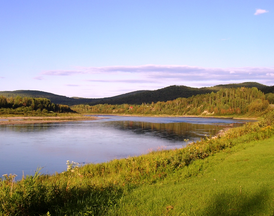
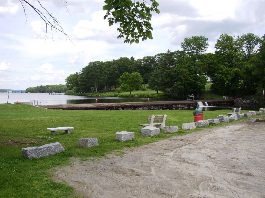
The village is at the intersection of north-south U.S. Route 1 and east-west Maine Route 6. Logging and hunting are major activities in this rural community. Topsfield has substantial resources in the long shoreline of Baskahegan Lake and the two smaller lakes: East Musquash and Farrow.

Steuben

Veterans

This Washington County fishing and summer residential community projects two peninsulas (Dyer Neck and Petit Manan Point) divided by Dyer Bay into coastal waters. See photos. A small section of Penobscot Indian Territory is located at Dyer Harbor on Dyer Neck. The main village lies at the head of Gouldsboro Bay on U.S. Route 1.

Standish

Daniel Marrett House (one of several historic buildings) in Standish, on East Ossippee Trail (2018)

Named in honor of Captain Miles Standish, the military leader of the Plymouth Colony, the town has a very long shoreline on Sebago Lake in its southwest corner, including its Lower Bay. See photos. In the 19th century, the Oxford-Cumberland Canal allowed passage of boats from Harrison to Portland. Steep Falls was a thriving village historically, with its excellent water power on the Saco River and the railroad station in its midst. Both a recreational area and suburb of Portland, the town is served by six Maine highway routes.

Starks

The New Vineyard Mountains from Route 43 (2003)

A farming town, Starks once boasted a canning factory to which farmers would bring corn, squash, pumpkins, and other produce each fall. See photos. The “corn shop,” as it was known, closed in 1964. The now abandoned Grange Hall was the site of many community dances and socials at least through the 1950’s. The winding Sandy River, the site of several ferry crossings, constitutes the town’s eastern boundary. A small chapel is located near an old cemetery on the River Road.

Stanwood, Cornelia

Stanwood Homestead and Sanctuary Entrance (2013)

(1865-1958), was a well-respected Maine ornithologist. At the age of 48, she found her true calling in life – the study of birds. After floating through one teaching job after another for 17 years, and a nervous breakdown, she remembered her childhood love of the outdoors and of the beautiful birds and their musical songs.…

St. John

Location Map for St. John

With the St. John River as its northern boundary, the town is located nearly at the end of Maine Route 161, a dead end road that travels west from Fort Kent to serve the small communities along the River. The Plantation has several modest sized lakes, including Wallagrass Lakes (Lakes 1 and 2) in the southeast, Wheelock Lake in the northeast, and Hunnewell Lake in the west. It hosts two lots of Maine Public Reserved Lands totaling 1,167 acres.

South Portland

A residential community serving the greater Portland area for over a hundred years, the City has developed independent economic resources. See photos. It is part of the Port of Portland and home to a major railroad yard and fuel tank storage facility. The Southern Maine Community College campus includes Fort Preble, named for Commodore Edward Preble.

St. George

In a park near the town office, St. George and the dragon reenact their famous battle. See photos. The Fort St. George’s memorial is nearby.St. George was the site of granite quarries and was the birthplace of the Granite Cutters Union in 1877, the first in the state’s history. The town may be better known by some by its villages of Port Clyde, at the southern tip of its long peninsular, and Tenants Harbor.

St. Francis

St. Francis down the St. John River from Allagash (2003

The St. Francis River, which forms the northeastern border with Canada along with the St. John River, joins the St. John at the town of St. Francis. Across the St. John lies Madawaska County, New Brunswick. The St. John River forms the northern boundary of this small community, which has been declining in population for the past two decades. It is the last organized town on Route 161, which follows the St. John River from Fort Kent.

Stacyville

Mount Katahdin and Hunt Mountain from Swift Brook Road in Stacyville (2017)

Its main village is Sherman Station on the Bangor and Aroostook Railroad line and Maine Route 11 just across the town line from the Town of Sherman. Stacyville Village is in the southwest of the township; Siberia village is in the center on the Grindstone Road. That portion of Route 11 in Sherman Station Village serves as the “Main Street” for the town, with community buildings and businesses.

Springfield

Wind Turbines on Rollins Mountain from Weatherby Hill on Route 6 in Springfield (2014)

Located on the east-west Maine Route 6 crossing eastern Penobscot and northern Washington counties, the town has a substantial area in wetlands. See photos. One account has the name commemorating “extensive fields abounding in springs.” The village is centered around the crossroads of Route 6, Park Street (Routes 169/170), and Shep Road.

Southwest Harbor

Location Map for Southwest Harbor

It lies on the southwest entrance to Somes Sound, diagonally across from Northeast Harbor, a village in the town of Mount Desert. Southwest Harbor has been both a fishing and summer resort community from its earliest days as a town. See photos. Maine Route 102 begins at entrance to Mount Desert Island and leads directly south to the main village of Southwest Harbor. Here the Wendell Gilley Museum celebrates the life and work of Gilley, a pioneer of decorative bird carving. South of the harbor, the small villages of Manset and Seawall face the entrance to Somes Sound and the Cranberry Isles.

South Thomaston

The town lies on the Weskeag River, which broadens into several large coves before emptying into the Muscle Ridge Channel. In addition to the main village, Pleasant Beach, Waterman Beach, and Spruce Head villages hug the shore on Penobscot Bay. Spruce Head Island, connected to the mainland by a bridge, juts into Muscle Ridge Channel, a favorite passage for boaters seeking the protection of the outlying islands.

South Bristol

Boats and Osier

The Darling Marine Center of the University of Maine is located in the village of Walpole. See photos. The population centers in the town’s southern most reaches are on Rutherford Island, perched at the end of a peninsular. The community is home to three nature preserves. Plummer Point is a 74 acre wooded peninsula with over a mile of shoreline. The Tracy Property is a town park with public access to the Damariscotta River. The wooded 18-acre Witch Island Sanctuary, provides two beaches and views of Johns Bay.

South Berwick

Counting House Day Lily Memorial Park at the Salmon Falls River (2018)

Maine’s oldest educational institution, Berwick Academy, was established here in 1791 when the town was part of Berwick. See photos. South Berwick is the birthplace of Sarah Orne Jewett, who attended Berwick Academy for four years — her only formal education. The town is accessible to the coastal communities of York and Kittery via Maine Routes 91 and 236.

Sorrento

Sorrento Harbor (2004)

Sorrento sits on Waukeag Neck, on Maine Route 185 south of Sullivan. See photos. The neck juts into Frenchman’s Bay with spectacular views of the mountains in Acadia National Park. Sorrento Harbor is a centerpiece of the community, especially when the “summer people” return and the water fills with pleasure boats. The town hosts two nature preserves in Sorrento Harbor, both maintained by the Nature Conservancy: Dram Island, is home to nesting osprey; Preble Island is densely forested with eagles roosting.

Somerville

School and Town Office (2003)

The Sheepscot River runs through the western portion of the town, and through Somerville Village itself. It widens into Long Pond (once known as Patricktown Pond), on which the town has substantial frontage. See photos. Somerville is east of Windsor on Maine Route 105, and north of Jefferson following Maine Route 206 to 105. This rural town has had a small, but growing population. Since the 1970’s it has grown to two and a half times its size then.

Solon

Interior of South Solon Meeting House, 121 South Main Street in Solon (2003)

Solon, Maine is a town in Somerset County, incorporated on February 23, 1809 from the township T1 R2 EKR. Settled in 1782 by William Hilton of Wiscasset, it was named for one of the great sages of Ancient Greece, in keeping with its neighboring town of Athens.

Smyrna

Farm Buildings in Smyrna (2003)

Named for a famous city in ancient Turkey, the town is west of Houlton on Interstate 95 and on U.S. Route 2, where the village of Smyrna Mills straddles the town line with Merrill. See photos. The town has become home to a substantial number of Amish people, who farm and work using simple, low technology methods. The Mattawamkeag River flows through the village. In the river is the ruins of an old dam and mill.