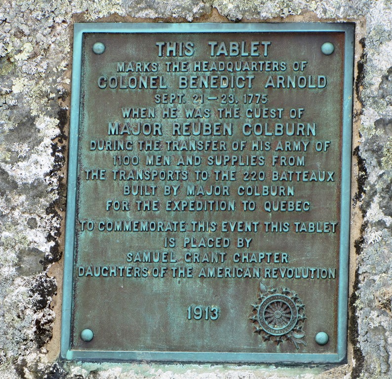
Carrying Place Township

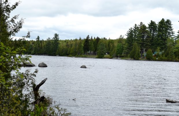
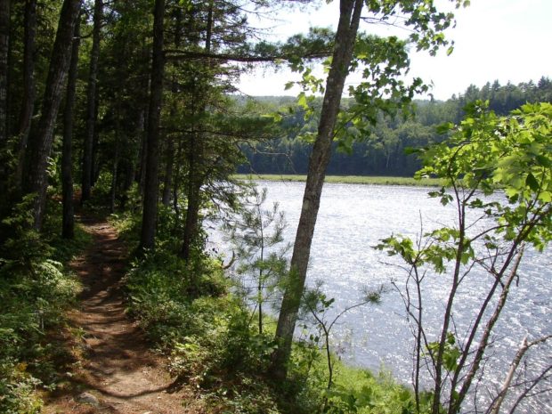
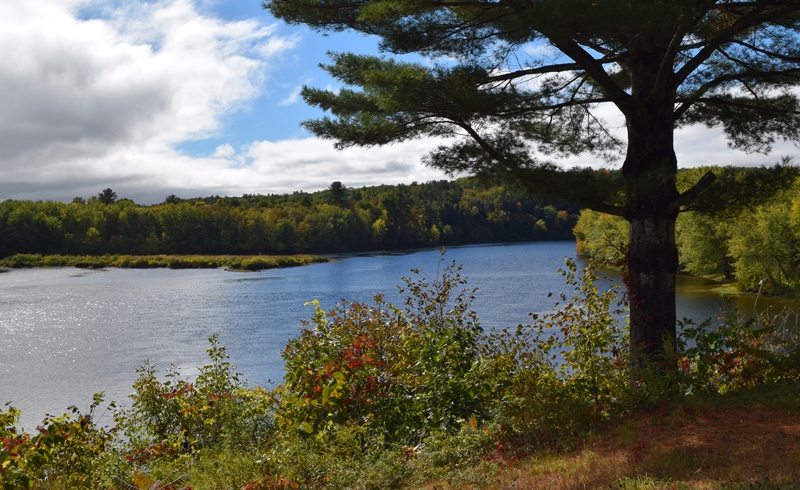
The township is immediately west of the Kennebec River, across from Caratunk, host to the next northerly section of the Appalachian Trail.  Access by road begins across the river from Bingham. A right turn  brings one to the Carry Pond Road, which proceeds north and becomes a gravel traveled way. The right fork about three…

Caratunk

in Somerset County lies 40 miles north of Skowhegan on the Kennebec River, where both Pierce Pond Stream and Pleasant Pond Stream enter. The Appalachian Trail crosses the river aided by a canoe shuttle. Benedick Arnold marched through on his way to Quebec. See video and photos.

Norridgewock

Kennebec River (2018) downstream from The Pines in Old Point in Norridgewock near the British massacre of the Indian village in 1724.

The village straddles a bend in the Kennebec River at the junction of Maine Routes 8 and 139, and U.S. Routes 2 and 201A. See photos. The Sandy River empties into the Kennebec in the town. Benedict Arnold’s expedition passed through in 1775. Norridgewock was the home of author Rebecca “Sophie May” Clark, and U.S.Representatives Cullen Sawtelle and Stephen D. Lindsey.

Madison

Madison Paper Industries (2009)

The site of many mills in its history, its largest has been a paper mill at the dam where U.S. Route 201 crosses the Kennebec River from Anson. Until the end of the log drives in 1976, the river was often choked with pulp logs destined for this mill and others. The Lakewood Summer Theater, opened in 1901 in East Madison. Benedick Arnold passed through on his way to Quebec.

Skowhegan

Recorded as Skwahegan in early reports, the name means “watching place for fish,” drawn from the falls in the Kennebec River that harbored salmon. See photos. Local Indians speared them as they attempted to scale the falls. Textile and shoe manufacturing were major employment options for local residents during the late 19th and early 20th centuries. Once home to Camp Modin, a camp for Jewish boys and girls until 1992, Lake George Regional Park is split between Skowhegan and Canaan.

Winslow

Winslow is on the east side of the Kennebec River, across from Waterville, on Routes U.S. 201 and Maine routes 32, 100, 100A, and 137. See photos. A reconstructed blockhouse of Fort Halifax, which incorporates many original timbers, stands on the fort’s original site.

Vassalboro

has sufficient space to support farming as well as serving as a residential area for people working in Augusta and Waterville. See video and photos. Benedict Arnold stopped here to obtain a canoe on his way to Quebec. Site of Oak Grove Seminary in 1844, then Oak Grove Coburn school in 1970, then the Maine Criminal Justice Academy in 2001.

Pittston

Historical Marker: Headquarters of Benedict Arnold Expedition September 21-23, 1775 (2013)

The Reuben Colburn House in Pittston, Maine is the site of one of the original settlements in Maine. Built in 1765, it was one of the first on the east side of the Kennebec River in an area later known locally as Colburntown. See photos. The house and carriage house is now owned by the Arnold Expedition Society. The village of East Pittston is located on the Eastern River near the town line with Whitefield. Route 194 serves the village and the Pittston Fair Grounds nearby.

Dresden

Kennebec River at the Pownalborough Court House, (2010)

is site of the 1761 Pownalborough Courthouse, the first built in Maine, visited by future President John Adams, Daniel Webster, and Benedict Arnold on his way to Quebec. The Earle R. Kelley Wildlife Management Area and the Dresden Bog are here in the area first settled in 1752.

Richmond

The main village is located on the west side of the Kennebec River, just south of Gardiner on Maine Route 24, where the river splits to form Swan Island. See photos.Benedict Arnold’s expedition, having first landed at Swan Island in the river across from the town, passed by the remnants of Fort Richmond. The town has a substantial collection of grand houses, including several Greek Revival specimens. Peacock Beach State Park is near the historic Peacock Tavern on U.S. Route 201.

Islesboro

Islesboro Ferry Terminal (2014)

is the marker for dividing East Penobscot Bay from West Penobscot Bay. It includes North and South Islesboro connected by a narrow segment of land, See chart and photo. Seven Hundred Acre Island, Job Island. The 129 acres of forested Warren Island hosts a state park with a dock and moorings. Grindel Point Light Station in Gilkey Harbor on Islesboro was established in 1850.

Cranberry Isles

Baker Island Light (1987)

in Hancock County, incorporated 1830, requires ferries or water taxis to access. The 200 acre cranberry marsh on Great Cranberry Island influenced Governor Bernard in 1762 to name the town as it is. Little Cranberry hosts the Islesford Historical Museum; The Baker Island and Bear Island light stations provide navigation assistance near Acadia National Park. See map.

Frenchboro

Frenchboro Harbor on Long Island (1011)

Settled in the early 1800s, the island had a population of 19 in 1820, when fishing and some logging sustained the community. Other than for a period of pulpwood harvesting, few roads were constructed outside Lunt Harbor. See amateur film, video and photos. While many Maine islands struggle to maintain a critical mass of population, Frenchboro experienced a substantial reversal of three decades of decline when the 2010 U.S. Census confirmed sixty-one people as resident.

Vinalhaven Island

Carver

The island town is home to two nature preserves, both managed by the Nature Conservancy. See photos. Granite quarrying was an important industry in the 19th and early 20th centuries, both on the main island and on nearby Hurricane Island, which is in the town of Vinalhaven. Now a community of summer residents and Maine residents, it is accessible by the State Ferry Service, which provides transportation, for passengers and vehicles, to and from Rockland.

Monhegan Island

Chairs on Monhegan Overlooking the Harbor (2007)

Attractive to artists since the late 19th century, its first draw was fish. See video and photos. After early European explorers passed by (Cabot in 1497, Weymouth and Champlain in 1605), the abundance of fish soon became apparent. Botanists have identified over six hundred varieties of wildflowers on the island. Monhegan Light was commissioned on July 2, 1824.

Damariscove Island

Map Showing the location of Damariscove Island. Green areas are unorganized territories.

Just south of Booth Bay, the island was one of the earliest places along the Maine coast inhabited by Europeans. Even before the Pilgrim’s Mayflower arrived, fishermen from England, France, Spain and Holland caught and dried cod, which was shipped to Europe. By 1605 the English were fishing near the island. In 1622 when the…