Stroudwater is a neighborhood in the City of Portland west of the railroad tracks to the Westbrook border. It has several locations central to its identity as an area with a special historical significance.
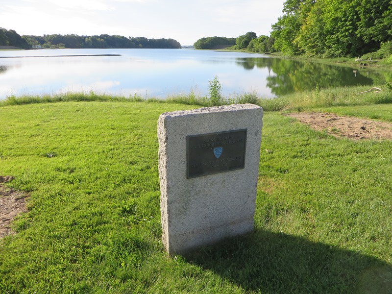
A small park off Congress Street on the banks of the Fore River proclaims “Historic Stroudwater” with a sign noting
Village founded in 1657
by Col. Thomas Westbrook
of Portsmouth, New Hampshire
Site of the mastyard & shipyard
However, the National Register nomination (see below) refers to Stroudwater’s three growth periods “The first was the permanent settlement, begun in 1727 by Colonel Thomas Westbrook . . .” Hmmm!
The Cumberland and Oxford Canal, opened in 1832. Beginning at Sebago Lake, it linked inland lakes with waterfronts in Portland and South Portland. Its route traveled through Stroudwater, emptying into the Fore River, navigable to the ports downstream. The memorial plaque in the park reads:
Maine Historic Civil Engineering Landmark
American Society of Civil Engineers
Cumberland & Oxford Canal
1830 – 1872
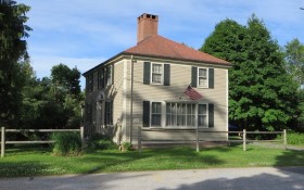
The Tate House Museum includes the 1755 Tate House and other nearby buildings. According to the museum “The house was built for Captain George Tate (1700-1794) and his family, who had arrived in the Colonies around 1750. Tate served as the Senior Mast Agent for the British Royal Navy, overseeing the cutting and shipping of white pines from Maine to England.” The Tate House (below right) adjoins the 1835 Martin Hawes House (center).
The outstanding architectural features of the Tate House, now a National Historic Landmark, are the clerestory gambrel roof and the fine interior paneling. The clerestory gambrel form is one of only two known examples of this once fairly common northern New England type, the other being the much less splendid Burnham Tavern of 1770 in Machias. The austere, unpainted exterior of the Tate House belies the quite lavish interior trim and typifies the pioneer conditions under which the building was built.*
The museum declares “. . . the impressive period furnishings, beautiful grounds and herb gardens, and unique architecture of Tate House offer an insightful glimpse at the 18th century and life in Colonial Maine.”
According to the Maine Historical Society’s Maine Memory Network,
A stone dam was built in the 1840s at Stroudwater on the western outskirts of Portland. It was built for a mill, but was low enough for alewives to go over in the spring.
In the late 19th century, the dam was raised to widen the stream to create more ice for the burgeoning ice industry.
National Register of Historic Places – Stroudwater
The National Register has designated the Stroudwater Historic District, the residential area at confluence of Stroudwater and Fore Rivers, as a National Historic Place. The following historical note is drawn from the nomination, researched by the Maine Historic Preservation Commission.
The village, a section of the City of Portland, occupies the west bank of the tidal Fore River at its head waters where it is joined by the Stroudwater River. The District encompasses the original Stroudwater settlement within the present village. It includes thirty residences from the Colonialrevival, Federalrevival and Greekrevival periods, still standing on the gentle hills sloping to the Fore River; the local burying ground; sites of the former mast landing, mills, tanneries and shipyards; and a section of the Cumberland and Oxford Canal along the eastern bank of the Fore River.
Three periods of growth formed Stroudwater and its character. The first was the permanent settlement, begun in 1727 by Colonel Thomas Westbrook, mast agent for King George II of England. Westbrook moved here from Portsmouth, New Hampshire. (Early settlers abandoned their sawmill on the Stroudwater River during the 1680’s in fear of Indian attacks.)
Westbrook built roads on which to haul the mast timbers, a landing from which to launch them down the Fore River to Portland where they were shipped to England, a huge bridge across the Fore River for the only road to Portland from the south, a garrisoned house for protection from the Indians; protection from the Indians, dams, saw mills and the first paper mill in Maine.
The next period was the prosperity that emerged after the Revolutionary War, with new shipyards, lumber exports and other enterprises. An economic downturn accompanied the Embargo Act of 1807.
Finally, the economy revived with the completion of the Cumberland and Oxford Canal. But the Atlantic and St. Lawrence Railroad, completed in 1853, took away a much of the Canal’s traffic. Stroudwater remains a unit, an intact example of a 19th century village, increasingly threatened but as yet not irreparably damaged by the modern world.
Additional resources
Cumberland County Soil & Water Conservation District. “Stroudwater River Watershed Survey.” (accessed July 21, 2014)
*Maine. Historic Preservation Commission. Augusta, Me. Text from National Register of Historic Places: http://pdfhost.focus.nps.gov/docs/nrhp/text/70000072.PDF
Maine Historical Society. Maine Memory Network. “Stroudwater Dam, Portland, ca. 1900.” https://www.mainememory.net/artifact/25620 (accessed July 21, 2014)
The Tate House Museum. http://www.tatehouse.org/(accessed July 21, 2014)


