| Year | Population |
|---|---|
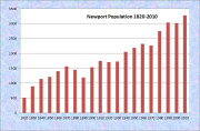
| 1970 | 2,260 |
| 1980 | 2,755 |
| 1990 | 3,036 |
| 2000 | 3,017 |
| 2010 | 3,275 |
| Geographic Data | |
|---|---|
| N. Latitude | 44:51:32 |
| W. Longitude | 69:13:45 |
| Maine House | District 100 |
| Maine Senate | District 10 |
| Congress | District 2 |
| Area sq. mi. | (total) 37.0 |
| Area sq. mi. | (land) 29.5 |
| Population/sq.mi | (land) 111.0 |
County: Penobscot
Total=land+water; Land=land only |
|
[NEW-port] is a town in Penobscot County, once known as Great East Pond Plantation, incorporated on June 14, 1814 from township T4 R3 NWP, as surveyed by Ephraim Ballard and Samuel Weston in 1792. Great East Pond is the former name of Sebasticook Lake.
The area was first settled in 1800 by Jame Houstin, a trapper from Fairfield. In 1807, the first permanent settlement was established in North Newport by Deacon John Ireland from Bloomfield (now part of Skowhegan).
The first formal gathering was in 1812, responding to a report that Indians were planning to massacre the white settlers. It turned out to be a false report. A large contingent of the Penobscot Tribe were fleeing a potential attack by the St. John Tribe. They remained nearby hunting and trapping for about ten days, then moved to Sebasticook Lake and down the Kennebec River.
A year after the town’s incorporation, the Newport Society for the Reformation of Morals was established in Newport, for the “suppression of immorality of every description, particularly Sabbath breaking, intemperance, profanity and falsehood.”
By 1820, the U.S. Census counted 520 residents in the growing community. The 1830’s saw an attempt to establish a silk industry with the importation of mulberry bushes to feed the silkworms. The project failed in the 1840’s. A later experiment with silk produced an unexpected threat to Maine’s forests. During this period the town hosted a sawmill, a grist mill, a tannery, and two stores.
The turn of the 19th/20th century saw the beginning of industrial development in Newport. A woolen mill was built in 1891. Two condensed milk companies were established, one in 1894 and another in 1902. In 1893 a branch of the Portland Packing Company arrived. Two years later the Newport Water Company was formed.
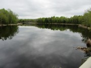
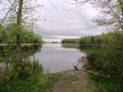
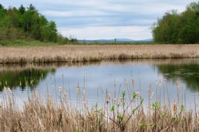
Newport features the six-mile long Sebasticook Lake, providing recreational opportunities for residents and summer visitors. The East Branch of the Sebasticook River drains Lake Wassookeag within the town of Dexter to the north and flows south through Corinna to Sebasticook Lake. Drought conditions in 2002 lowered the water level substantially. Sebasticook Lake is the largest waterbody in Maine that lies solely within a single township – Newport. Sebasticook River continues south of the lake, eventually entering the Kennebec River in Winslow.
Prior to the opening of what became the Maine Central Railroad in 1855, Newport was a center of stage coach transportation. First, between Skowhegan and Bangor, and, until the opening of the Dexter & Newport Railroad in 1869, between Newport and Moosehead Lake.
Newport is still a heavily traveled crossroads, now of Interstate 95, U.S. Route 2, and Maine Routes 7, 11, and 100.
Its strategic position on main routes from Piscataquis County to the north, and from western Penobscot and eastern Somerset counties, have supported commercial development in recent decades.
Mullen Woods nature preserve, off Rutland Road, consists of a grove of old-growth white pines and hemlock on overgrown farmland with stone walls, granite foundations, and remnants of an old brickyard.
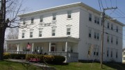
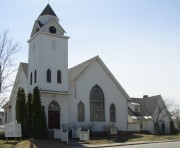
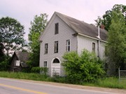
Downtown, U.S. Route 2, retains much of its traditional look. The Newport Inn had been a destination for many years. It is now an independent living center for seniors. The United Methodist Church is at right.
East Newport
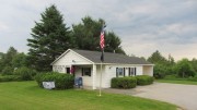
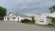
The portion of Newport east of Sebasticook Lake is known as East Newport. A small post office and grocery store are located at the intersection of U.S. Route 2 with the Stetson Road and the Roussin Road (Route 7).
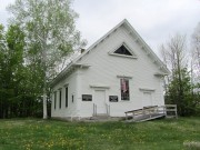
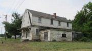
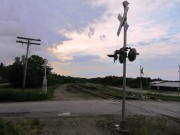
Nearby on the Stetson Road stands what is reportedly the old East Newport General Store, in poor condition. The old meeting hall on Route 7 may be the site of the Eastville Grange, organized in 1904. A freight rail line runs east-west just north of U.S. Route 2.
Form of Government: Town Meeting-Select Board-Manager.
Additional resources
Chadbourne, Ava Harriet. Maine Place Names and The Peopling of its Towns.
Dover, Foxcroft, Guilford, Sangerville, Dexter, Newport, Corinna Souvenir 1908. 1908. University of Maine, Raymond H. Fogler Library, Special Collections]
Friend, Gilman N. Newport Sesqui-Centennial, 1814-1964. Newport, Me. 1964. [University of Maine, Raymond H. Fogler Library, Special Collections; Maine State Library]
Heath, Solyman. Papers, 1832-1855. (Cataloger Note: Contains two volumes dating from 1832-1855 used by Heath in his law practice to record money received from individuals. In some cases the reasons for the payments are given. The first volume also contains records of the Newport Society for the Reformation of Morals . . . .)
*Maine. Historic Preservation Commission. Augusta, Me. Text edited from National Register of Historic Places: http://pdfhost.focus.nps.gov/docs/nrhp/text/xxxxxxxx.PDF.
Hexagon Barn: 94001245.PDF
North Newport Christian Church: 95000726.PDF
Mitchell, W.H., ed. A Broad Expanse of Lake Sebasticook Newport, Maine. Newport, Me. A.W. Lander. 1914. [University of Maine, Raymond H. Fogler Library, Special Collections; Maine State Library; also known as A Brief History of Newport, Maine, 1814-1914. http://www.archive.org/stream/briefhistoryofne00mitc/briefhistoryofne00mitc_djvu.txt (accessed June 28, 2013)]
Town of Newport. “Brief History of Newport.” http://www.newportmaine.net/site/history.asp (accessed June 28, 2013) [Most material extracted from A Brief History of Newport, Maine, 1814-1914]
National Register of Historic Places – Listings
Hexagon Barn
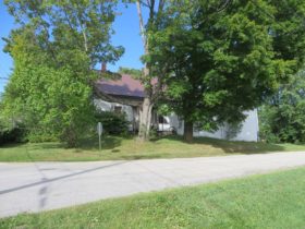
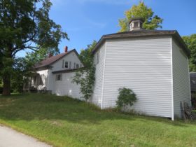
[Spring and Railroad Streets; N44° 50′ 3.36″ W69° 16′ 35.40″] The Hexagon Barn is architecturally unique in Maine. There are no polygonal agricultural structures of any kind known to exist in the state. About twenty-octagon houses have been identified. Why the barn was built this way remains a mystery, as does the identity of its builder.
The Greek Revival Cape to which it is attached was built about 1850. Aside from the door, changed because of its use as a garage, the barn appears to have undergone no major alterations.*
North Newport Christian Church
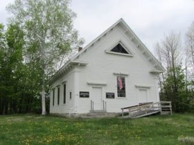 [junction of Maine Route 222 and Pratt Road, northeast corner North Newport; ] Built in 1857 by local carpenter Abiah Steward, the North Newport Christian Church is a virtually unaltered example of a modest rural religious building that combines Greek Revival and Italianate style characteristics. Built by both the Baptist and Christian congregations, the church has long been used solely by the latter denomination.
The John Ireland family first settled the community of North Newport in 1807. In 1817 a Baptist Church was organized, and the Christian Church was founded about 1840. The two congregations met in separate schoolhouses. In 1850 meetings were held to discuss erecting a single church building in which both groups could meet. These led to the formation of the North Newport Union Meeting House Company. In 1857 it purchased the one-third acre lot on which the building now stands. Tradition holds that the location was chosen as the mid-point between the two schoolhouses, with the two congregations each occupying the one-half of the church nearest their former place of worship.* [See related photos above.]
Sebasticook Lake Fishweir Complex, Address Restricted


