")

Location Map for Kennebunkport
| Year | Population |
|---|---|
| 1970 | 2,160 |
| 1980 | 2,952 |
| 1990 | 3,356 |
| 2000 | 3,720 |
| 2010 | 3,474 |
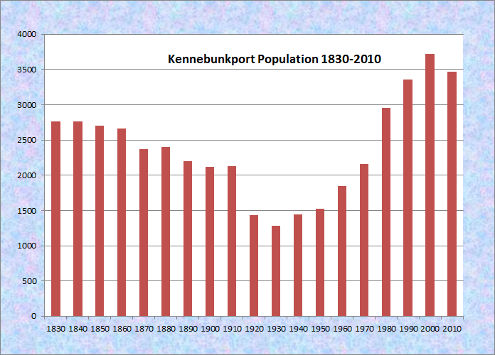
Population Trend 1830-2010
| Geographic Data | |
|---|---|
| N. Latitude | 43:23:54 |
| W. Longitude | 70:34:24 |
| Maine House | District 9 |
| Maine Senate | District 32 |
| Congress | District 1 |
| Area sq. mi. | (total) 22.0 |
| Area sq. mi. | (land) 20.6 |
| Population/sq.mi. | (land) 168.6 |
County: York
Total=land+water; Land=land only |
|
[KEN-eh-bunk-port] is a town in York County, incorporated on July 5, 1653 as Cape Porpoise.
After early white settlers were driven away by Indian raids, the community was reorganized under the name Arundel in 1718 in honor of the Earl of Arundel. In 1821 its name was changed to Kennebunk Port.

Larrabee’s Garrison

The Cliffs at Cape Arundel
Nearly a century later, on April 1st, 1915, a new town was created from Kennebunk Port to be known as North Kennebunkport. Engraved images above from A Gazetteer of the State of Maine.
Its name was changed in 1957 to Arundel. Thus, the “new” Arundel occupies a small portion of the town so named in 1719. Another naming challenge: the town of Kennebunk is just west of Kennebunk Port.
In probably the earliest patriotic incident in Maine, a Maine militia captured the Arundel sloop Polly (which had been seized by the British in Plymouth, Massachusetts) on June 1, 1771, when it returned to Arundel and was surrendered by her master.
")
Site of 1749 Tide Mill Grist Mill (2012)
")
Remains of the dam at the Mill Site (2012)
")
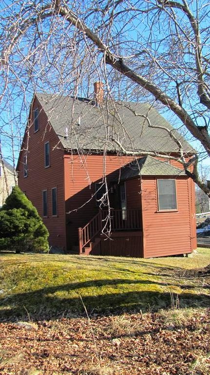
Jail, Town House/School, Shipbuilding Office (2012)
 (2012)")
Masons Lodge in Kennebunkport (2012)
Mid-19th century U.S. Representative Joshua Herrick lived in Kennebunkport, where he also was closely involved in town government.
Kennebunkport’s well-known residents have included writers Booth Tarkington and Kenneth L. Roberts.
")
Village Baptist Church (2012)
Kennebunkport has long been an attraction for tourists and summer residents.
Cape Porpoise remains as a coastal village in the town, along with Goose Rocks Beach another seaside settlement.
In the 1930s a post office at a small rustic village was known as Beachwood. Undoubtedly the scene in this 1936 postcard had been changed beyond recognition in 2018.
")
Kennebunkport Shops (2012)
")
Shops in Dock Square (2012)
Kennebunkport became famous for visits by the two Presidents Bush – George H.W. (the father) and George W. (the son). The elder Bush had a summer residence on Walker’s in the community. George H. W. visited as President in the 1980s; George W. Bush visited as President in summers after taking office in 2001.
")
Village Fire Company (2012)
")
Kennebunk Post Office (2012)
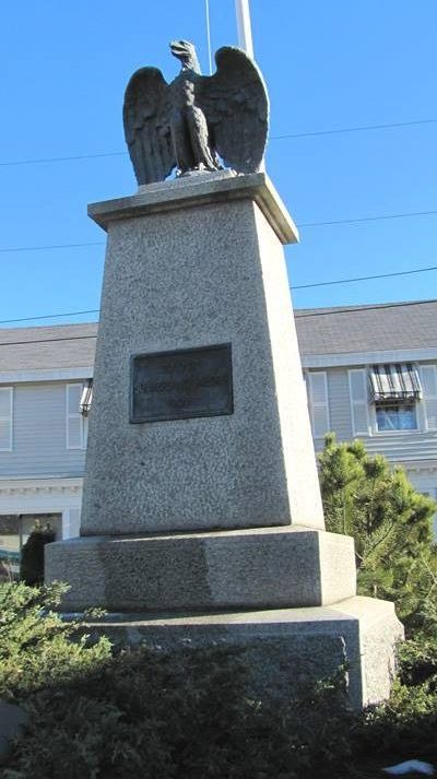
Soldiers and Sailors Memorial (2012)
 N43° 21' 30.52\" W70° 28' 29.42\"")
“Our Forebears of the Coast” (2015)
Additional resources
")
1824 South Congregational Church UCC (2012)
Bradbury, Charles, 1798-1864. History of Kennebunk Port, from its first discovery by Bartholomew Gosnold, May 14, 1602, to A.D. 1837. Kennebunk, Printed by J. K. Remich, 1837. Kennebunkport, Me. Durrell Publications. 1967.
Butler, Joyce. A Kennebunkport Album. Kennebunk Landing, Me. Rosemary House Press. c1984.
Butler, Joyce. Kennebunkport Scrapbook. Kennebunk, Me. T. Murphy. c1977.
Collins, Jerome A., Monique D. Collins, Cynthia C. Daley. A History of Printing: Finding Inspiration in the Kennebunks. Kennebunkport, Me. Buttonwood Press 2006.
Kennebunkport (Me.). 300th Anniversary Committee. 300th Anniversary, Kennebunkport, Maine, 1653-1953. 300th Anniversary Committee. Kennebunkport, Me. The Committee. 1953 (Kennebunk, Me. Star Print.)
MacAlister, Lorimer W. Chronicles of Cape Porpoise and Kennebunkport. Being scenes and episodes in an old Maine village and vicinity. Cape Porpoise, Me. Atlantic Firemen’s Educational Association. 1949.
*Maine. Historic Preservation Commission. Augusta, Me.
Old Houses of Kennebunk and Kennebunkport. Kennebunk, Me. Brick Store Museum. 1962.
Olivier, Julien. Prendre le large: Big Jim Cote pêcheur. Bedford, N.H. National Materials Development Center for French. 1981.
Photo: “Club house, Kennebunkport, Maine.” Library of Congress Prints and Photographs Division Washington, D.C. Reproduction Number: LC-DIG-det-4a07983 http://www.loc.gov/pictures/item/2016801859/ (accessed December 13, 2017)
Schmidt, Henrietta. Down to the Seas. Kennebunk, Me. Star Press, Inc. c1977.
Schmidt, Henrietta. Through the Years. Kennebunk, Me. Star Press. 1975.
Varney, George J. A Gazetteer of the State of Maine. 1886. pp. 297, 299.
See Ann A. Gunter comment posted in Old Town article.
National Register of Historic Places – Listings
Maine. Historic Preservation Commission. Full text and photos are at https://npgallery.nps.gov/nrhp
Cape Arundel Golf Club
 N43° 22' 26.42\" W70° 28' 40.30\"") [19 River Road] The Cape Arundel Golf Club on the northeast bank of the Kennebunk River in Kennebunkport is among the oldest surviving golf clubs in Maine. The golf course was first established in 1896, about 20 years after the Cape Arundel Summer Colony was established.
[19 River Road] The Cape Arundel Golf Club on the northeast bank of the Kennebunk River in Kennebunkport is among the oldest surviving golf clubs in Maine. The golf course was first established in 1896, about 20 years after the Cape Arundel Summer Colony was established.
The Kennebunkport Golf Club reorganized in 1900 as the Arundel Golf Club. The clubhouse was designed by Prosper L. Senat and the first nine holes were laid out by Alexander H. Findley, a professional golfer from Scarsdale, New York. The course was thoroughly redesigned, and expanded to eighteen holes, by the noted golf architect Walter J. Travis between 1920 and 1922. Shortly thereafter the club house was expanded.
 N43° 22' 19.09\" W70° 28' 49.96\"")
 N43° 22' 17.24\" W70° 28' 49.10\"")
Although the Club is now located north of the village center (and thus not adjacent to the cottage colony) there is no doubt about the connection. The first president of the club, Prosper L Senat, had both a cottage and studio in the colony, as did most of the other elected officers. For the first few years the golf links were located in a “field off Main Street” and the clubhouse was in a barn. In 1900 the club was renamed and the course relocated.
The Cape Arundel Golf Club is an example of a golf course by a well respected landscape architect who specialized in golf course design. The design reflects attempts to modernize the game as its popularity grew and its participants became increasingly skilled. The formation and evolution of the Club was fueled by the well-heeled residents of the nearby summer colony, and became an important recreational outlet for its summer residents.
Cape Arundel Summer Colony Historic District
")
The Colony Hotel (2012)
[roughly bounded by Chick’s Creek, Ocean Avenue, South Main Street, Endcliff Road, and Walkers Point] The Colony Historic District is an example of the summer resorts that developed during the final quarter of the 19th century. Planned and promoted by the Boston & Kennebunkport Sea Shore Company in the 1870s, the summer colony at Kennebunkport with the historic colonial village, rocky coastline, beaches and natural beauty, drew vacationers seeking respite from growing urban pressures.
The Company bought relatively undeveloped high land above the ocean. It published a map of Cape Arundel in 1873 showing proposed roads, parks, house lots, and hotel sites, featuring new picturesque place names. It built the Ocean Bluff hotel to house guests attracted by their extensive advertising.
")
Nonantum Resort on Kennebunk River (2012)
")
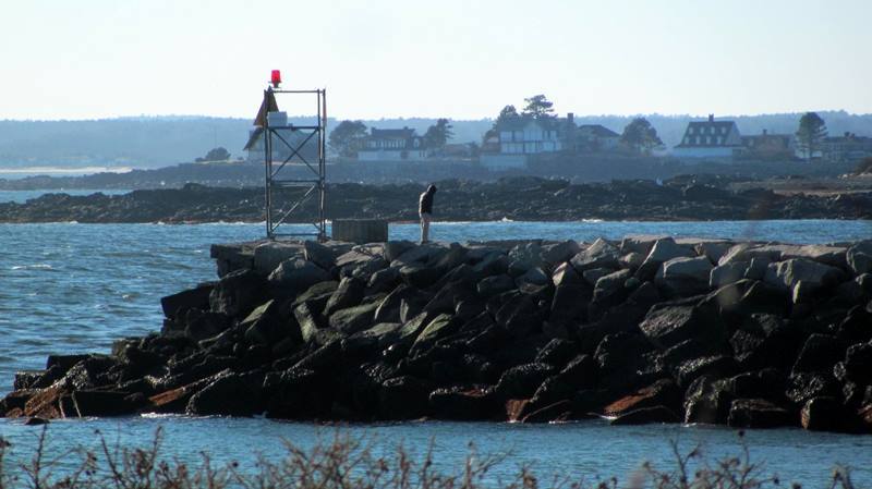
Gooch’s Beach near the Breakwater (2012)
Transportation was critical in spurring the growth of the community. Road improvements began to ease access to potential cottage sites. By 1882 there were five more hotels but only about ten cottages. Great impetus for change came with the arrival of the Boston and Maine Railroad across the bridge from Dock Square in 1883. Trains ran several times daily to Boston and Portland, supplemented by stage lines to the station at Kennebunk.
About thirty cottages were built in the remainder of the decade and community institutions that would become the center of social activity were started: the Arundel Casino (1886), comprised of a hall for musical and theatrical entertainments, bowling alley, billiard room, library, and rooms for single gentlemen; St. Anne’s Episcopal Church (1886); the Kennebunk River Club (1889), a boating and canoeing club. Events such as church fairs, river carnivals, expeditions through back roads, parties, and dances were prominent features.
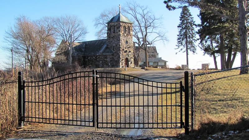
St. Ann’s Episcopal Church (2012)
The Breakwater and Cottages (2012)
Much of the architecture reflected the nostalgia for Colonial times, and simultaneously responded to the new informality of summer life. The many Shingle Style cottages seemed to grow out of the undulating landscape. The Colony drew its share of notable architects: John Calvin Stevens, William Ralph Emerson, and Henry Paston Clark, all of whom made significant contributions to the character of Cape Arundel. Several literary figures were prominent members of the summer colony, including Booth Tarkington. Artists added to the social life with the business and professional cottage residents.*
Clock Farm
[Maine Route 9 and Goose Rocks Road] Somewhere hidden in the midst of this happy collection of Greek Revival extended architecture (probably the ell immediately to the left of the main house) is the original dwelling built on this site by Peter Johnson in 1773.
 N43° 24' 19.78\" W70° 25' 39.29\"")
The important feature of this landmark, is the large four faced clock in the cupola on the front section of the barn. At some point in the late 19th century, the farm was purchased for a summer residence by Thomas Emmons, a Lawrence, Massachusetts, manufacturer. Founder of the Emmons Loom Harness Company, he had installed the clock on his Massachusetts factory in 1870. It is said that over the years the clock kept such bad time that it caused strained relations between management and labor as to actual working hours. Whatever the reason, in the early 20th century Mr. Emmons had the clock transported to his summer residence where it was installed in a specially built tower and became an important architectural curiosity and local landmark.*
Goat Island Light Station
[Goat Island, Cape Porpoise Harbor Cape Porpoise] The light station at Goat Island was established in 1833 as a guide to the harbor of refuge at Cape Porpoise. Despite alterations to the keeper’s house, the station maintains its importance.
")
Goat Island Light Station (Robert Moor photo 1986)
Located on the south side of treeless Goat Island, the light station serves not only as a navigational aid to the entrance of Cape Porpoise Harbor but also as a warning beacon to the numerous small islands and rock shoals that populate this short stretch of coast northeast of Kennebunkport. The original configuration of the station is not clear, although the 1848 light list indicates that the tower was approximately twenty feet high.
")
The Keeper’s House on Goat Island (Robert Moor photo 1986)
In 1859 the tower and keepers house were demolished and their present replacements built. Goat Island Light Station is one of the few remaining staffed lights in Maine. Goat Island is significant for Maine’s critical reliance on maritime transportation and the aids that made navigation possible. The station’s distinctive character primarily reflects mid-19th century light station design and construction.
Graves, Abbott, House
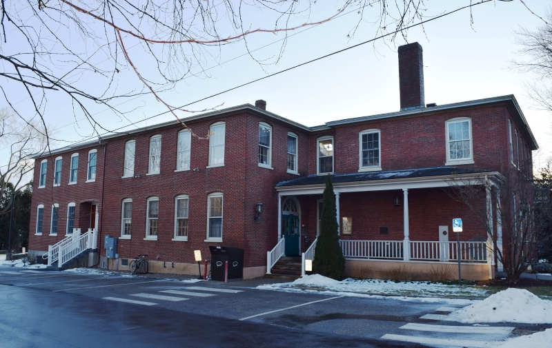
") [Ocean Avenue] The Louis T. Graves Memorial Library, formerly a U.S. Custom House, is both architecturally and historically significant. Built in 1815 by the Kennebunk Bank of Arundel, the Federal style structure has been a familiar landmark in Kennebunkport. The first floor was used as a bank until 1831 when the bank’s charter was revoked.
[Ocean Avenue] The Louis T. Graves Memorial Library, formerly a U.S. Custom House, is both architecturally and historically significant. Built in 1815 by the Kennebunk Bank of Arundel, the Federal style structure has been a familiar landmark in Kennebunkport. The first floor was used as a bank until 1831 when the bank’s charter was revoked.
In 1832 the building was purchased by the government for use as a U.S. Custom House. The Customs service had been using the building since 1815 on the second floor. In 1800 Kennebunkport became the headquarters port for the District of Kennebunk, which included the ports of Kennebunk, Kennebunkport and Wells. From 1800 to 1815, the U.S. Customs office was located in Kennebunk but with the completion of the new building they moved to Kennebunkport.In 1812, the amount of customs collected was $119,850. By 1850 the amount was over one million dollars on West Indian imports alone. The collector of customs received 2 ½% of his collections along with fees for entering and clearing vessels. In 1913 the District of Kennebunk was merged with twelve other districts into the District of Portland.
In 1916, the Kennebunkport Library Association was formed and the building was rented from the government. In 1920 it was purchased by Mr. & Mrs. Abbot Graves who built an addition to the building. In 1921 the property was deeded to the Library Association provided it be named for Louis T. Graves, the son of Mr. & Mrs, Abbot Graves. In 1956, another addition was created through the generosity of the Rev. Dean Emerson. This new wing houses his 1,000 volume collection.* [Frank A. Beard photo]
Kennebunk High School, (Former)
The former Kennebunk High School is a two-and-a-half story flat roofed Colonial Revival brick building with a projection in the rear of 20 feet by 37 feet for the gymnasium.
Built in 1921-1922, with Mid-Century Modern additions in 1954 and 1962, the school is located in a residential neighborhood.
It was designed by the Boston architecture firm of Hutchins and French, the 1921-1922. Is is significant in the area of architecture and education for the town of Kennebunk. As a noteworthy example of early twentieth century Colonial Revival design and construction, the former Kennebunk High School was placed on the National Register.
Kennebunk River Club
[Ocean Avenue] By the mid 19th century, America’s wealthy and middle classes had found it healthful and fashionable to escape cities during the summer using improved rail and steamboat transportation. After the Civil War, Maine’s beaches and lakes drew Philadelphians, New Yorkers, and Bostonians to such resorts as Bar Harbor, Poland Spring, and Mount Kineo.
")
A group of Boston businessmen purchased the entire shoreline of Kennebunkport in the 1870s. The small coastal village was in the twilight of its shipbuilding days as a new era of summer hotels and cottages dawned. Along with the picturesque shore and the long sandy beach, the adjacent Kennebunk River proved a major recreational asset for the town. By 1888 boating on the river was termed “one of the most enjoyable features of life at Kennebunkport.”
The canoe was by far the most popular vessel. By 1894 almost 500 were owned on the river. For many only a casual pastime, canoeing also became a highly organized activity. A “Lobster, Boat and Canoe Club” started by Summer residents in the 1870s became the Kennebunk River Club in 1889. That year the group began building the clubhouse, a striking example of Shingle Style architecture, a favorite for recreational buildings and summer cottages in the late 19th century. It was completed and opened in 1890.
The Kennebunk River Club has served as the focal point for summer activity on the Kennebunk River. The popularity of canoes continued until World War I, and the clubhouse was the starting point of all canoe trips up the river. These outings usually ended at a great stone outcropping known as Picnic Rock or Sunset Rock, which the club first leased and then purchased in 1896. The Rock was also the scene of a three day annual canoe race in August. [See additional photo above.]
")
An Old Clubhouse (c. 1890-1901)
To meet demand, canoes were made in Kennebunkport and the town became as famous for them as it once had been for sailing ships. Indians came from the reservation at Old Town, pitched their tents at the mouth of the river, and built canoes ordered by summer people. They also hired themselves as guides for canoe trips on the afternoon tide. It became a favorite way to entertain guests and it was not unusual to see 200 canoes on a flood tide.
After World War I, canoes were replaced by motorized launches and sailboats. Occasional canoe races are still staged from time to time.
Kennebunkport Historic District
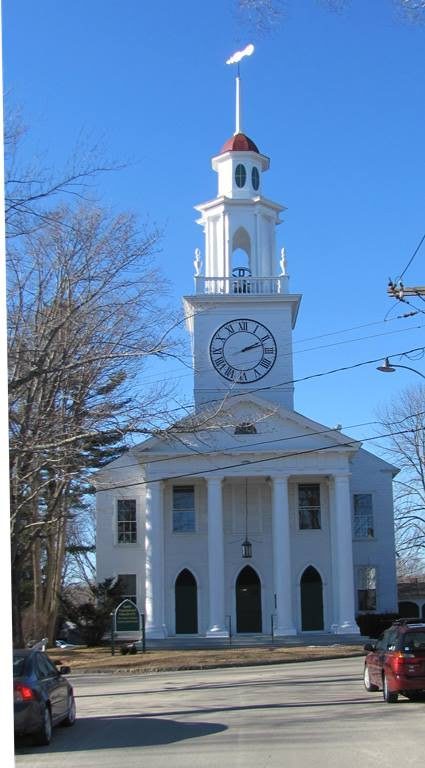
1824 South Congregational Church (2012)
[bounded roughly by South, Maine, North, and Lock Streets, and the Kennebunkport River] The years between the close of the American Revolution and the Embargo of 1807 witnessed a dramatic growth in the maritime communities of the Maine coast. While many towns were later transformed into commercial centers, Kennebunkport retained its character as a Federal Period seagoing town. Much of the evidence of Kennebunkport’s once thriving docks and shipyards no longer exists. However, the community’s 19th century success remains apparent through the many handsome buildings that constitute the historic district. Although styles range from the Colonial Period into the 20th century, the predominant architectural theme is the Federal with more than a third of the structures in the district in this style.
While Kennebunkport’s greatest period of development took place in the late 18th and early 19th centuries, its history has its roots in the 17th century. Permanent settlement in Kennebunkport was established about 1630. The site is reported to have been named Cape Porpoise by Captain John Smith because he encountered many porpoises off the cape. The area now known as Kennebunkport was first incorporated as Cape Porpoise in 1653. Driven off by early Indian wars, the inhabitants returned in 1719 and resettled along the river under the name of Arundel. In 1820 when Maine became a state, that name was changed to its present one.
")
1853 Knott House; Historical Society
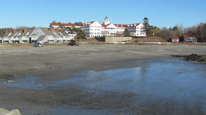
The Colony Hotel in Kennebunkport
Beginning in the 1870s people from Boston and Sanford, Maine, attracted by the natural beauty of the area began to build summer cottages, some of considerable size, along the shore both at Cape Porpoise (now a village within Kennebunkport) and at Cape Arundel. By the turn of the 20th century a large summer colony had emerged which still exists and provides an important economic base for the town, as does a thriving tourist business.* [Photos of selected buildings in the Historic District 2012]
Lord, Capt. Nathaniel, Mansion
[Pleasant and Green Streets] Kennebunkport was an important shipbuilding center and port of entry until during the War of 1812 when the British blocked the mouth of the Kennebunk River. All shipbuilding and commerce ceased in this area at that time. Consequently, the ship carpenters became idle. Nathaniel Lord, a wealthy shipowner and merchant, commissioned these men to build a large house and barn upon a piece of land given to his wife, Phoebe Walker, by her father.
")
 N43° 21' 31.09\" W70° 28' 26.62\"")
The detailed workmanship illustrates the talent of these craftsmen. The unsupported elliptical staircase in the front entrance hall is a dramatic example. Inheritance of the house went from daughter to daughter through several generations. This accounts for the many names this house has gone, by as marriages took place. It has been known as the: Lord, Clark, Buckland and Fuller estate at one time or another. Sale of the house 1972 meant for the first time in its history, does not belong to an ancestor of Capt. Nathaniel Lord. The total restoration that has occurred then has created quite an interest among the local people.*
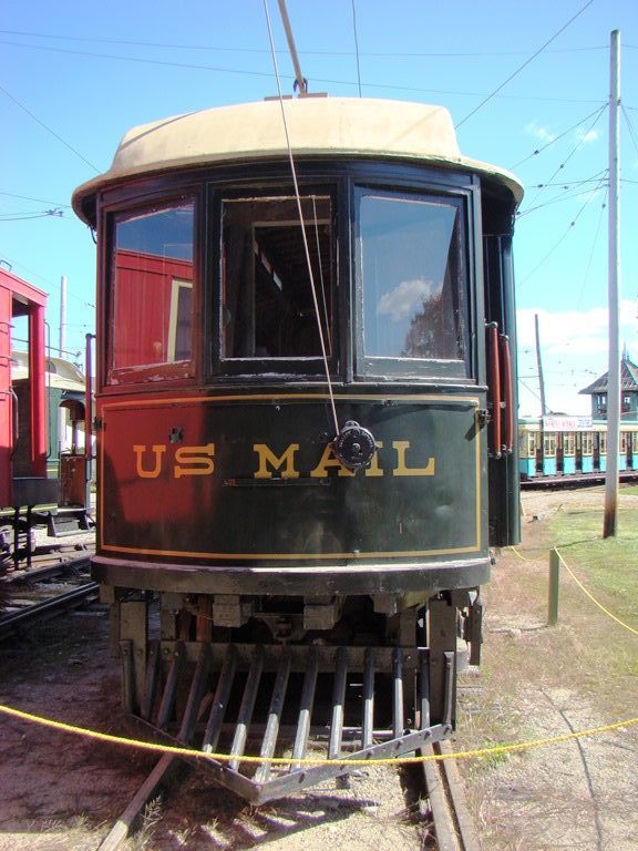
Maine Trolley Cars
")
Trolleys at the Museum (2009)
[Seashore Trolley Museum is in Kennebunkport nearby] The street car has virtually disappeared from the American scene. As recently as 1921 the electric railway business was America’s fifth largest industry. In providing transportation that was fast, comfortable and reasonably priced, it promoted urban development and supported suburban living to many.
Trolley excursions to the beach, lake, park and countryside were a part of everyday living in the pre-automobile age. Many electric railways engaged in express and freight business, contributing to the growth of commerce.
Trolley at the Museum (2009)
Beginning in the 1890s, a vast trolley network spread across Maine. By 1910 dozens of electric railway companies operated over more than 2000 miles of track. These lines in most cases linked with one another so that it was possible, for example, to travel the entire distance from Boston to Portland on the trolley with several changes. Trolley guides were published for those who made a practice of long excursions on the electric cars.
In Maine, the trolley played an important role in the development of the very significant resort industry. It also resulted in the development of suburban parks specifically built to promote travel on the newly developed lines.
By the late 1920s, the trolley had almost disappeared in Maine except for some urban lines. The rural and interurban routes had ended with the coming of the automobile. In 1980 ten trolley cars in the Seashore Trolley Museum were placed on the National Register.* [See also Railroads]
Perkins Tide Mill
")
Perkins Tide Mill (1973)
[Mill Lane] The Perkins Tide Mill is one of the last remaining examples of an 18th century tidewater grist mill in the United States. The mill was built in 1749 and operated until 1939. Tidewater mills were operated by tidal ebb and flow rather than by the flowing waters of a stream or river. In 1973 he mill building itself had received only minor modifications such as the addition of a 19th century cupola as shown in the accompanying photograph. Architectural features included a variety of exposed framing, knee braces, mill machinery and early hardware.
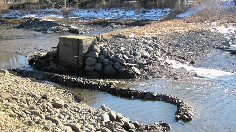
Remains of the dam at the site of the 1749 Tide Mill Grist Mill in Kennebunkport
Tide Grist Mill (2012)
Although the preservation purist might frown upon the Mill’s use as a restaurant in 1973, the building survives today because it was an early example of adaptive use. The Perkins Grist Mill may not be the best example of adaptive use but the building did serve a functional economic purpose, as a restaurant in 1973. In any event, enough remains to restore it to its original state.* [1973 photo credit: Historic American Buildings Survey, Jack E. Boucher, Library of Congress]
Since the 1973 nomination to the National Register, the mill building has become a residence and has changed structurally.
U.S. Customhouse
[Main Street] The Louis T. Graves Memorial Library, formerly a U.S. Custom House, is both architecturally and historically significant. Built in 1815 by the Kennebunk Bank of Arundel, the Federal style structure has been a familiar landmark in Kennebunkport. The first floor was used as a bank until 1831 when the bank’s charter was revoked.
")
In 1832 the building was purchased by the government for use as a U.S. Custom House. The Customs service had been using the building since 1815 on the second floor. In 1800 Kennebunkport became the headquarters port for the District of Kennebunk, which included the ports of Kennebunk, Kennebunkport and Wells. From 1800 to 1815, the U.S. Customs office was located in Kennebunk but with the completion of the new building they moved to Kennebunkport. In 1812, the amount of customs collected was $119,850. By 1850 the amount was over one million dollars on West Indian imports alone. The collector of customs received 2 ½% of his collections along with fees for entering and clearing vessels. In 1913 the District of Kennebunk was merged with twelve other districts into the District of Portland.
In 1916, the Kennebunkport Library Association was formed and the building was rented from the government. In 1920 it was purchased by Mr. & Mrs. Abbot Graves who built an addition to the building. In 1921 the property was deeded to the Library Association provided it be named for Louis T. Graves, the son of Mr. & Mrs, Abbot Graves. In 1956, another addition was created through the generosity of the Rev. Dean Emerson. This new wing houses his 1,000 volume collection.* [Richard D. Kelly photo]
Former U.S. Custom House (2019)
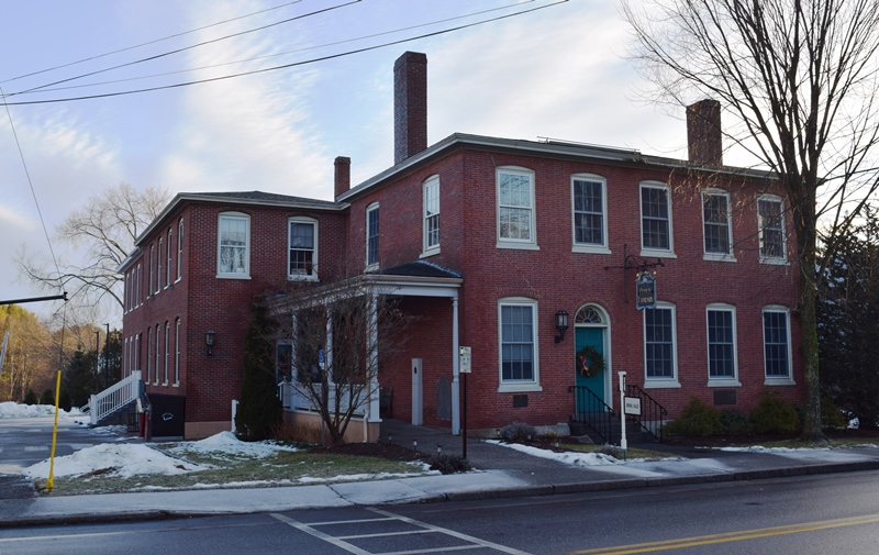
Former U.S. Custom House (2019)
Hello! I’m trying to refresh my memory. In the 1969 / 1970 era there was a Coffee House,
Coffee Bar upstairs I believe at 15 Ocean Avenue, where Toys in the Attic is now being shown. The Coffee House had coffee, and would also make special drinks and beverages, I believe there was no alcohol served.They also had musical performers as well as “open” Mic performances.
Any chance you would know the name of this place?
Thanks! Joel Pelletier