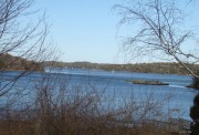
Windows on the River: Moosehead to Popham
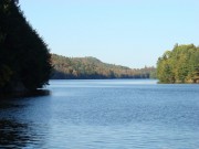
The Kennebec flows from Moosehead Lake through the West Outlet and the East Outlet, both of which empty into Indian Pond. The water passes through the ten miles of Indian Pond to join the Dead River at The Forks, thus forming the main body of this important river.
Its name is from the Penobscot Indian term “large expanse of water” or “long pond.”
One of the two largest branches is the Sandy River, draining Franklin County from the west, and entering just below Madison and Anson. The other, the Sebasticook River, joins in Winslow from Cambridge in northeastern Somerset County.
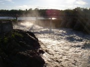
Benedict Arnold, who used the river extensively during his expedition to Quebec, crossed it from Moscow to Pleasant Ridge Plantation. Downstream from Pleasant Ridge, the river is a source of electric power at the Wyman Dam in Moscow.
South of Moscow in Caratunk, the Appalachian Trail crosses the river, requiring a canoe-ferry service for passage.
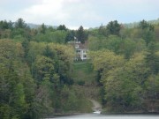
Concord Haven, J. Leon Williams’ mansion designed by John Calvin Stevens, sits high on the banks of the Kennebec in Embden.
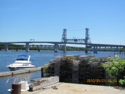
The Kennebec flows through the important mill and shopping communities of Madison, Skowhegan, Winslow, Waterville, Augusta, Gardiner, and Bath. Ephraim Ballard surveyed the land along the river, encouraging the towns along its banks.
A historic moment in the River’s history occurred on July 1, 1999 when the Edwards Dam at Augusta was breached, allowing the river to flow freely there for the first time in 162 years.
Navigable up to Augusta, the river must be cleared of ice to allow shipping and to prevent ice dams the cause flooding.
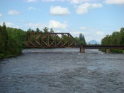
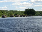
Hydro power and log drives characterized this and other Maine rivers until the end of the drives in the 1970’s. The abandoned cribworks near Vassalboro and Augusta are silent reminders of those log drives.
After passing Bath Iron Works, it winds past Arrowsic (with its wetlands in the curves), and Georgetown on the left bank; Phippsburg, with its old Congregational Church, on the right.
At its end point, the Kennebec passes Fort Popham and empties into the Atlantic at Popham Beach, frequently causing difficulties for boaters when the current and tides conspire to produce rough seas.
The southern portion river was explored in 1605 by George Weymouth and was the site of the Popham Colony in 1607.
Counting the longer West Outlet route from Moosehead Lake, the river stretches 170 miles and drains 5,900 square miles of central Maine.
Additional sources
Calvert, Mary R. Black Robe on the Kennebec. Monmouth, Me. Monmouth Press. c1991.
Calvert, Mary R. Dawn over the Kennebec. Lewiston, Me. Twin City Printery. c1983.
Coffin, Robert P. Tristram. Kennebec: Cradle of Americans. Illustrated by Maitland de Gogorza. New York Farrar & Rinehart, Inc. c1937.
Gilman, Stanwood C. and Margaret Cook Gilman. Land of the Kennebec: “ye great and beneficial river,” 1604-1965. Boston. Branden Press. c1966.
Hall, Jon F. The Upper Kennebec Valley [pictorial]. Dover, N.H. Arcadia. c1997.
Mallar Development Services. Augusta to the Atlantic: A Recreational Use Strategy for the Kennebec River. Prepared for the cities of Augusta, Gardiner and Hallowell. [Maine?] Mallar Development Services. 1983.
Wood, Richard G. A History of Lumbering in Maine: 1820-1861, p. 14.


