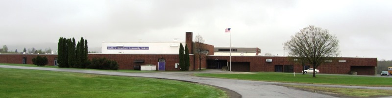
Southern Aroostook Community School (2014) @

Location Map for Dyer Brook
| Year | Population |
|---|---|
| 1970 | 165 |
| 1980 | 275 |
| 1990 | 244 |
| 2000 | 199 |
| 2010 | 213 |
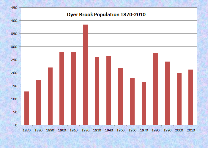
Population Trend 1870-2010
| Geographic Data | |
|---|---|
| N. Latitude | 46:04:28 |
| W. Longitude | 68:13:12 |
| Maine House | District 145 |
| Maine Senate | District 2 |
| Congress | District 2 |
| Area sq. mi. | (total) 38.5 |
| Area sq. mi. | (land) 38.5 |
| Population/sq.mi. | (land) 5.5 |
County: Aroostook
Total=land+water; Land=land only |
|
 N46° 5' 15.06\" W68° 10' 59.34\"")
Dyer Brook Community Church (2003) @
[DIYER BROOK] is a town in Aroostook County, organized as a plantation for election purposes as early as September 6, 1858. After several addition “organizations,” it was incorporated as a town on March 21, 1891.
The first settlement was in 1844 when Orrin Laughton same from Smyrna and built a log house. By 1880 the plantation had 40 voters.
")
Old Barn in Dyer Brook on Route 2 (2003)
Dyer Brook, so named for the stream that flows through it and into the Mattawamkeag River, is in the heart of potato country. Under economic pressure as are many northern Aroostook towns, it lost 18 percent of its population in the decade 1990-2000, though it regained about 6 percent by 2010.
")
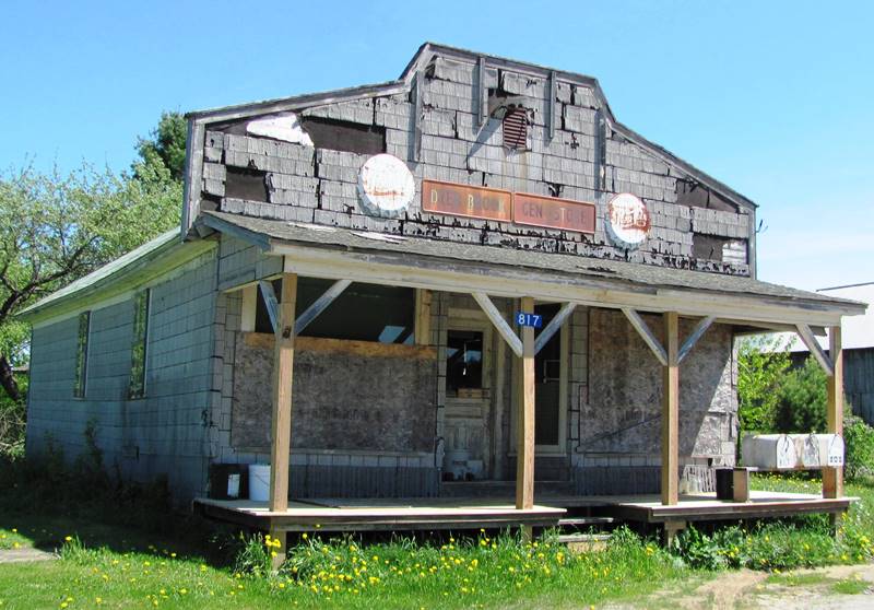
U.S. Rt. 2 in Dyer Brook (2012) Old General Store above
U.S. Route 2, in its eastern area, is the main road through the town and the only village, with Townline Road defining its northern boundary. Few paved roads exist elsewhere.
Interstate 95 slices through just to the west of Route 2, but with no interchanges in the township. A rail line is sandwiched between the two roads on its way north to Oakfield.
")
Town Office in former School on U.S. Rt. 2 in Dyer Brook (2012)
Form of Government:
Town Meeting-Select Board-Manager.
Additional resources
Sanborn Map Company. Smyrna Mills, Aroostook County, Maine: including Oakfield & Dyer Brook. New York : The Sanborn Map Company. c1931. (Cataloger Note: Includes location map. Includes index and index map on sheet.) [University of Maine, Raymond H. Fogler Library, Special Collections]
Karsberg, Lenorma Ellis. The Ellis Family of Haynesville–Dyer Brook, Maine. Worcester, Mass. : L.E. Karsberg, c1983. [Bangor Public Library]
")
")
 N46° 3' 59.64\" W68° 11' 49.08\"")
The small chapel-like building below at the Dyer Brook Cemetery was removed after 2012.
")
Small Building at a Cemetery on U.S. Route 2 in Dyer Brook (2012)
")
Dyer Brook Cemetery on U.S. Route 2 in Dyer Brook (2014)
 N46° 2' 53.46\" W68° 13' 30.78\"")
Dyer Brook Picnic Area on U.S. Route 2 (2014)
")
Dyer Brook Picnic Area on U.S. Route 2 (2014)