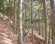
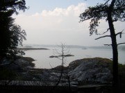
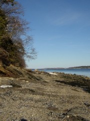
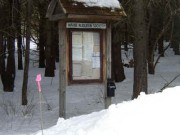
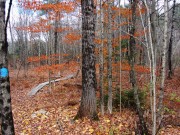
Basket Island, Cumberland. 9 acres of mixed forest and shell and gravel beaches. Osprey nest on nearby ledges. Watch out for abundant poison ivy. Popular picnic spot. Managed by The Nature Conservancy.
Bay Bridge Landing, Brunswick. A six-acre wetland park with a trail and interpretive signs, this area off Bay Bridge Road features osprey and snapping turtle habitat, kayak and canoe launching, and parking.
Bowdoin College Coastal Studies Center, on Orr’s Island in Harpswell, is described as “a natural, protected environment, with 2.5 miles of intertidal shoreland and 118 acres of woodlands nd fields.” Its website continues “a place to walk and reflect, to appreciate nature and biodiversity, to contemplate our coastal environment in its artistic, economic, historic, literary, scientific, and social contexts.” [http://www.bowdoin.edu/csc/, July 16, 2011]
*Doughty Preserve, Harpswell. This 42 acre preserve is made up of a peninsula with a mature mixed forest and two-acre Doughty Island. Osprey nest here. There are no trails and access is by water only. Managed by the Nature Conservancy. Across Gurnett Narrows from Prince’s Point.
Douglas Mountain, Sebago. This is a popular hike in Southern Maine as it relatively short and offers spectacular views of the White Mountains and the Sebago Lake area from atop the 1400 foot summit. Douglas Hill Road, off Route 107. Managed by The Nature Conservancy.
Fore River Sanctuary, Portland. Bird life abounds in this 76-acre area, and a number of hardwoods provide colorful contrast to stands of hemlock and white spruce. The two-and-a-half mile trail system is suited for day hikes and passes within sight of Portland’s only waterfall. Managed by Maine Audubon Society. Rowe Avenue, Portland.
Gilsland Farm, Falmouth. 2-1/2 miles of trails through 60 acre nature sanctuary of fields, woods, and marsh bordering the Presumpscot River. This is the headquarters of Maine Audubon just minutes from the city of Portland.
Hiram Nature Study Area, Baldwin. 60 acres of woods along the Saco River near Central Maine Power Company dam, with self-guiding nature trails, nature tours, picnic area and fishing.
*Long Reach Preserve, Harpswell. Located on Route 24 adjacent to the Trufant-Summerton Ball Field, the 93 acre site includes upland forest, freshwater and coastal wetlands, and extensive tidal frontage on Long Reach. Managed by the Harpswell Heritage Land Trust, it abuts 213 acres of land protected by a HHLT permanent conservation easement, which abuts 220 acres owned and managed by the Baxter State Park Authority.
Mackworth Island Public Reserved Land, Falmouth. An island of approximately 100 acres, it is connected to the mainland by a causeway at the mouth of the Presumpscot River. Proximity to Portland and the Presumpscot accounts for the unique blend of human and natural history that has shaped Mackworth Island. The 1 ¼ mile trail that encircles the island takes about an hour at a leisurely pace and visitors are treated to stunning views of Casco Bay and Portland. In 1946, Governor Percival Baxter donated Mackworth Island to the State to be used for state public purposes and as a sanctuary for wild beasts and birds.
Mast Landing Sanctuary, Freeport. Self-guiding nature trails through fields, woods, salt marsh, and along streams with beavers in residence. Operated by the Maine Audubon Society. On Upper Mast Landing Road.
Mill Cove, South Portland. 31 acres of tidal flats, salt marsh and upland visited by many bird species.
Mill Creek Preserve, Falmouth. Salt marsh and uplands along Mill Creek. The town manages trails through the area; canoeing is also popular. Managed by the Nature Conservancy and the town of Falmouth. Northwest of Route 88.
New Gloucester Intervale Preserve, a 30-acre space, is located on the Royal River on the east side of the Intervale Road (Maine Route 231). Its short, flat trail provides public access to the River, and views of a marsh with its opportunities for bird watching.
Pineland Public Reserved Land includes more than 600 acres of land on both sides of Route 231 in New Gloucester, Gray and North Yarmouth. This rolling land with its forests and agricultural fields helps fill the growing need for open space and outdoor recreation in populous Cumberland County. Upland species include white-tail deer, red fox, snowshoe hare, red squirrel, gray squirrel, ruffed grouse, woodcock, and wild turkey. Where the forests meet the fields, more than eight miles of edges provide especially valuable habitat for many animals, including bluebirds, meadowlarks, and kestrels.
Scarborough Marsh, Scarborough. Guided canoe and kayak trips, and canoe/kayak rentals, are available through the museum and visitor center at Maine’s largest salt marsh. Operated by the Maine Audubon Society, in cooperation with the Maine Department of Inland Fisheries and Wildlife, the marsh features walking trails and bird watching opportunities.
*Upper Goose Island, Harpswell. The state’s largest great blue heron rookery is also home to osprey, and a mature hardwood forest. Seals often haul-out on the ledges. Closed during nesting season, and there are no trails, though can be explored along the beach. Managed by The Nature Conservancy.
Wolf Neck Woods State Park, Freeport. Self-guiding nature trails through picturesque woods fronting the Harraseeket River and Casco Bay. Picnic area and active osprey nest on small island just offshore.
*See more details on Harpswell preserves and hiking/walking trails in The Harpswell Guide at http://www.harpswell.maine.gov/.


