Coos Canyon in Byron (2007)

Location Map for Byron
| Year | Population |
|---|---|
| 1970 | 132 |
| 1980 | 114 |
| 1990 | 111 |
| 2000 | 121 |
| 2010 | 145 |
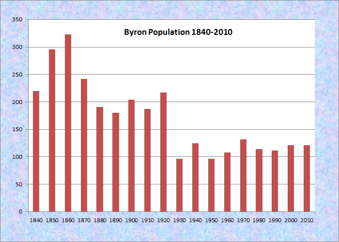
Population Trend 1840-2010
| Geographic Data | |
|---|---|
| N. Latitude | 44:44:02 |
| W. Longitude | 70:39:34 |
| Maine House | District 117 |
| Maine Senate | District 18 |
| Congress | District 2 |
| Area sq. mi. | (total) 52.5 |
| Area sq. mi. | (land) 51.8 |
| Population/sq.mi. | (land) 2.8 |
County: Oxford
Total=land+water; Land=land only |
|
")
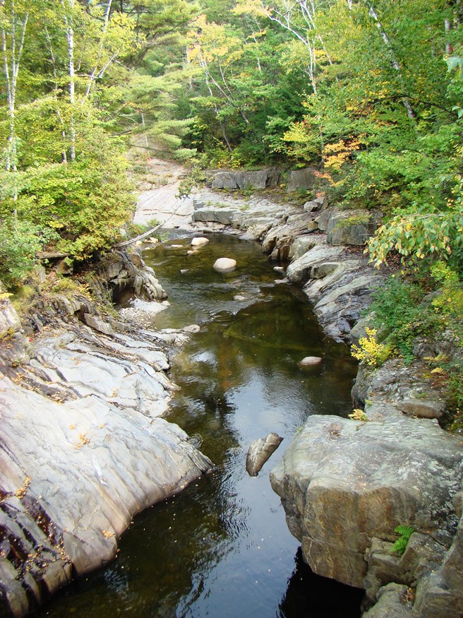
Coos Canyon (2007)
")
Coos Canyon (2007)
") [BUY-run] is a town in Oxford County incorporated on January 24, 1833 from township number eight. It was named for British poet Lord Byron.
[BUY-run] is a town in Oxford County incorporated on January 24, 1833 from township number eight. It was named for British poet Lord Byron.
The village is located on the Swift River nears Coos [CO-oss] Canyon, legendary source of gold and other minerals.
")
The Swift River (2007)
")
The Swift River (2007)
According to Varney in his Gazetteer of 1886,
The western part is largely drained by numerous small streams that gather at the southern part in one stream [Garland Brook], and empty into Ellis Pond. There are nine or ten mountains in the town; of which the double-peaked Mount Turk (local name Turk and Broad) is the highest, being nearly 3,000 feet. . . .
Byron Post-Office is located on Swift River, south-west of Whale’s Back Mountain. Above, on different powers, are two saw-mills. The nearest railroad is the Grand Trunk, with which it is connected by means of the stage from Andover to Bryant’s Pond Station, 26 miles distant by road. . .
The first settlers of this town were Samuel Knapp, Jonas Green, James Bawn, John Thomas, J. Stockbridge, Richerd Merrill and Abraham Reed. The land was purchased by the settlers of a Mr. Brown of Newburyport, Mass. Skillertown is said to be the Indian name.
")
Coos Canyon School (2007)
")
Volunteer Fire Department (2007)
This sparsely populated town is served by Maine Route 17 connecting it with the Rumford–Mexico area to the south.

Medal of Honor Augustus Merrill
Congressional Medal of Honor recipient:
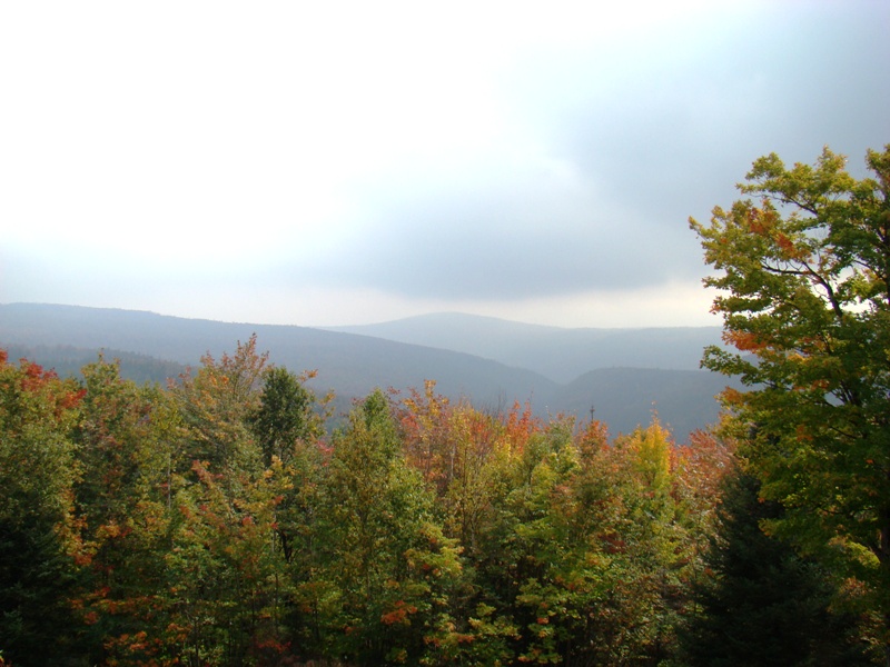
Below: Fall foliage and mountains in Township D just north of Byron on Route 17
Form of Government: Town Meeting-Select Board.
Additional resources
“A Brief Geological Review of Coos Canyon, Byron, Maine.” Maine Geological Survey. http://www.maine.gov /doc/nrimc/mgs/explore/bedrock/sites/jan08.htm (accessed October 9, 2011)
Varney, George J. A Gazetteer of the State of Maine. 1886. p. 151
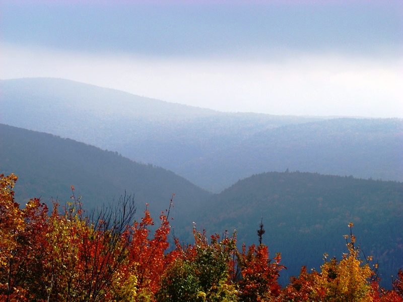
Fall foliage, mountains and Mooselookmeguntic Lake from north of Byron in Township D on Route 17 near the Appalachian Trail Crossing.