 N45° 56' 33.77\" W67° 49' 48.56\"")
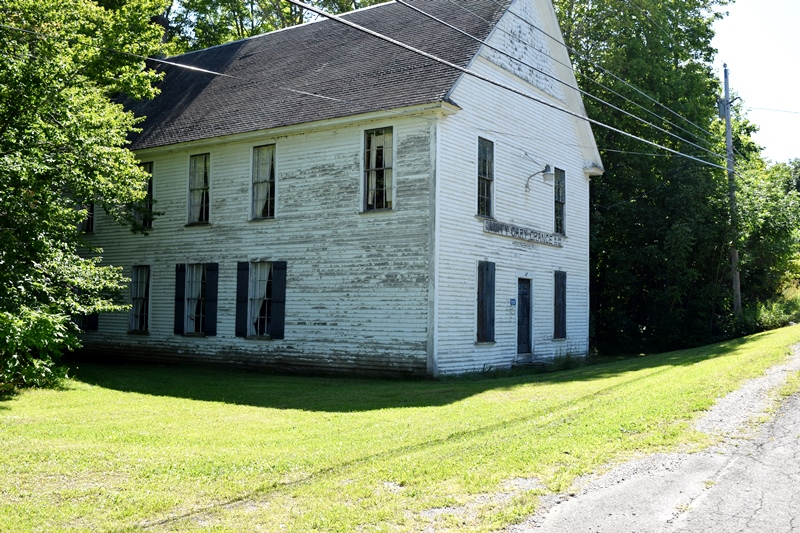
North Amity Church (2014) @

Location Map for Amity
| Year | Population |
|---|---|
| 1970 | 156 |
| 1980 | 168 |
| 1990 | 186 |
| 2000 | 199 |
| 2010 | 238 |
| Geographic Data | |
|---|---|
| N. Latitude | 45:54:51 |
| W. Longitude | 67:51:34 |
| Maine House | District 144 |
| Maine Senate | District 2 |
| Congress | District 2 |
| Area sq. mi. | (total) 42.1 |
| Area sq. mi. | (land) 42.1 |
| Population/sq.mi. | (land) 5.7 |
County: Aroostook
Total=land+water; Land=land only |
|

Population Trend 1840-2010
[AM-ih-tee] is a small town in Aroostook County, incorporated on March 19, 1836 from township T10 R01, also known as “Number 10.” Settlement began in 1826 with Jonathan Clifford, Jonathan Greenleaf and Columbus Dunn.
Amity-Cary Grange on U.S. Route 1 in Amity (2019)
According to George Varney in his Gazetteer, “The early settlers bought their land for twenty cents per acre, payable one half in cash and one half in work on the public highways.” By 1880 the own had three public schoolhouses. In 1902 a Grange Hall was built, serving both Amity and adjoining Cary (now Cary Township).
According to local sources the town was named in reference to the 1794 Treaty of “Amity, Commerce, and Navigation between England and the United States.”
Among other matters, the treaty was to settle the New England boundary with British Canada by means of a joint commission.
The treaty never met that goal, which was only achieved by the Webster-Ashburton Treaty that finally concluded the bloodless Aroostook War.
Amity, which now borders Canada, was one of the towns within what the British called “the disputed territory.”
")
North Amity Veterans Memorial (2014)
Even as Aroostook County has lost population over the years, Amity has managed slow but consistent growth.
Split by U.S. Route 1, its eastern boundary is with Canada, defined primarily by Monument Brook. The church is just north of Lycette Road on Route 1.
A veterans memorial is located across the road from the church.
The roughly seven-mile north-south “main street” (U.S. Route 1) was populated in 2019 by several fine farms and, in contrast, several abandoned houses.
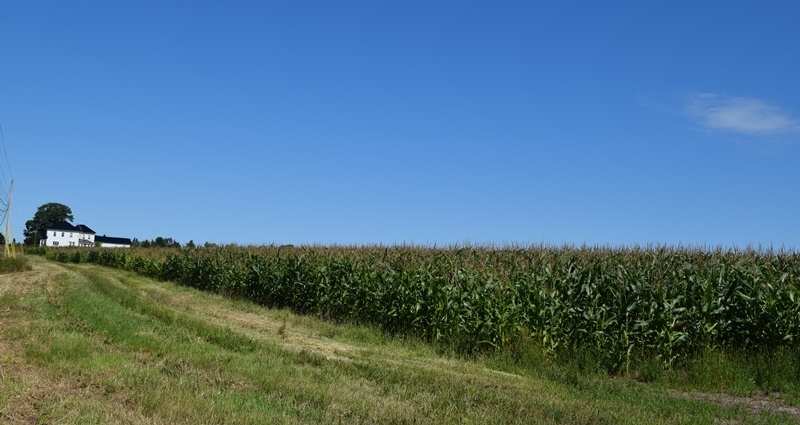
Farmhouse and Barn with Corn Field on U.S. Route 1 (2019)
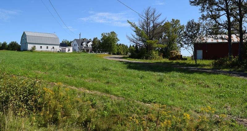
Farmhouse with Barns and Bulldozer in Amity on U.S. Rte 1
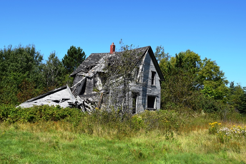
Abandoned house on U.S. Route 1 in Amity
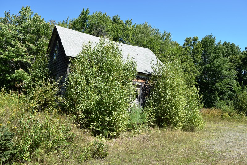
Abandoned house on U.S. Route 1 in Amity
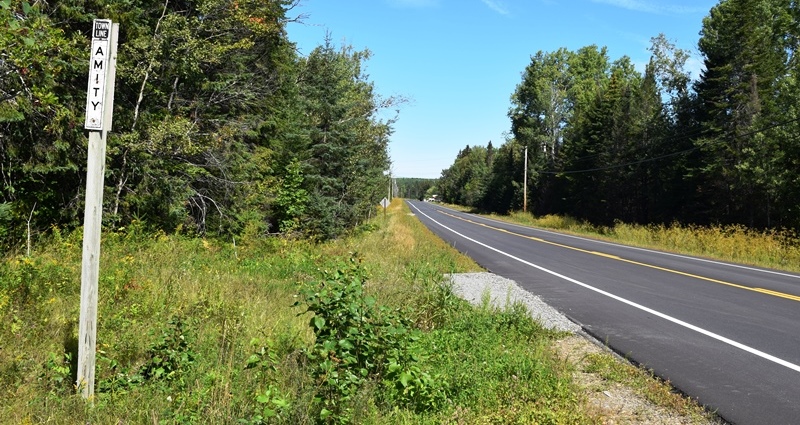
Town Line Sign “Amity” on U.S. Route 1 (2019)
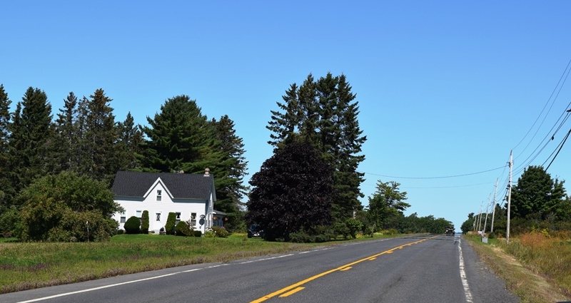
House in Amity on U.S. Route 1 (2019)
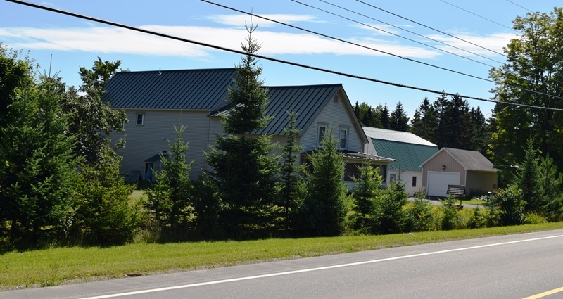
House, Large and Small Garages on U.S. Route 1
Form of Government: Town Meeting-Select Board-Manager.
Additional resources
Maher, Hilda. Folklore: Folk Hero John Stockford; legends of Pirate’s Cove; ghost, witch and devil stories; forerunners; jokes and anecdotes; tall tales; George Knox stories. Orono, Me. Hilda Maher. 1962. [Material was acquired for the Northeast Archives of Folklore and Oral History, Maine Folklife Center, University of Maine, Orono. Completed for UM course: Comparative literature 180 Fieldwork done in Amity, Cary, Hodgdon and Houlton, Maine.]
Maine. Historic Preservation Commission. Augusta, Me. Text and photos from National Register of Historic Places: http://pdfhost.focus.nps.gov/docs/nrhp/text/01001270.PDF and http://pdfhost.focus.nps.gov/docs/nrhp/photos/01001270.PDF
Varney, George J. A Gazetteer of the State of Maine. 1886. p. 71.
National Register of Historic Places – Listings
Reed School
[US 1, 0.1 mile south of junction with Lycette Road, North Amity] According to historical data, the school was kept as many weeks of the year as the town could afford. “All ages from the primer class to young men and women were housed in the one-room wooden building, often painted red, but sometimes white.”
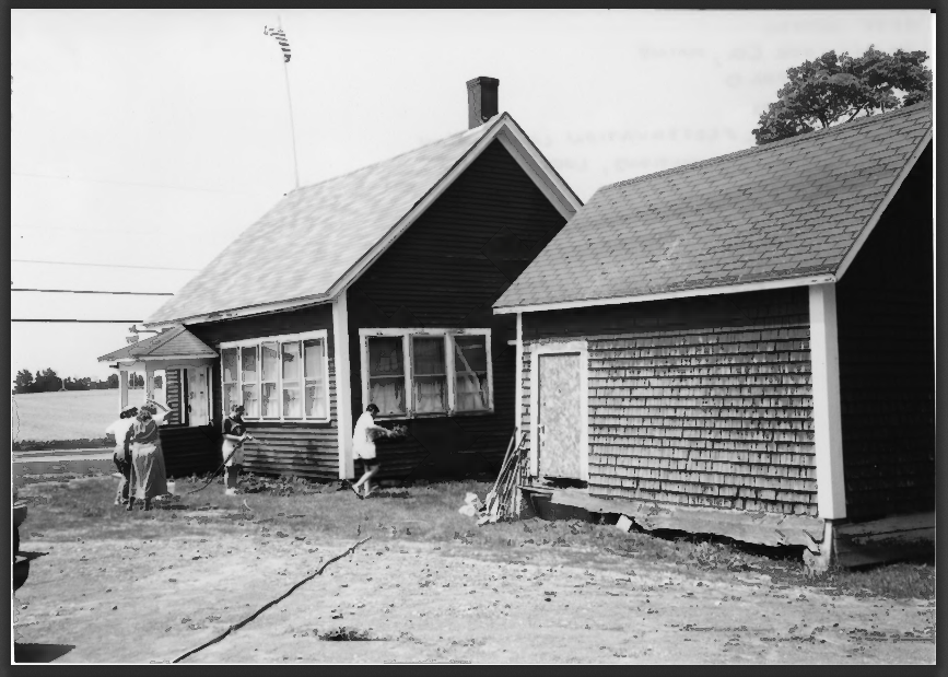
Amity Reed School Exterior (2001)
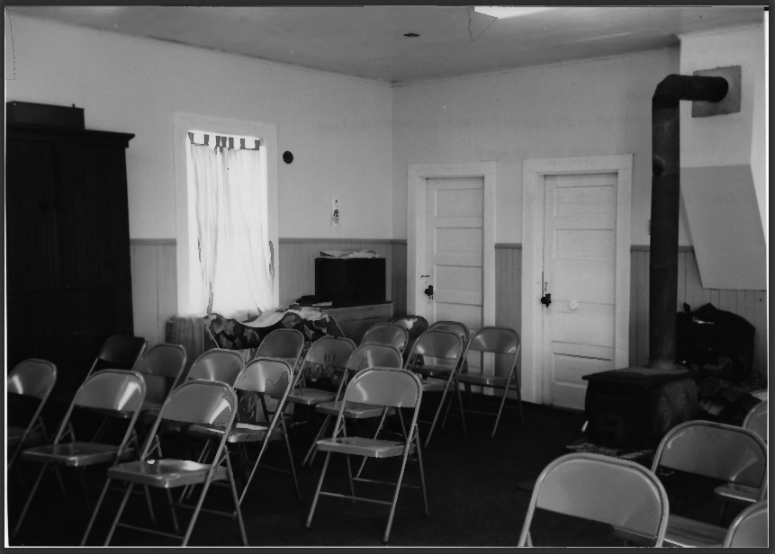
Amity Reed School Interior (2001)
The interior of the classroom had the teacher’s platform at the front with her desk and the chalkboard behind it. There was a big wooden chest in the corner that held textbooks. The original stove was iron and had a stovepipe that ran the length of the ceiling to the chimney in the back of the classroom. The children sat on crude benches and desks. There was a chart, a big dictionary, and a tin water pail and one dipper.
The school was one of the centers of community life, the other being the church (see photo above). It hosted evening singing school and a Lyceum for debates and short plays. There were spelling bees and a Farmers’ Club. [Bette Bickford Photos]
The once “little red schoolhouse” still served the community in 2019 as the Amity Town Office.
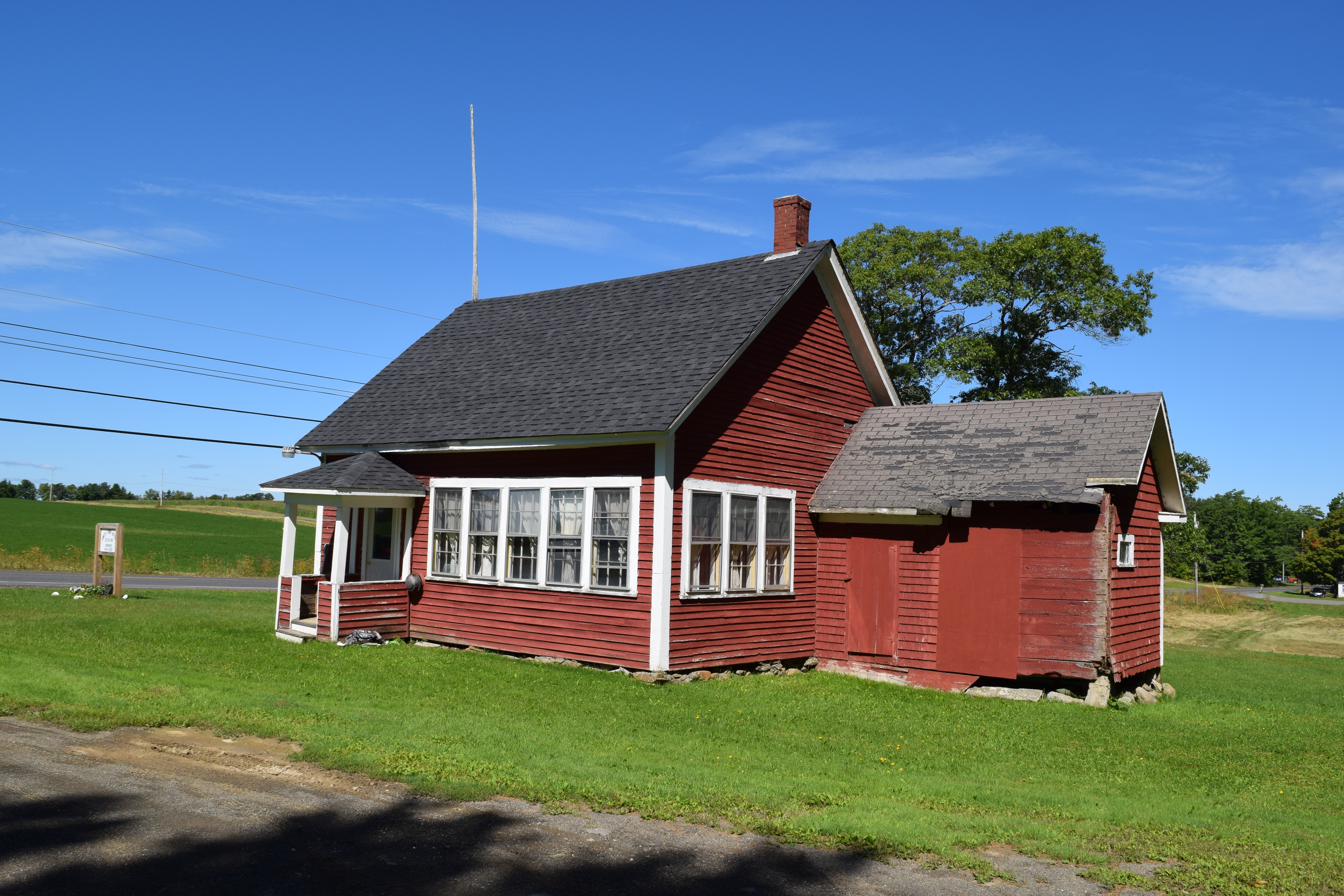
Historic one-room Reed School
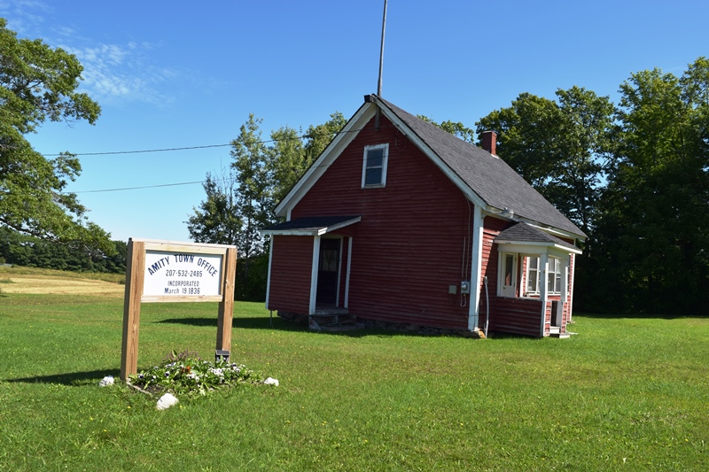
Amity Town Office in Reed School (2019)