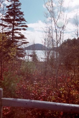
is in Hancock County on Mount Desert Island, about which explorer Samuel de Champlain created the first reliable European record in 1604. Through the gateway town of Bar Harbor, the Park now receives over 3 million visitors a year, with the busiest months being July, August, and September.
In 1901, Harvard president Charles Eliot formed the Hancock County Trustees of Public Reservations to help preserve some of the beautiful spots on Mount Desert Island. The Trustees acquired 5,000 acres in donated land that they presented to the Federal Government. In 1919 it became the first national park east of the Mississippi River.
Acadia Quick Facts
Evolution
Acadia has had three designations over the years:
1916 – Sieur de Monts National Monument – Presidential Proclamation
1919 – Lafayette National Park – Act of Congress
1929 – Acadia National Park – Act of Congress
From 1913-1940 a network of carriage roads and bridges was developed by John D. Rockefeller, Jr. The park was substantially destroyed by the great fire of 1947.
Physical Summary
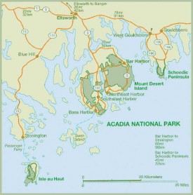
46,000 acres, distributed as . . .
30,300 acres of which are on Mount Desert Island
2,728 acres on Isle au Haut
2,194 acres on Schoodic Peninsula
10,452 acres in conservation easements
1,110 other acres
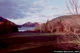
The State’s famed rocky coastline is on graphic display as one travels the loop road around the edges of the park on its eastern shore. The Park has about 125 miles of walking and hiking trails. Moderate effort hiking trails include Cadillac Mountain (4 miles), The Bee Hive (2 miles), Gorham Mountain loop (3.2 miles). The strenuous Precipice Trail is an exposed nearly vertical climb!
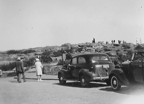
From October 7 to March 6, the 1530-foot Cadillac Mountain is the first place in the United States where you can see the sun rise and is the only mountain in the park with an auto road to the summit. In 1932 people gathered on the summit of Cadillac Mountain to view an eclipse of the sun. See an amateur film that recorded the event, from the archives of Northeast Historic Film.
In all, 26 mountains inhabit Acadia National Park, the highest of which, over 1,000 feet, are the following:
- Cadillac 1,530
- Sargent 1,373
- Dorr 1,270
- Pemetic 1,248
- Penobscot 1,194
- Bernard 1,071
- Champlain 1,058
- Gilmore 1,036
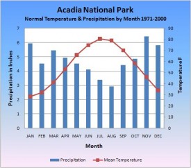
As the chart at right implies, the summer climate offers several months of comfortable temperatures with relatively infrequent precipitation, while the winter cold is accompanied by a good share of rain and some snow.
Wildlife Summary
Eleven species of amphibians have recently been identified on park lands and two others have been historically reported.
Over 273 species of birds have been identified on Mount Desert Island and in the adjacent waters.
Twenty-four species of fish have been found in island lakes and ponds, including several species that are introduced.
Over a thousand species of invertebrates have been reported from the park and Mount Desert Island area.
Insect inventories completed in the late 1940’s reported over 6500 species and subspecies for the Mount Desert Island area. Additional species have been identified since then.
Forty mammal species have been identified on park lands and more than a dozen other terrestrial and marine mammals have been identified on adjacent lands or water bodies.
Seven species of reptiles have recently been identified on park lands and four others have been historically reported on the island.
Sources: Publications of the National Park Service.
National Register of Historic Places – Listings
Carriage Paths, Bridges and Gatehouses
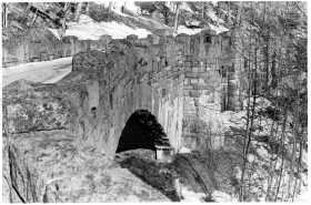
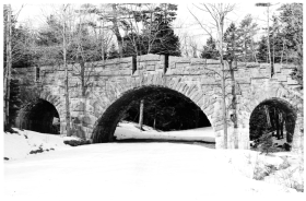
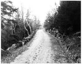
The Carriage Paths wind throughout the eastern half of Mount Desert Island through 57 miles of woodland in a stunning landscape of mountains and sea. They were planned and constructed in company with the sixteen bridges (thirteen are within the Park) by John D. Rockefeller, Jr., a summer resident of Seal Harbor during the second and third decades of the 20th century. Frederick Law Olmsted, Jr. reviewed and approved the plans.
The Paths follow the natural contours of the terrain maximizing wherever possible scenic vistas of mountains, ponds, and bays. Rustic, weathered wooden signposts mark destinations at path junctures, mark path names, and indicate foot trails that entice one into further penetration of the dense forests.
The Paths are about 16 feet wide and have been surfaced with gravel throughout. A crew of local workers that Rockefeller hand-picked for their skill at the outset of his project, were closely monitored by him for its two-decade duration.
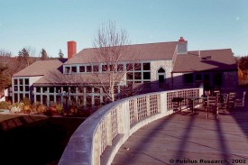
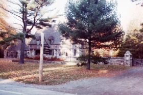
Rockefeller had two massive gates constructed where the paths intersected motor routes at Jordan Pond and at Brown Mountain. These complexes consisted of Gatekeepers’ Houses and Carriage Houses and permitted Rockefeller and his neighbors to have an untroubled entry to the Paths while restricting outsiders’ use.
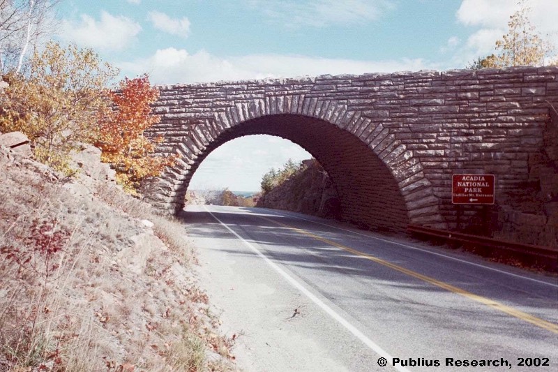
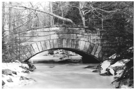
The thirteen bridges within the park occur where a ravine or motor route dictated a crossing. Each is constructed by hand of hand hewn local granite.
Each has individual design features that blend with their surroundings and that, in many cases, take advantage of natural waterfalls, site contours and great heights to enhance the drama of the landscape. Frequently small viewer’s platforms are designed into the bridges so that both the view and the handiwork of the bridge may be admired. In one case, a staircase leads to the valley floor so that the particularly spectacular three-span bridge may be seen from all vantage points.*
Seawall Campground, Acadia National Park,1935-1942
Additional resources
Butcher, Russell D. Fieldguide to Acadia National Park (Maine). New York. Reader’s Digest Press: distributed by Thomas Y. Crowell. 1977.
Coffin, Tammis E., ed. The Rusticator’s journal: A Collection of Articles from the Journal of Friends of Acadia. Bar Harbor, Me. Friends of Acadia. c1993. [University of Maine, Raymond H. Fogler Library, Special Collections; Bangor Public Library; Maine State Library]
Collier, Sargent F. The Triumph of George B. Dorr: Father of Acadia National Park. Bar Harbor, Me. The Author. c1964.
Dorr, George B. Acadia National Park: Its Growth and Development. Bangor, Me. Burr Printing Co. 1948.
Eckhoff, J. D. Forest Vegetation Monitoring in Acadia National Park. Orono, Me. Maine Agricultural and Forest Experiment Station, University of Maine. 2003.
Goldstein, Judith S. Tragedies & Triumphs: Charles W. Eliot, George B. Dorr, John D. Rockefeller, Jr., The Founding of Acadia National Park. Somesville, Me. Port in a Storm Bookstore. 1992.
Maine. Historic Preservation Commission. “National Register of Historic Places – Inventory Nomination Form: The Carriage Paths, Bridges and Gatehouses, Acadia National Park.” Augusta, Me. June 7, 1979. Photo credit: Anthony P. Menzietti. Photo dates: January 1979. Image source: National Register of Historic Places: http://pdfhost.focus.nps.gov/docs/nrhp/photos/79000131.PDF. Text source: pdfhost.focus.nps.gov/docs/nrhp/text/79000131T.PDF [condensed and edited] (accessed December 17, 2014)
Moore, Barrington. Vegetation of Mount Desert Island, Maine and its Environment. Brooklyn, N.Y. Brooklyn Botanic Garden. 1927.
Patterson, William A. Fire Regimes of the Coastal Maine Forests of Acadia National Park. Boston, Mass. U.S. Dept. of the Interior, National Park Service, North Atlantic Region, Office of Scientific Studies. 1983?


