Islands

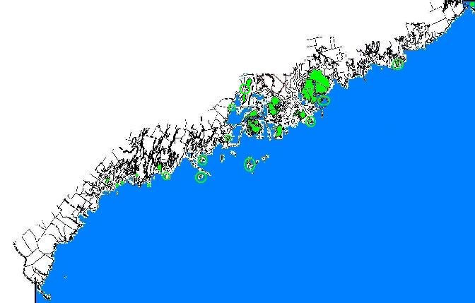
  Maine has thousands of islands. Many have had an interesting history in the discovery of Maine by Europeans, to granite quarrying, sheep raising, tourism, and summer cottages. Here is a tour of some of the more substantial islands, from Downeast to the southern coast. Hover over the green to find your island, then click…

Washington County

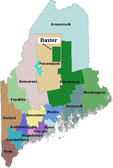
Map of Maine Counties and Baxter Park

Washington is the fourteenth most populous of the sixteen counties, located on the eastern most coast of Maine. It was formed on May 1, 1790 comprising all land west from the St. Croix River to the then eastern boundary of Hancock County. Only one town, Machias, existed within its boundaries. The county lost half its…

Waldo County

Map of Maine Counties and Baxter Park

is the eleventh most populous of the sixteen counties, located in mid-coast Maine, and was formed on July 3, 1827 from portions of Hancock, Kennebec, and Lincoln counties. Several adjustments were made in the 19th century, resulting in the current boundary containing the City of Belfast and the towns of Belmont, Brooks, Burnham, Frankfort, Freedom,…

Somerset County

Map of Maine Counties and Baxter Park

    A series of boundary changes in the 19th century came to an end in 1885 when a portion of Wellington in Piscataquis County was annexed to Cambridge in Somerset. The county now consists of the towns of Anson, Athens, Bingham, Cambridge, Canaan, Caratunk, Cornville, Detroit, Embden, Fairfield, Harmony, Hartland, Jackman, Madison, Mercer, Moose…

Sagadahoc County

Map of Maine Counties and Baxter Park

is the twelfth most populous of the sixteen counties, located in southern mid-coast Maine. Formed on April 4, 1854 from a portion of Lincoln County. All its initial municipalities still comprise the county: the City of Bath and the towns of Arrowsic, Bowdoin, Bowdoinham, Georgetown, Perkins, Phippsburg, Richmond, Topsham, West Bath, Woolwich. The only exception…

Piscataquis County

Map of Maine Counties and Baxter Park

is the least populous of the sixteen counties, located in north central Maine. Formed on April 38, 1838 from portions of Somerset and Penobscot counties. Initially it had twenty-two towns, two more were incorporated later, Dover and Foxcroft combined, and seven towns surrendered their organization, becoming townships. The well-known Baxter State Park is located on…