Wind turbines and wind “farms” of many turbines are sprouting all over Maine. Ridges and mountains are the most likely spots. As a result, they are visible for many miles and may intrude on enjoyment of hikers or residents near the devices.
Electricity generated by the turbines displace that generated by other sources, including those powered by fossil fuels, such as coal and oil, that emit carbon dioxide.
According to a 2011 audit report on the unorganized territories,
Wind parks, and their accompanying Tax Incremental Financing (TIF) Districts are emerging financial issues of consequence to the Unorganized Territory in Maine. Since 2010, the UT Education and Services Fund has paid out $9.65 million dollars in TIF payments on two wind parks, one in Franklin County, and the other in Washington County. To date, Franklin County has received $4.42 million, and Washington County has received $5.23 million.
Here are some images that have changed the Maine landscape in recent years. Captions and GPS data are from the location the image was acquired.
Bull Hill in T16 MD township in Hancock County
")
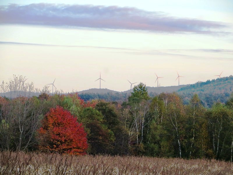
Wind Turbines from a Hill in Beddington on Route 9 (2013)
 N45° 23' 51.9\" W68° 7' 38.5\"")
Blueberry Barrens, Deblois near Rt193 (2014) @
Record Hill in Roxbury
")
Roxbury Wind Farm (2011)
From Route 120 in Roxbury
")
Record Hill Roxbury (2011)
From Route 120 in Roxbury
Rollins Mountain in Lincoln and Lee

Downtown Lincoln (2014)
N45° 21′ 44.0″ W68° 30′ 16.0″
")
Route 6 in Lincoln (2014)
N45° 21′ 57.6″ W68° 21′ 52.7″
")
Weatherby Hill, Springfield ’14
N45° 23′ 51.9″ W68° 7′ 38.5″
Stetson Mountain in T8 R3 NBPP

U.S. 1 in Brookton
Mars Hill in Mars Hill
 near N46° 29' 20.42\" W67° 52' 6.71\"")
Mars Hill mountain with Wind Turbines from U.S. Route 1 in Blaine (2014) @
Wind Turbines on Mountains over a Corn Field in Rumford from Route 232 (2014)
A ridge of turbines are visible from cornfields in south Rumford on Route 232.
Additional resources
Maine. Department of Audit. Unorganized Territory: Fiscal Year 2011 Annual Report. The Department. Augusta, Me. October, 2012. p. 27
REPLY TO KAREN BELOW:
If you were facing North Northwest it is unlikely that you were seeing Deblois or Beddington since they are North Northeast of Mt. Cadillac.
Try searching for “list of wind farms in Maine” which has a map of wind farms. Good Luck!
Hi, what turbines did I see from the top of Cadillac? I was facing North Northwest.
Deblois? Beddington?