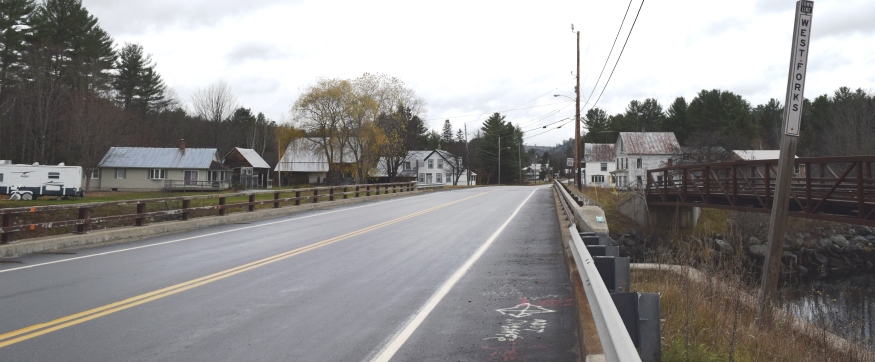
Entering West Forks Village at Cold Stream and the Kennebec River on U.S. Route 201 (2019)

Location Map for West Forks
| Year | Population |
|---|---|
| 1970 | 74 |
| 1980 | 72 |
| 1990 | 63 |
| 2000 | 47 |
| 2010 | 60 |
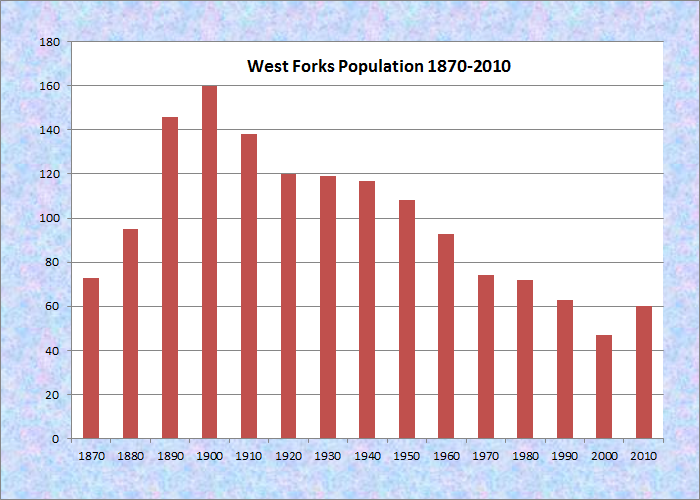
Population Trend 1870-2010
| Geographic Data | |
|---|---|
| N. Latitude | 45:24:05 |
| W. Longitude | 70:00:58 |
| Maine House | District 118 |
| Maine Senate | District 3 |
| Congress | District 2 |
| Area sq. mi. | (total) 49.4 |
| Area sq. mi. | (land) 48.9 |
| Population/sq.mi. | (land) 1.2 |
County: Somerset
Total=land+water; Land=land only |
|
West Forks, a plantation in Somerset County, was fully organized March 31, 1893, though it had been organized for election purposes in 1859. It is north of The Forks Plantation.
")
Mountain, South on Rt 201 (’04)
")
Berry’s General Store (2004)
")
Dead River Rapids (2002)
West Forks lies north of the Dead River and west of the Kennebec just above where the two rivers combine at The Forks.
The Kennebec River forms the plantation’s eastern boundary. The turbulent and dangerous 10-mile
")
Veterans Memorial (2004)
Kennebec River Gorge, is accessible only by experienced whitewater rafters.
The heavily forested area with a small and dwindling population is bisected by U.S. Route 201 on its way north to Jackman, then to the Province of Quebec.
Three sections of Maine Public Reserved Lands totaling 1,204 acres are located on the west side of U.S. Route 201. One is adjacent to West Forks Village on the highway.
Form of Government: Assessors-Annual Meeting.
Additional resources
Hall, Jon F. The Upper Kennebec Valley. Dover, N.H. Arcadia, c1997.
Hall, Jon F. The Upper Kennebec Valley, Volume II. Charleston, S.C. Arcadia. c1999.