 N44° 57' 54.70\" W67° 38' 59.82\"")
Blueberry Barrens, Route. 9 [The Airline Stage Road] (2013) @

Location Map for Wesley
| Year | Population |
|---|---|
| 1970 | 110 |
| 1980 | 140 |
| 1990 | 146 |
| 2000 | 114 |
| 2010 | 98 |
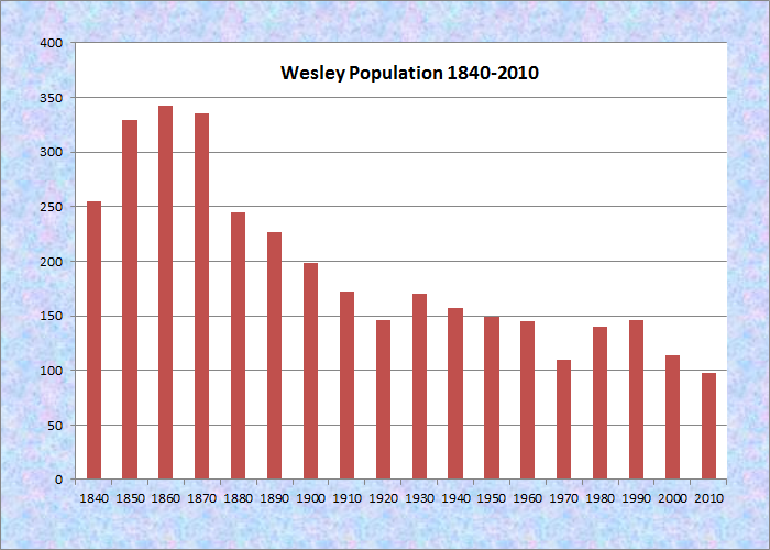
Population Trend 1840-2010
| Geographic Data | |
|---|---|
| N. Latitude | 44:55:42 |
| W. Longitude | 67:38:53 |
| Maine House | District 137 |
| Maine Senate | District 6 |
| Congress | District 2 |
| Area sq. mi. | (total) 50.9 |
| Area sq. mi. | (land) 50.1 |
| Population/sq.mi. | (land) 2.0 |
County: Washington
Total=land+water; Land=land only |
|
") [WESS-lee] is a town in Washington County.
[WESS-lee] is a town in Washington County.
It was incorporated on January 24, 1833 from the township T25 ED and a portion of T26 ED. Wesley is located on the historic Airline Stage Road, Maine Route 9.
While an agricultural town in the late 19th century, Wesley had a shingle mill producing 10,000 shingles per day.
 N44° 57' 17.14\"")
Community Church (2013) @
 N44° 57' 7.49\" W67° 39' 46.17\"")
Historical Society (2013) @
Fishing and camping is available at Seavey Lake, Little Seavey Lake and the western shore of Long Lake.
A subdivision accessible by gravel roads exists at the 111-acre Little Seavey Lake off Route 192 about a mile south of Wesley Village.
 N44° 57' 6.35\" W67° 39' 47.81\"")
Wyman Blueberry Facility (’13) @
Blueberry Barrens, Rt. 9 (2013) @
Blueberry production is a major industry in this Washington County town.
The Jasper Wyman company is the primary employer and owner of the blueberry barrens in the area.
 N44° 57' 37.40\" W67° 39' 14.39\"")
Wesley Fire Station on Route 9 (2013) @
 N44° 57' 42.32\" W67° 39' 10.59\"")
Old Wesley Volunteer Fire Department on Rt. 9 (2013) @
Maine Routes 9 and 192 pass through this sparsely populated, heavily forested area.
 N44° 56' 54.97\" W67° 41' 43.54\"")
P&J Grocery on Route 9 (2013) @
 N44° 57' 5.45\" W67° 39' 49.47\"")
Veterans Memorial, Rt. 9 (2013) @
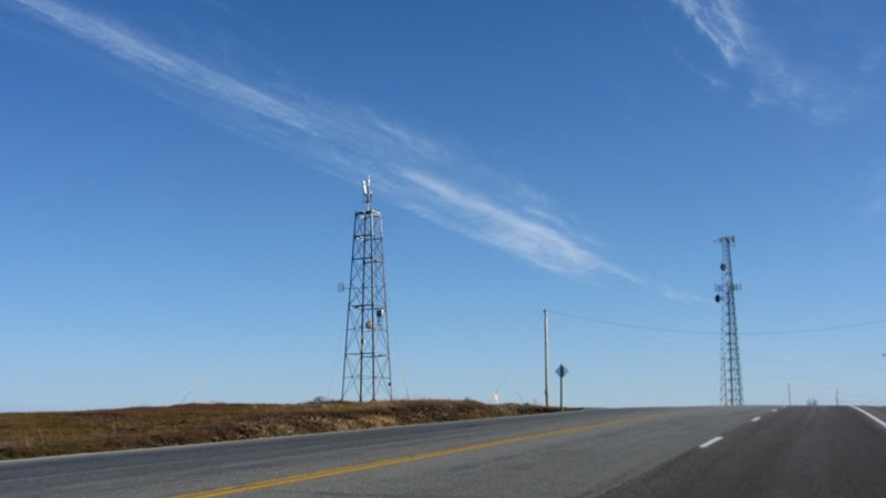
Communication Towers in Wesley on Route 9
Form of Government: Town Meeting-Select Board.
Additional resources
Day, J. Wilbur. Autobiography. [undated] (Cataloger Note: J. Wilbur Day was a hunter, guide, and farmer living in Wesley.) [University of Maine, Raymond H. Fogler Library, Special Collections]
Wesley Historical Society. The History of Wesley, Maine. Wesley, Me. Wesley Historical Society. 2011.
my husband and i went to sabeo every summer for years. his mother used to own a camp on an island, which got sold. we camped at campsite too. loved it. my husband has since past and i enjoy your site.next best thing to being there. i can hear the loons! ha ha evelyn
Lower Sabeo Lake is about 16 miles west of Wesley Village, as the crow flies, in Township T35 MD. This is one of those “you can’t get there from here” situations. The township has no paved roads, the best of which is the private Stud Mill Road and does pass near the lake.
Can anyone tell me about or share with me any information regarding the “Equalized Telephone Association” of Wesley Maine?
Thank you.