Longhorn Cattle on a Farm in Waltham

Location Map for Waltham
| Year | Population |
|---|---|
| 1970 | 437 |
| 1980 | 559 |
| 1990 | 515 |
| 2000 | 306 |
| 2010 | 352 |
| Geographic Data | |
|---|---|
| N. Latitude | 44:41:27 |
| W. Longitude | 68:20:07 |
| Maine House | District 136 |
| Maine Senate | District 7 |
| Congress | District 2 |
| Area sq. mi. | (total) 33.0 |
| Area sq. mi. | (land) 29.7 |
| Population/sq.mi. | (land) 11.9 |
County: Hancock
Total=land+water; Land=land only |
|
 N44° 41' 49.36\" W68° 20' 39.57\"")
Sign to Aurora, Eastbrook and Franklin (2013) @
 and Mariaville on Route 179 (2013) N44° 44' 55.86\" W68° 19' 17.61\"")
Union River E. Branch at Jones Bridge, Rt. 179 (’13) @
 N44° 37' 35.88\" W68° 22' 47.84\"") [WALL-tham] is a town in Hancock County, incorporated on January 29, 1833 from the township Number 14 MD, BPP. It ceded land to Eastbrook in 1872.
[WALL-tham] is a town in Hancock County, incorporated on January 29, 1833 from the township Number 14 MD, BPP. It ceded land to Eastbrook in 1872.
Waltham was first settled in 1804 when all travel was by boat or canoe on the Union River, which flows through Graham Lake.
The lake and a portion of the river constitute the full eight-miles (as the crow flies) of the town’s western boundary.
 N44° 38' 50.01\" W68° 22' 0.36\"")
Signs for Land Sales on Route 179 (2013) @
")
Long View of Graham Lake from Route 200 (2013)
Maine Route 179 parallels the east side of Graham Lake.
The frontage on this nine-mile lake, which also touches Ellsworth, Mariaville, and Fletchers Landing, has encouraged some developers to consider creating subdivisions near its shores.
Farming has long been a tradition in Waltham, and it continues in this sparsely populated rural community. Remains of apple orchards and currently worked blueberry barrens dot the landscape.
 N44° 41' 9.63\" W68° 21' 33.74\"")
Harmony Mill on the Fitchburg Road (2013) @
 N44° 41' 13.68\" W68° 20' 58.46\"")
sign: Harmony Mill Farm, on Route 179 (2013) @
 N44° 41' 10.65\" W68° 20' 59.56\"")
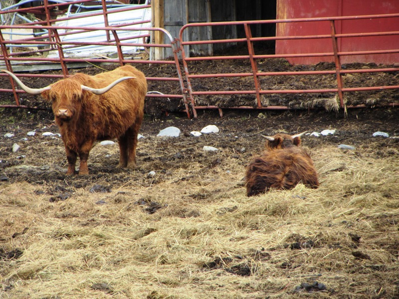
Longhorn Cattle on Route 179 (2013) @
 N44° 41' 9.40\" W68° 21' 0.47\"")
Farmhouse with Animals and Barn (2013) @
According to the Gazetteer of Maine in 1886,
The pretty village flat at Hastings’s bridge has the appearance of having been a lake bottom not many centuries since. In Cave Hill is a considerable cavern, in which three rooms have been explored. The rocks here are said to be of the same family and age as those in Orland [and Otis, both nearby in Hancock County] where caves occur. . . . Waltham has a soil well fitted for potatoes and for apple orchards. The principal crop is hay and potatoes. . . . There is one mill for the manufacture of staves and shingles.
Waltham is about ten miles north of Ellsworth on Route 179. Route 200, also known as Cave Hill Road, connects the community to Eastbrook. Cave Hill is on the north side of the road, near JR Ralph Road. The scenes below are on Route 200.
 N44° 41' 35.86\" W68° 18' 33.88\"")
Contractor Business in Waltham (2013) @
 N44° 41' 55.22\" W68° 20' 9.18\"")
Recently Burned Blueberry Barren (2013) @
 N44° 41' 54.20\" W68° 20' 20.69\"")
Town Road Facility with Salt/Sand Shed (2013) @
 N44° 41' 54.22\" W68° 20' 20.91\"")
Waltham Fire and Rescue Building (2013) @
 N44° 38' 47.64\" W68° 15' 42.54\"")
Rock Strewn Blueberry Barrens (2013)
 N44° 38' 46.98\" W68° 15' 39.72\"")
Cave Hill Cemetery (2013) @
On Route 179 a large former Grange Hall in surprisingly good condition was for sale in 2017. Even the old outhouse privy was intact!
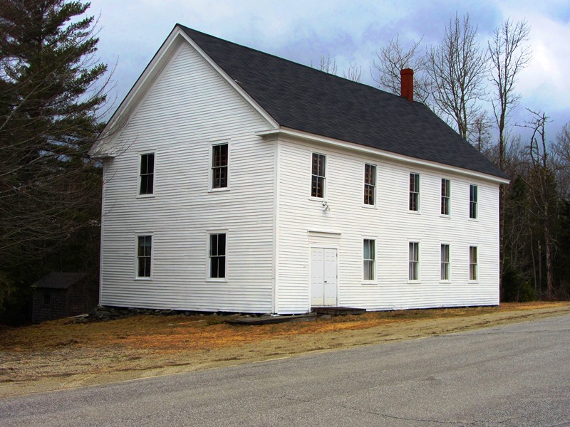
Old Grange Hall on Route 179 (2013)
 N44° 42' 44.10\" W68° 20' 17.58\"")
Old Grange Hall on Route 179 (2013) @
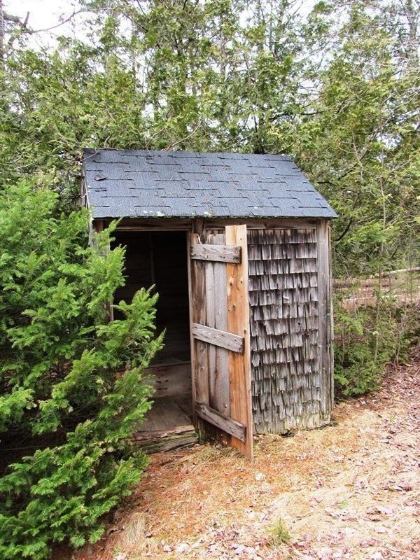
The Privy (2013)
Form of Government: Town Meeting-Select Board.
Additional resources
Varney, George J. A Gazetteer of the State of Maine. 1886. pp. 562-563.