")
Rolling Hills in Rural Wales (2002)

Location Map for Wales
| Year | Population |
|---|---|
| 1970 | 642 |
| 1980 | 862 |
| 1990 | 1,223 |
| 2000 | 1,322 |
| 2010 | 1,616 |
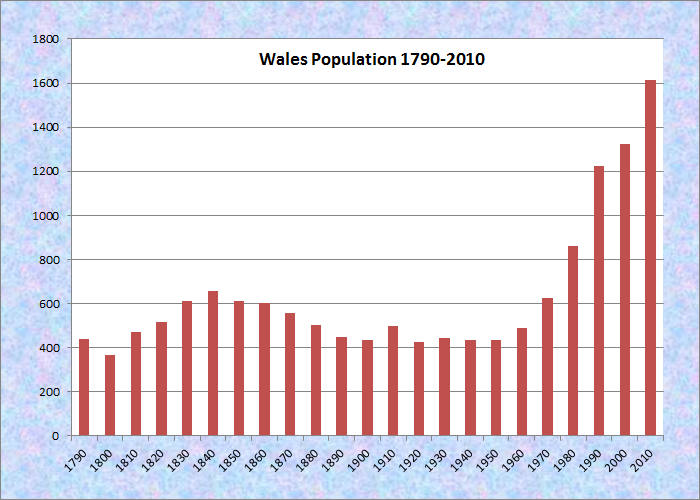
Population Trend 1790-2010
| Geographic Data | |
|---|---|
| N. Latitude | 44:09:44 |
| W. Longitude | 70:02:56 |
| Maine House | District 82 |
| Maine Senate | District 22 |
| Congress | District 2 |
| Area sqmi | (total) 17.1 |
| Area sq. mi. | (land) 16.1 |
| Population/sqmi | (land)100 |
County: Androscoggin
Total=land+water; Land=land only |
|
")
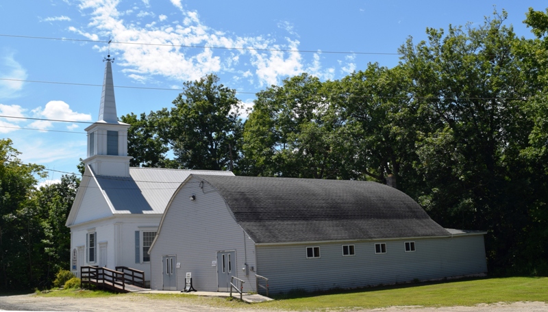
Wales Grange Hall (2012)
") [WAALS] is a town in Androscoggin County, incorporated on February 1, 1816 from Wales Plantation. It annexed land from Litchfield (1827, 1856), Leeds (1855), and Monmouth (1855).
[WAALS] is a town in Androscoggin County, incorporated on February 1, 1816 from Wales Plantation. It annexed land from Litchfield (1827, 1856), Leeds (1855), and Monmouth (1855).
Later, in 1867, it ceded land to Webster, now Sabattus.
The early settlers arrived in about 1773, some of whom came from Wales in Britain.
The gentle hills in the town reflect the landscape of the old country. That may have been the reason some Amish folks moved there in 2019.
")
Apple orchard & ladder (2002)
")
Field & farm buildings (2002)
According to the Town’s 2004 Comprehensive Plan,
As Wales’ population grew there was a need for more schools. At one time, there were five one-room schools in Wales. In order to pass state inspection in 1946, the town had to modernize every one of the schools or build a central school. It was not until 1951, however, when the schools were all condemned by the State Insurance Commission, that the citizens voted to construct a central school. Since there was no high school in Wales, the upper grade students could attend wherever they chose and the town paid the tuition. In 1974, Wales became a member of Litchfield, Sabattus, and Wales School District and the three towns built Oak Hill High School in Wales which opened in the fall of 1976.
")
Central School Building (2012)
")
Site of Old Town House (2012)
Wales Central School closed in 2011 with reuse pending a final decision by the town. Students now attend another school in the District.The site of an older community building, the Old Town House, is adjacent to a town garage.
")
Farm at Sabattus Pond (2012)
")
The Pond at Woods Rd (2012)
The grange hall is home to several community organizations including the Masons, Order of the Eastern Star and a snowmobile club.
With access to Sabattus Pond, the town is within easy reach of Lewiston–Auburn via Maine Route 132, and of Gardiner by way of Routes 9 and 126.
")
Wales Fire Department (2012)
")
Farmhouse and attached Barn in Wales Center
(2012)
")
Twin Silos in Wales (2012)
Form of Government: Town Meeting-Select Board.
[WALES 2020]
In 2019 the residents of Wales learned that several Amish families would soon be settling in their community. The early reaction was mixed, with concerns for road safety and hopes to rejuvenate the towns agricultural economy.
Most of the families apparently were to settle along the Leeds Junction Road. Two local residents noted that the Amish bought the land from Roger Fortin, a longtime farmer who was been looking for the right buyer since at least 2012. Reportedly he wanted to pass his 350-acre farm to someone who would work the land. A farm and farmers market (below) have been established on the Leeds Junction road. In apparent reaction to the Covid-19 epidemic in Maine, the Presbyterian Church (below, left) has posted a notice as follows: “Church Services Outside Only, Sunday 9 AM, Welcome.”
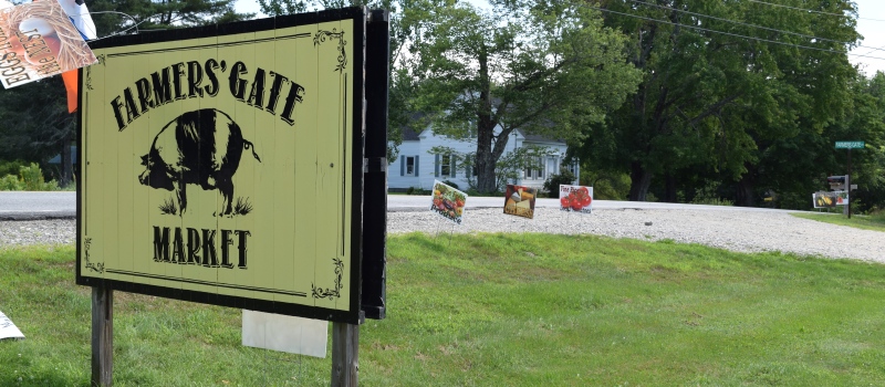
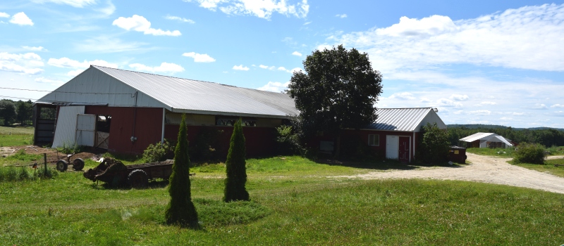
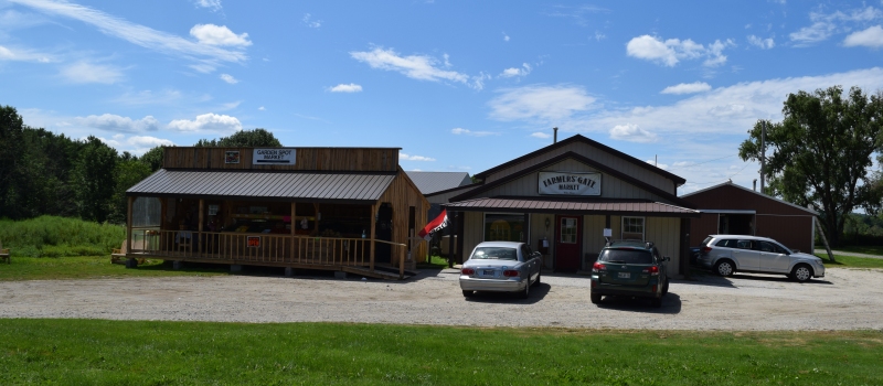
Amish Farm and Farm Stand
Wales Presbyterian Church on Route 132 (2020)
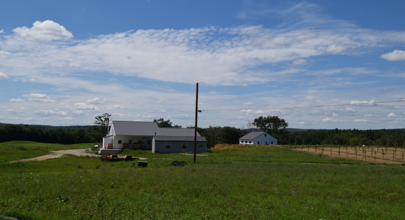
Farm with new orchard on Leeds JCT Road (2020)
Additional resources
“Maine’s Amish community plans to renew farm lifestyle after expanded into Wales.”
Daily Bayonet. https://dailybayonet.com/maines-amish-community-plans-to-renew-farm-lifestyle-after-expanded-into-wales/ (accessed 8/10/2020)
Cochrane, Harry H. History of Monmouth and Wales [microform]. East Winthrop, Me. Banner. 1894. [Maine State Library]
Mitchell, H. E. (Harry Edward). The Town Register: Wayne, Wales, Monmouth, Leeds, Greene, 1905. Brunswick, Me. H. E. Mitchell. 1905.
Town of Wales Comprehensive Plan. Wales, Me. 2004.