
Detail of 1940’s Township C Topographic Map
 This oddly shaped, [click Location Map for red location] trapezoidal township, not to be confused with the triangular C Surplus, is immediately west of Township D, host to the next northerly section of the Appalachian Trail. The trail travels about one mile in the township’s southeast corner on the southwest slope of Old Blue Mountain. The green dots on the maps trace the current route.
In the 1940’s, the Trail (black broken line) went due north through the Township then followed the Clearwater Brook before trekking just southeast of Elephant Mountain*. (See the detail map.) Now the trail turns east through Andover North Surplus at the southern boundary of Township C and enters it only briefly.
Lower Richardson Lake dominates the western portion of the township. Mountains here include South Arm, Elephant, Metallak, Black Cat and C Bluff.

1940’s Township C Topographic Map – Broad View
Access to the trail is by East B. Hill Road in the west, or in the east by South Arm Road. Both are accessible from the town of Andover about seven miles to the south.
*Not to be confused with Elephant Mountain in Bowdoin College Grant West Township near Moosehead Lake, on which a B-52 bomber crashed in 1963.
Topographic maps were created from the following: University of New Hampshire Dimond Library, Documents Department & Data Center, Historic USGS Maps of New England & New York, accessed 1/6/2008: Old Speck Mountain, ME Quadrangle (1945), http://docs.unh.edu/nhtopos/OldSpeckMountain.htm; and Oquossoc, ME Quadrangle (1942) http://docs.unh.edu/nhtopos/Oquossoc.htm. (accessed 1/7/2008)
![]() <= South Appalachian Trail – click a boot North =>
<= South Appalachian Trail – click a boot North =>![]()
Richardson Lake has a long record of “ice-out” data, which may be significant as a measure of climate change due to global warming. The lake was once the major path for moving logs from forests to mills, thus the exceptional record keeping.
As with Moosehead Lake, a trend toward earlier dates for an ice free lake is clearly evident as the chart below demonstrates. In 1889, the ten-year average ice-out date was May 12th; in 2005 it was May 5th. In 2013 the ice was gone by May 1st; in 2016 it was April 18th, the earliest since 1945. (Data for 2006-20012, 2014 and 2015 1s not available.)

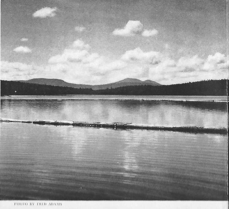
Middle Dam (center left on the second topo map) was the setting for We Took to the Woods, a classic memoir by Maine author Louise Dickenson Rich. Middle Dam is on the shore of Lower Richardson Lake and near the Rapid River and Pond in the [Rapid] River. Access is by water from the Lake.
Pond in the Rapid River (1940) *
Additional resources
Maine. Department of Agriculture, Conservation and forestry. Bureau of Parks and Lands. “2016 Maine Lake Ice Out Dates.” http://www.maine.gov/dacf/parks/water_activities/boating/ice_out16.shtml (accessed April 20, 2017)
- photo from We Took to the Woods