Columbia Falls

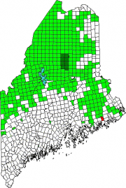
Location Map For Columbia Falls

Year Population 1970 367 1980 517 1990 552 2000 599 2010 560 Geographic Data N. Latitude 44:40:23 W. Longitude 67:42:49 Maine House District 138 Maine Senate District 6 Congress District 2 Area sq. mi. (total) 24.7 Area sq. mi. (land) 24.5 Population/sq.mi. (land) 22.9 County: Washington Total=land+water; Land=land only [kol-UM-bee-ah FALLS] is a town in…

Jonesboro

village is in Washington County on U.S. Route 1 where it splits to create Route 1A, then both reunite at Machias to the northeast. See photos. Chandler River, which empties into Englishman Bay, runs through the village. The banks of the river show evidence of ruins, possibly a dam. Hannah Westin, and her sister supported the effort to capture the British vessel Margaretta in 1775.

Jonesport

The town hosts a U.S. Coast Guard station, headquartered at the entrance to the Jonesport-Beals Bridge. See video and photos. The main village, a lobster fishing center, is located on Moosabec Reach and the Indian River. Two nature preserves are in the town, both on islands. A bridge across the Reach leads to the island community of Beals.