Crimes, Notorious

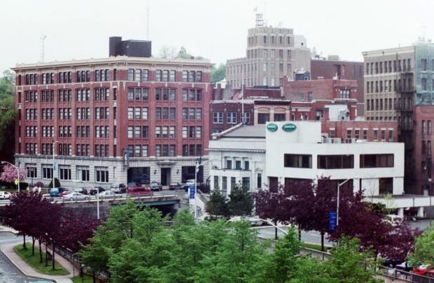
Maine has had its share of notorious crimes, such as the 2003 mass poisoning in New Sweden. The Brady Gang was responsible for another. Its career ended in Bangor on October 12, 1937. Here is an excerpt from the Federal Bureau of Investigations account of their crime spree: During the latter part of the year…

Veazie

Veazie Dam on the Penobscot River (2003)

At only 3.4 square miles in area, Veazie is one of the smallest municipalities in the state. U.S. Route 2 is also its Main Street. Created in 1853, it was named, and likely created, for General Samuel Veazie who owned the saw mills and most of the property in the new town. Mills and a power station took advantage of the Penobscot River here.

Topsham

Recently the downtown (see photos) has witnessed a renewal with modern buildings. Topsham has been a very rapidly growing community both in population and in commercial development.The area of the Topsham Fair Mall is located adjacent to Interstate 95. Pejepscot Village was once an active community when the Pejepscot Paper Mill was in full production. Falls in the Androscoggin River between Topsham and Brunswick encouraged the development of paper and textile mills which dominated the economy into the 20th century.

South Portland

A residential community serving the greater Portland area for over a hundred years, the City has developed independent economic resources. See photos. It is part of the Port of Portland and home to a major railroad yard and fuel tank storage facility. The Southern Maine Community College campus includes Fort Preble, named for Commodore Edward Preble.

Smithfield

A summer recreational center, it hosts the bulk of two of the Belgrade Lakes: North Pond and East Pond. East Pond is home to several summer camps for young people, some that cater to adults, and some that are individually owned summer cottages. See photos. The main village is on the eastern shore of North Pond, where a sandy beach attracts area residents and summer visitors.

Perry

Passamaquoddy Tribal Office in Perry promoting Indian Day (2013)

Named for Commodore Oliver H. Perry, a naval hero of the War of 1812, the town was incorporated even as the British still held Eastport only six miles away. Perry is the gateway, via Maine Route 190, to the Pleasant Point Passamaquoddy Indian Reservation located withing the town, and to the City of Eastport. Boyden Lake dominates the northwest portion of the town, while the southwest has miles of protected coves approaching Cobscook Bay.

Oakland

Waterville’s commercial strip that is Kennedy Memorial Drive continues into Oakland for about a mile before becoming a more scenic road. See photos. Here the village emerges as it sits at Messalonskee Stream. Long the home of the New England Music Camp, recreational opportunities include access to several of the Belgrade lakes.

North Yarmouth

North Yarmouth’s rapidly growing community, nearly triplng its population since 1970, is within easy reach of Yarmouth, Brunswick, and the greater Portland area. King William’s War started here when Indians attacked the settlement in the late 1680’s.

North Berwick

Mill Buildings on the Great Works River (2002)

The North Berwick Woolen Mill is a historic landmark on the banks of the Great Works River that passes through the main village. See photos. More than a dozen National Register historic places testify to the town’s significant role in Maine’s early history.It is home to the historic Hussey Plow Company and a Pratt & Whitney defense plant.

Newfield

The old center of Newfield village was destroyed by the great forest fire of 1947. See photos. The Willowbrook Historic District covers this area and the buildings that survived the fire. In 1984 the application to establish the historic district reported “Very little change in the buildings or landscape has occurred in the last one-hundred years so that the sense of time and place of a remote southwestern Maine rural community of the 19th century remains strongly present.” At the source of the Little Ossipee River, and dotted with ponds and streams, Newfield is a rapidly growing community about twenty miles northwest of Sanford

Mexico

Stack of Paper Mill in Rumford near the Androscoggin River from the Mexico-Rumford Bridge (2013)

The town, across the Swift River and the Androscoggin River from Rumford, is home to many workers in the Rumford paper mill. See photos. In the 1960’s, the mill employed over 3,000 people; by 2009 it employed less than 600. The crash in this and other manufacturing has contributed to the sharp population decline Mexico has experienced since 1970.

Indian Township

Peter Dana Point, in the southwest corner, is the village center for the Passamaquoddy people in the township. U.S. Route 1 hosts another cluster of facilities and population. The tribe’s governing body is the policy maker for the Passamaquoddy People of Indian Township with each member elected for a four year term. Municipal offices, public safety building, housing authority and Boys & Girls Club Fitness Center are in the southeast corner near the town line with Princeton and near the shore of Lewy Lake.

Eliot

Country Living (2012)

in York County, settled in the 1630s, on the east side of the Piscataqua River dividing Maine from New Hampshire, is a growing residential community serving Kittery and Portsmouth. See photos. Its population expanded by almost 12% in the 1990-2000 decade. Eliot was home to Maine’s first Quaker Meetinghouse built in 1776.

Bucksport

in Hancock County was settled in 1762. Jed Prouty’s Tavern and Inn, no longer operating, was a stop for the Bangor to Castine stage route. The paper mill (once St. Regis, then Champion, then Verso) dominates the north end of town and is across the Penobscot River from Fort Knox. Northeast Historic Film, a moving image archives, research and education center is located here. See photos.

Brunswick

Picard Theater and Maine State Music Theater at Bowdoin College (2018)

Since the demise of textile and shoe manufacturing, Brunswick has become a service center for the region and a residential community for commuters to the greater Portland area. With Bowdoin College, Maine State Music Theater, Maine Writers and Publishers Alliance, Pejepscot Historical Society, and many historic buildings, it is a powerful cultural magnet. AMTRAK service to Boston resumed in 2012. The town has a 66 mile ocean shoreline and 12 miles along the Androscoggin River.

Brownfield

Named for Captain Henry Y. Brown, who received a land grant for service in the French and Indian Wars, the town sits between the New Hampshire border and the Saco River. The Stone Mountain Arts Center, with excellent attractions and food, brings visitors from long distances. See photos.

Acton

Historic 1884 Lincoln One-Room School Interior (2014)

is a town in York County, incorporated on March 6, 1830; it ceded land to Shapleigh in 1831. It was part of a much larger tract of land in purchased in 1661 by Francis Small from Chief Sunday of the Newichawannock Tribe. Settled in 1776, the town’s first mill, a grist mill, was built on the Salmon Falls River in 1779 by Joseph Parsons.

Bangor

Bangor Downtown near the West Market Square Historic District (2001)

When Maine separated from Massachusetts in 1820, the vast Maine timberlands were put on the block for speculation, which drew investors and fortune hunters. By the 1830s, Bangor was building 500 structures annually. Dow Air Force Base provided an economic and civic boost during the Cold War until closing in 1968. The creation of Bangor International Airport turned the potential liability into an asset.

Counties

Maine has sixteen counties, as well as hundreds of local governments. The earliest established was York, in 1652; the latest, Knox in 1860. The structure and functions of county government are similar throughout the state. For a brief sketch of each county, click on its name in the map at right. Aroostook is the largest…