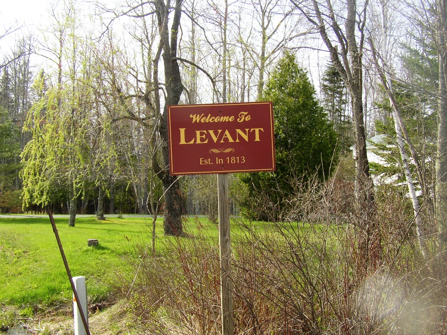
Coburn Gore

Approaching U.S. Inspection Station (2017)

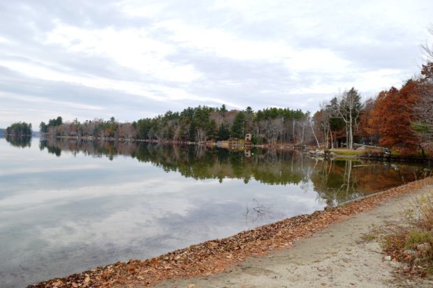
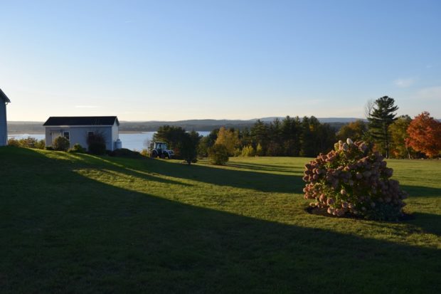
This is a small unorganized township in Franklin County on the border with Canada. It has a very small village with few houses and one store. Logging trucks abound, both in the village and those traveling through from Canada, many with lumber. Without mountains, it does have three water bodies: Arnold Pond, Crosby Pond, and…

Winterport

Marsh Bay on the Penobscot River just South of Winterport Village (2003)

Winterport is primarily a rural community with its land area extending ten miles westward from the river. See photos. An attraction along Route 139 among the farms and woods is the Winterport Dragway, featuring auto drag races with specialty vehicles and “street” vehicles. In recent years a marina has expanded and an export business has been established on the river. A dockside freezer operation enabled the storage and shipping of commodities such as fish and chicken.

West Gardiner

Its community center is on the Spears Corner Road where the town office, fire department, town garage, elementary school, and convenience store all lie in close proximity. See photos. West Gardiner is the site of one of the Maine Turnpike Authority’s service plazas, home to the Center for Maine Craft, which features a retail gallery and cultural tourism information.

Stetson

Road to Stetson Shores Campground (2014)

Just 20 miles northwest of Bangor and adjacent to Newport, the town is a growing, but still rural community. Settled in 1800, it was soon organized as a plantation for election purposes. The post office opened in 1829. In the 1880’s Stetson was home to three sawmills, a grist mill, Stetson Cheese Factory, and a carriage factory.

Springfield

Wind Turbines on Rollins Mountain from Weatherby Hill on Route 6 in Springfield (2014)

Located on the east-west Maine Route 6 crossing eastern Penobscot and northern Washington counties, the town has a substantial area in wetlands. See photos. One account has the name commemorating “extensive fields abounding in springs.” The village is centered around the crossroads of Route 6, Park Street (Routes 169/170), and Shep Road.

Smithfield

A summer recreational center, it hosts the bulk of two of the Belgrade Lakes: North Pond and East Pond. East Pond is home to several summer camps for young people, some that cater to adults, and some that are individually owned summer cottages. See photos. The main village is on the eastern shore of North Pond, where a sandy beach attracts area residents and summer visitors.

Sidney

Bounded by the Kennebec on the east and Messalonskee Lake (the modern name for Snow’s Pond) on much of the west, Sidney is located between Augusta and Waterville. See photos. Sidney Bog is located in the southeastern corner of the town.

Pownal

Location Map for Portland

Bradbury Mountain State Park offers picnicking, a modest walk to the summit, and a historic cattle pound. See video and photos. “Pineland Center ” is a community of non-profits and local businesses. Most of the town is rural residential, with homes and a few farmhouses widely spaced along the local roads. The few commercial establishments are clustered in Pownal Center Village.

Oakfield

Caboose near Oakfield Station on the Station Road in Oakfield (2012)

Originally settled in 1831 and organized for the assessment of taxes in 1866, the town itself was incorporated on February 24, 1897. See photos. The main village, is located on the Mattawamkeag River, just south of Smyrna Mills. Its mountainous terrain, known as the Oakfield Hills, earned it the name “Switzerland of the Aroostook” by one observer. Sam Drew Mountain is the highest point at 1,516 feet.

Livermore Falls

Livermore Falls Birdseye View 1889

For years Livermore Falls was a thriving paper mill town. See video and photos. Recently, the employment future has become less certain, as shown by the age of the housing stock. Pikes Corner at Route 133 and 106 is in the East Livermore area, in Livermore Falls. The town is directly north of the Lewiston-Auburn area. An extensive logging and manufacturing operation produces wood pallets.

Litchfield

The town contains the Tacoma Lakes, Cobbosseecontee Stream, a portion of Cobbosseecontee lake, Pleasant Pond, and several other ponds. See photos. Between Lewiston and Augusta, it offers summer cottage locations for many area residents. Litchfield Corners, in the southern tip of the community, hosts an old tavern, new town office and a country store.

Levant

sign: "Welcome to Levant, Est. 1813" (2005)

In the 1990-2000 decade Levant, just 8 miles from Bangor, was one of the fastest growing towns in the area with population growing by more than 25%. The next decade it grew by over 31%. The Minerva Grange was formed in1902 when 54 people voted to do so. It is still used for community meetings.

Lee

Historic 1889 Mallett Hall in Lee Village, built as a hotel by James Mallett (2014)

in Penobscot County, incorporated in 1832, is home to Lee Academy. Victorian style Mallett Hall, also known as the Mount Jefferson House, has been a fixture in the town since 1889. village center lies at the intersection of Route 6 and the short Route 168 from Winn.

Lamoine

Lamoine Consolidated School (2013)

a town in Hancock County, incorporated in 1870. Mount Desert Narrows separates Mount Desert Island from Trenton and Lamoine. Eastern Bay is east of the narrows between Lamoine and the island. Lamoine State Park and Lamoine Beach are both on the shore of Eastern Bay. They are at the end of Maine Route 184, which departs from U.S. Route 1 in Ellsworth.

Guilford

Park in Guilford with mill buildings downtown (2002)

The Piscataquis River flows through the main village with neighboring Sangerville, formed with some land from Guilford, on the southern shore. The town was long a center for textile production. The late 20th century was marked by fires, floods, and economic instability, but the early 21st century opened with efforts at renewal with a river festival and downtown revtlalization.

Chelsea

in Kennebec County, named for a town in Massachusetts, incorporated in 1851. Togus Medical Center, known generally as “Togus” is here. Originally it was the National Home for Disabled Volunteer Soldiers from the Civil War. The grange, school and town hall are clustered near each other. See photos.

Athens

Somerset Academy Building (2003)

Settled by Revolutionary War soldiers, Athens incorporated in 1804. Somerset Academy now serves as town office, American Legion hall, and Christian Fellowship meeting place. The Union Meetinghouse has served the community since 1840. Athens has hosted a small agricultural fair for many years.

Arundel

A town “Arundel” formed in 1719. In 1821 it became Kennebunk Port, from which, in 1915 a new town emerged: “North Kennebunkport.” In 1957 it changed to Arundel. Kenneth Roberts’ historical novel “Arundel” recounts the early life of the area and influenced the reemergence of the name. See video and photos.