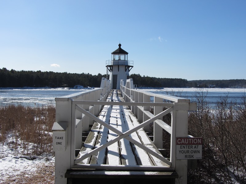
Lighthouse Photo Galleries

Halfway Rock Lighthouse with birds circling a lobster boat on Casco Bay (2004)

Lighthouses are specialized architectural structures.  As they dot the Maine coast, they are impressive as much for their settings as for their designs, of which there are many variations. Many are recognized on the National Register of Historic Places. To see names and locations, hover over an image with your mouse or click the image…

Townships

Tumbledown Pond in Township 6 North of Weld in Franklin County (2008)

Townships is the designation of minor civil divisions that have no organized local government, such as a plantation, town or city.
School Bell Commemorating the Maine Unorganized Territory School System (2001)

Bell Recalling the Unorganized Territory School System (2001)

Townships in Maine are administered directly by the State government. Taxes are due directly to the State Bureau of Taxation, with funds disbursed to support township services such as schools. They have names or may simply be designated by a township and range identification, such as T3 R4 WELS or T5 ND BPP. T stands for township, and R indicates a range. More abbreviations are here.

Masardis

Railroad Crossing in Masardis near Fraser Timber Mill on Route 11 (2015)

The Aroostook River flows northward through the middle of the township and by the village of Masardis. The small Pollard Flat Wildlife Management Area lies on the west bank of the river north of the village. A boat launch provides access to Scopan (formerly Squa Pan) Lake. Most of the Lake is in adjoining Scopan Township.

Arrowsic

Doubling Point Light on the Kennebec River in Arrowsic (2014)

Arrowsic Island in the Kennebec River separates Georgetown from Phippsburg, which was settled in 1607. In 1625 Europeans moved to Arrowsic, five years after the Pilgrim landing. Two lighthouses have been established on Arrowsic’s Kennebec shore. See videos and photos.