
Location Map for Swan Island county: Sagadahoc
")
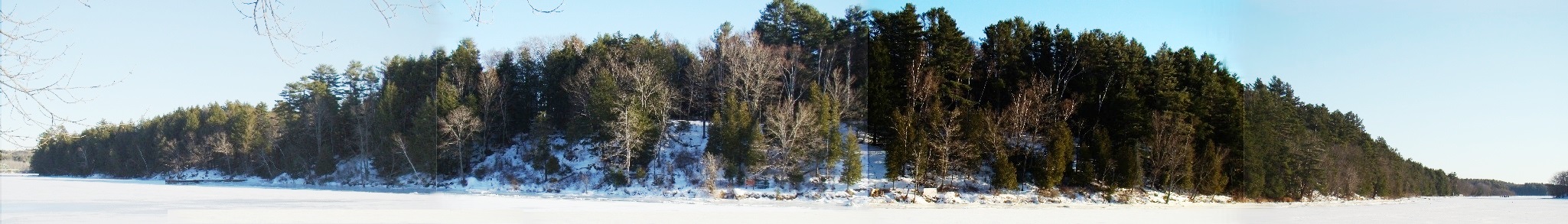
Topographic Detail for Swan Island (1957)
in the Kennebec River between Richmond and Dresden in Sagadahoc County is the only state-owned wildlife management area that is also a game preserve providing sanctuary for migrating waterfowl and the resident white-tailed deer. It is also the only management area where camping is allowed and programs are provided for visitors.
The 1,500 acre island, known for its abundant and often quite visible wildlife (especially nesting bald eagles, white-tailed deer and wild turkey), is actually an abandoned 18th and 19th century town called Perkins Township, and has long been recognized for its varied and interesting history. It was used by Native American tribes, early explorers, and settlers, and was reportedly visited by American historical figures such as Aaron Burr and Benedict Arnold.
In 1750 Captain James Whidden lived there with his daughter’s family, all of whom were later captured and brought unharmed to Canada by the Indians. The Dumaresq family of Boston built a house in 1758.
")
Swan Island Information Poster in Richmond (2008)
In the ninteenth century Thomas H. Perkins married Jane Dumaresq and spent many summers on the island. Perkins was active in helping the town get its charter from the new state of Maine on June 24, 1847. It later surrendered its organized status on March 1, 1918, when it became Perkins Township administered directly by the State.
Today it constitutes the Steve Powell Wildlife Management Area operated by the Maine Department of Inland Fisheries and Wildlife.
On September 21, 1775 Benedict Arnold’s expedition made landfall on Swan Island after having left Newburyport in Massachusetts. From here it would proceed up the Kennebec River, obtain bateaux (boats), and travel across western Maine to Quebec.

 <== To Quebec To Beginning ==>
Additional resources
Maine Department of Inland Fisheries and Wildlife. Swan Island: Enjoy Maine’s Wildlife in a Truly Unique Environment. Augusta, Me. 1992.
Maine Department of Inland Fisheries and Wildlife. A report to the Joint Standing Committee on Inland Fisheries and Wildlife: L.D. 398 – Resolve, to develop a management plan for the nonwildlife components of Swan Island and Little Swan Island in Perkins Township, Sagadahoc County: the stakeholders group findings and recommendations. Augusta, Me. 2010.
Simpson, Dorothy. The Maine Islands in Story and Legend.
Text describing the Island from Maine Department of Inland Fisheries and Wildlife, http://www.maine.gov/ifw/education/swanisland/index.htm. (accessed June 10, 2011)
This topographic map was created from the University of New Hampshire Dimond Library, Documents Department & Data Center, Historic USGS Maps of New England & New York, accessed 1/24/2008: Gardiner, ME Quadrangle (1957), http://docs.unh.edu/nhtopos/Gardiner.htm. (accessed June 10, 2011)
National Register of Historic Places – Listings
Swan Island Historic District
[Kennebec River, between Richmond and Dresden] The Historic District contains a well preserved historic landscape that reflects the agrarian community that flourished there from the 1760s until the second decade of the 20th century. Archaeological sites of the 18th, 19th, and early 20th centuries contain fundamental data on diet, trade patterns and standards of living.
 N44° 2' 29.13\" W69° 48' 56.58\"")
South end of the Island (2016) @
A party of French explorers under Samuel de Champlain who sailed up the Kennebec River in the summer of 1605, were the first known Europeans to see Swan Island. (probably viewing its south end as shown at right) The expedition had been sent from the St. Croix Island settlement, established a year earlier and barely clinging to survival, to try to find an alternate site for a permanent colony. Champlain wrote: “Pursuing our route, we came to the lake [Merrymeeting Bay], which is from three to four leagues in length, where there are some islands, and two rivers enter it, the Quinibequy [Kennebec] and the other from the northwest [Androscoggin]…” Two years later Champlain drew a manuscript map of New France clearly showing the Kennebec River and several large islands in its upper reaches, one of which may well be a depiction of Swan Island.
In 1607 the English mounted their first effort to obtain a permanent settlement in New England: the Popham Colony, established at the mouth of the Kennebec River. Soon a party under Raleigh Gilbert sailed upriver as far as the future site of Augusta and passing Swan Island on each leg of the trip: “We fynd this ryver to be very pleasant with many goodly Illands.” This is clearly a reference to Swan and Little Swan Islands. A map published in 1609 includes the labeled “Kinibeki”, with a large island near its confluence with the unnamed Androscoggin. The island, unnamed, was Swan Island.
Swan Island enters history in a deed dated 1667 from the local Indians Abbagasset and Kennebes to Christopher Lawson, a prominent entrepreneur and land agent representing Boston interests on the Kennebec. This deed references: “One island lying & adjoyning in the River of Kennebeck commonly called & knoune by the Indians Capeanagusset, and by the English commonly called & knoune by the name of Swann Island.” The origin of the name is not certain, but it is not derived from that kind of bird. Bartholomew Gosnold sailed the Maine coast in 1602. Recording in detail the natural resources he observed, including “Fowles”. Swans are not among the fifteen species of birds listed. Another tradition claims that “Swan” is a slightly shortened version of the Indian name “Swango”, close to the word “sowangan”, meaning the bald eagle. “Eagles” top Gosnold’s 1602 list of Maine birds. Swan Island has been, and is, one of the more important breeding areas in the northeast of the bald eagle.
In 1668 Lawson used Swan Island as collateral for a loan from the wealthy Boston merchant Humphry Davy, referencing “… my now [new] dwelling house… with one out house [outbuilding].” Four years later Lawson defaulted on the loan and transferred title to Swan Island “with the house and all appurtenances” to Davy.
By the 1680s the Pejepscot Company had gained title to the island to supplement its land holdings on the lower Kennebec. In 1714 the company was acquired by the Pejepscot Proprietors. Two years later seven of the partners transferred title to the island to the eighth partner, Adam Winthrop. Throughout the last quarter of the 17th century and the early years of the 18th, there is no record of Anglo-Americans using the island for any purpose, let alone residing there. Maine was devastated by decades of frontier wars beginning in 1675. It was not until the waning days of the frontier wars, that prospects for the permanent settlement of Swan Island improved. In 1719 the Pejepscot Proprietors hired Captain Joseph Heath to survey the Kennebec River, from which he generated a detailed map of the river, indicating a building near the southeast corner of Swan Island. Shortly thereafter, the Proprietors built Fort Richmond near the western bank of the Kennebec opposite the northern end of Swan Island.
While the fort was intended to encourage European settlement in the area, the island appears to have been uninhabited for a number of years. In 1750 Captain James Whidden’s purchase of Swan Island represented its first permanent settlement and anticipated the creation of the Town of Frankfort (Dresden) by the Kennebec Proprietors in 1752. Swan Island and Little Swan Island became part of the Town of Frankfort upon its creation.
At the same time, the northern two-thirds of the island and Little Swan Island was granted to Dr. Silvester Gardiner. Island residents appear to have been relatively prosperous during the first decades of the 19th century. Several retired sea captains are known to have settled on the island during this period. The American Revolutionary veteran Major Samuel Tubbs had a Federal manner house built on the northern head of the island overlooking both channels of the Kennebec. The prominently situated Tubbs-Reed House survives as the second oldest building on the island.
 N44° 4' 21.91\" W69° 47' 29.41\"")
Gardiner-Dumaresq House (2016) @
")
Tubbs-Reed House (2016)
By the 1840’s residents of Swan Island were reportedly dissatisfied with the high tax rates levied by the Town of Dresden. While there seems to have been significant opposition from the “mother town” to the secession, the inhabitants of Swan Island prevailed, and in 1847 Swan Island and Little Swan Island became the Town of Perkins. The town was named after Col. Thomas Handasyd Perkins, Jr., a wealthy Boston china merchant who married Jane Frances Dumaresq. Introduced to the island by his wife in the 1820’s, Perkins is credited with having been instrumental in the establishment of the township. Thomas Perkins is perhaps best known as the patron of the Perkins Institute for the Blind in South Boston.
The two decades following incorporation appear to have been prosperous ones for the Town of Perkins, with agriculture being the mainstay of the economy. A system of small interconnected roads linking the north and south appears to have developed early in the 19th century as all areas of the island were settled. Houses on Swan Island built during the 19th century were oriented to the roads as opposed to the river, as had been the case during the 18th century. The settlement of White’s Landing (now Richmond), beginning about 1815 seems to have induced Swan Island residents to develop the landing at the northwest corner of the island. By the second half of the 19th century, regular ferry service to Richmond had been established from the landing and a brick kiln (which is said to have produced the bricks for the Hathorn Block in Richmond) was in operation nearby.
Perkins experienced economic and population decline in the years immediately following the Civil War. The year-round population of Perkins grew slightly to 78 in 1880, but thereafter began to steadily decline as agriculture and the ice industry waned.
")
Long interested in acquiring land with which to undertake waterfowl management in Merrymeeting Bay, the Department of Inland Fisheries and Wildlife began buying farms on the island during the early 1940’s. By the 1950’s. the only remaining private land was the Curtis cemetery (left), which was sold to the Department. The maintenance of the island’s historic land use pattern is in large part due to the protection provided by the Department. Approximately 900 acres on the island are forested while 400 acres remain in open fields, mowed by I.F. & W. This ratio of forested to open land is nearly equivalent to the land use pattern visible in c. 1940 aerial photographs of the island. During the late 1960’s, the Department restored both the Gardiner-Dumaresq and Tubbs-Reed Houses. The Robinson House and Priest House are both used to house Inland Fisheries and Wildlife workers.
Thanks so much for the detailed article. Very interesting history and photos to boot! Your site haste best photos a available on the web of this little-known gem.