N45° 54' 57.37\" W68° 21' 11.25\"")
Sunset over Mount Katahdin from the Scudder Road in Sherman (2012)

Location Map for Sherman
| Year | Population |
|---|---|
| 1970 | 949 |
| 1980 | 1,021 |
| 1990 | 1,027 |
| 2000 | 937 |
| 2010 | 848 |
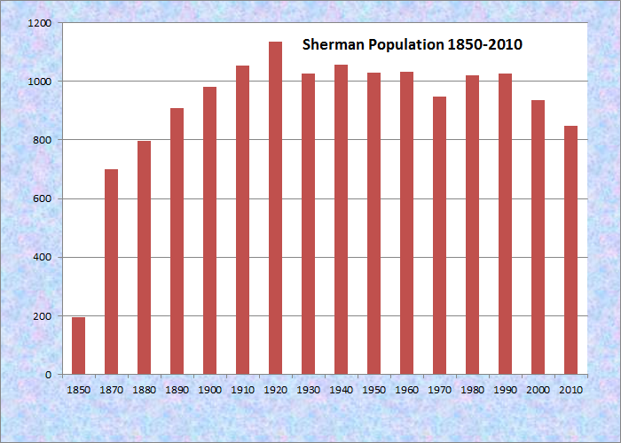
Population Trend 1850-2010
| Geographic Data | |
|---|---|
| N. Latitude | 45:53:40 |
| W. Longitude | 68:21:34 |
| Maine House | District 145 |
| Maine Senate | District 2 |
| Congress | District 2 |
| Area sq. mi. | (total) 40.8 |
| Area sq. mi. | (land) 40.3 |
| Population/sq.mi. | (land) 21.0 |
County: Aroostook
Total=land+water; Land=land only |
|
")
Washburn Memorial Church
")
[SHEHR-man] is a town in Aroostook County, settled in 1832 and incorporated on January 28, 1862 from Golden Ridge Plantation.
It annexed land from Silver Ridge Plantation in 1870 and from Crystal Plantation in 1881.
")
Sherman Post Office (2012)
")
Fire Department (2012)
")
Caldwell Brothers Civil War Memorial (2003)
The town, formed during the Civil War, was named for John Sherman, a prominent abolitionist U.S. Senator from Ohio.
In 1982, local residents created a memorial near the public library to the six Caldwell brothers from Sherman who served in the Civil War, three of whom died during the conflict.
In all Sherman sent 113 men to the War, 34 of whom died in that conflict.
In the 1880’s the town had a starch factory, a grist mill, and two sawmills. Molunkus Stream, providing power to the mills, runs through the main village.
")
Downtown Sherman (2003)
Alfred H. Spooner was a druggist in Sherman from 1891 until his death in 1915. Following his death, the store was operated by his wife, May H. Spooner, and her niece, Ida May Stevens.
In 1955 the business was purchased by Jesse, Eugene, and Emily Crockett, who operated “Crockett’s Variety Store” until 1972 when they sold it to Walter and Velma Heath.
The Alfred H. Spooner House was purchased from Mrs. Martha Perry in 1891 and a tower was added. [from Selections from Diaries of Alfred H. Spooner.]
Nearing the end of World War II, a farm on the Golden Ridge Road hosted German prisoners of war.
")
Sherman Public Library (2003)
")
High School/Jr High (1976)
")
One-room school (1976)
")
One-room school site (2016)
")
One-room School (1985)
The “one-room-school” above was called the Golden Ridge School. In 1878, the “Free High School” opened on September 2nd under the guidance of F. S. Bunker of Cambridge, Maine, a graduate of the State College in Orono. Fifty-eight students were in attendance. According to the school Supervisor Leonard E. Caldwell, “The church bell is rung for the school at 8:45 and at 12:45.”* In 1917 a High School/Junior High School opened serving until 1967.
The Bandstand, with its food concession below for Old Home Days, is at the center of the village. Nearby is the market and the remains of the old “Crockett’s Store.”
Many Amish families have moved to the area after the year 2000. Several have established farms and have modest markets.
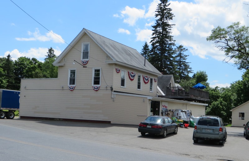
Thriftway Market (2014)
 N45° 52' 21.95\" W68° 23' 10.28\"")
The Bandstand (2014) @
")
“Crockett’s Store” once (2014)
")
Municipal Building (2003)
")
Sherman Veterans Memorial at “Old Home Days” (2001)
")
Barn, Hay, and Mt. Katahdin on the Golden Ridge Road (2012)
Potatoes and strawberries are components of its agricultural economy, and Mount Katahdin is an every day presence. An Amish family, one of several recently settled in town, now is one of several that have migrated to has the potato a farm like shown in the photo. As a result, horses have returned to the landscape, both for work and transportation, that take with up with “buggies” drawn by fine horses.
The traditional harvest-time social gathering typical of farming communities is embodied in Sherman’s “Old Home Days” celebration each Labor Day weekend.
 and Dairy (upper left) Farms on the Golden Ridge Road (2001)")
Potato (lower) and Dairy (upper left) Farms on the Golden Ridge Road (2001)
")
A Home-Cooked Meal at “Old Home Days” in the Park near the Church (2003)
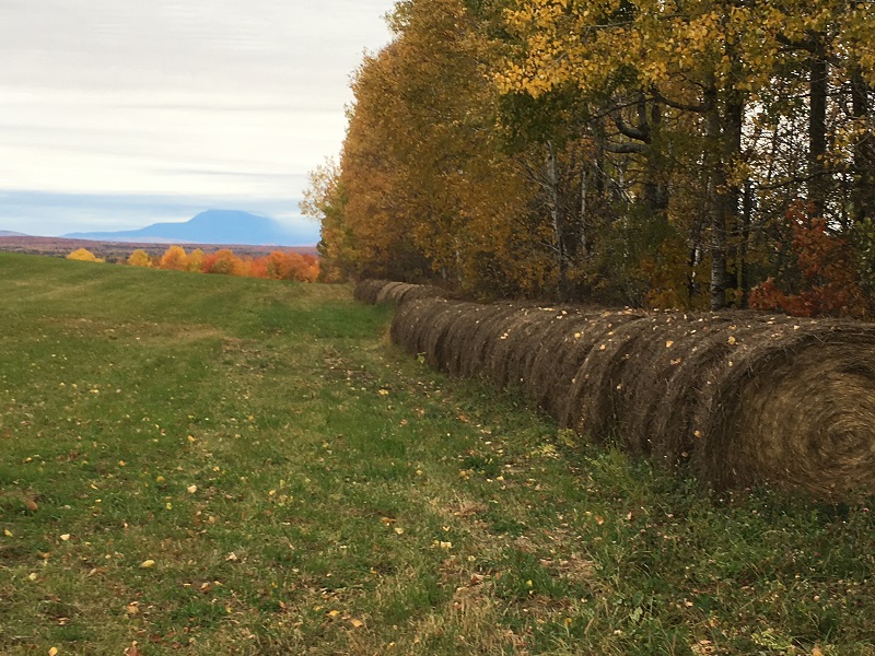
Katahdin Range and Hay Bales in a field at the end of the Scudder Road (2016)
The town square becomes the route around which the annual parade passes – twice. The “grounds fee,” and proceeds from food sales and the beano tent, all go to support the Washburn Memorial Congregational Church and other community organizations.
")
“Old Home Days” in Sherman (2003)
")
Snowmobile Club on Molunkus Stream (2012)
")
Old Barn in Sherman (2012)
")
Farm in Sherman (2012)
")
Sign: Caution Horses (2012)
The lower portion of the Thousand Acre Bog in Crystal is separated from the better agricultural soils by Interstate 95. It is accessible from the Sherman to Patten 6-mile multiple use (bike, hike, ski, ATV, snowmobile) trail. Short State Route 158 connects Sherman Mills village with U.S. Route 2.
 N45° 55' 20.54\" W68° 20' 38.80\"")
Amish Farm with Barn in Sherman (2014) @
 N45° 53' 3.92\" W68° 22' 38.74\"")
Amish Farm with Barn in Sherman (2014) @
The relatively shallow (8 feet) Macwahoc Lake, also known as Upper Macwahoc Lake, is the the largest in Sherman at 269 acres. Macwahoc Stream is its outlet, leading to Lower Macwahoc Lake in T2 R4 WELS Township.
 N45° 52' 8.96\" W68° 18' 27.80\"")
Bridge over Macwahoc Stream (2014) @
 N45° 52' 9.07\" W68° 18' 27.97\"")
Macwahoc Stream, the Lake Outlet (2014) @
Sherman Station, on the Bangor and Aroostook Railway line, is actually just over the line in Stacyville.
Form of Government: Town Meeting-Select Board-Manager.
Additional resources [Click images to enlarge and clarify]
**Maine. Historic Preservation Commission.
Augusta, Me. Additional text and photos available from National Register of Historic Places: http://pdfhost.focus.nps.gov/docs/nrhp/text/86001336.PDF, http://pdfhost.focus.nps.gov/docs/nrhp/photos/86001336.PDF
*Sawyer, Nina Caldwell. Selections from Diaries of Alfred H. Spooner. Sherman, Maine? 1982.
Spooner, May H. Sherman, Maine in the Civil War. 1927?
Varney, George J. A Gazetteer of the State of Maine. 1886. p. 510.
National Register of Historic Places – Listings
Leavitt, A. B., House
 N45° 52' 21.48\" W68° 23' 19.62\"")
“Plum Gables” House in Sherman Village
[Maine Route 158; N45° 52′ 21.48″ W68° 23′ 19.62″] This house is significant as the most outstanding example of mail-order architecture identified in Maine. The remarkably unaltered residence is based on Design 28, of a catalog produced by the architectural firm of Palliser, Palliser & Company, which originated the concept of mail-order house plans in 1876. Numerous examples of the firm’s work can be found in Maine, although none as distinctive and imposing as the Leavitt House.
")
The house was built by Alva B. Leavitt in about 1890, who had a wheelwright, blacksmith, paint and repair shop in town. He also served as postmaster from 1893-97.
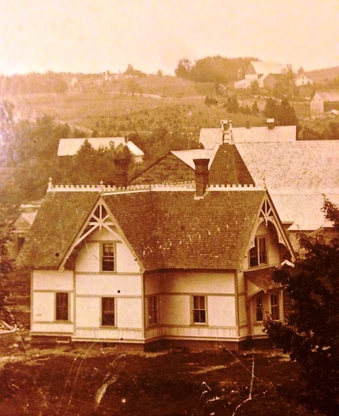
Early photo of the Leavitt House
The contractor was Chester Coburn, a local builder who also erected a large and unusual Queen Anne style house in Sherman Mills for Alfred Spooner. The latter employed Palliser details but is not a Palliser design. For the Leavitt House, Coburn expanded upon the Palliser scheme by including an attached carriage house. This is an integral part of the design, and it repeats motifs used for the main section of the house.
Note: another similar house was erroneously displayed as the Leavitt. We regret the error.
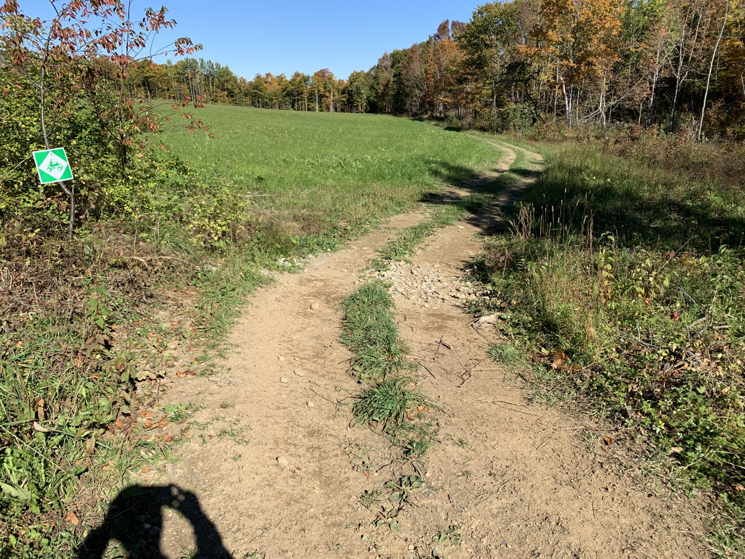
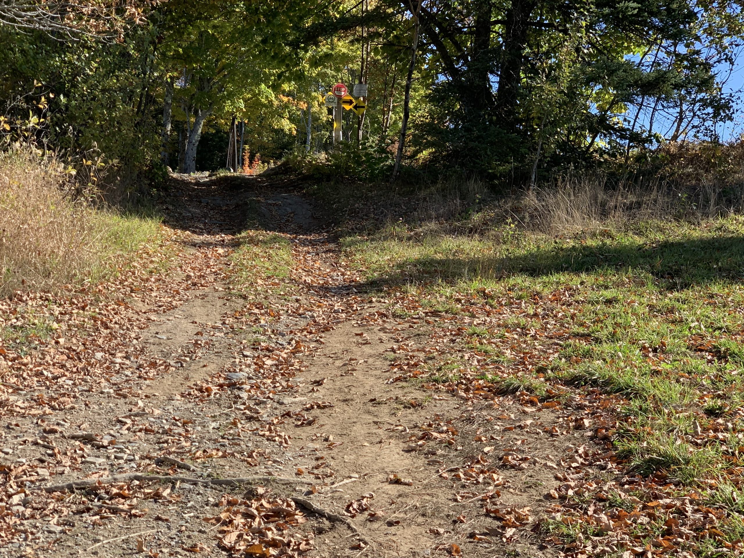
As with many rural towns having broad open spaces, Sherman allows” “FOUR Wheelers (small open vehicles) to travel on dirt roads and edges of privately owned fields, at the permission of the landowners. Groups, and clubs often maintain trails and pathways in forested. The first photo below is the turnoff from Scudder Road. The next shows a small forested area. And the the third an open area approved by the landowner.
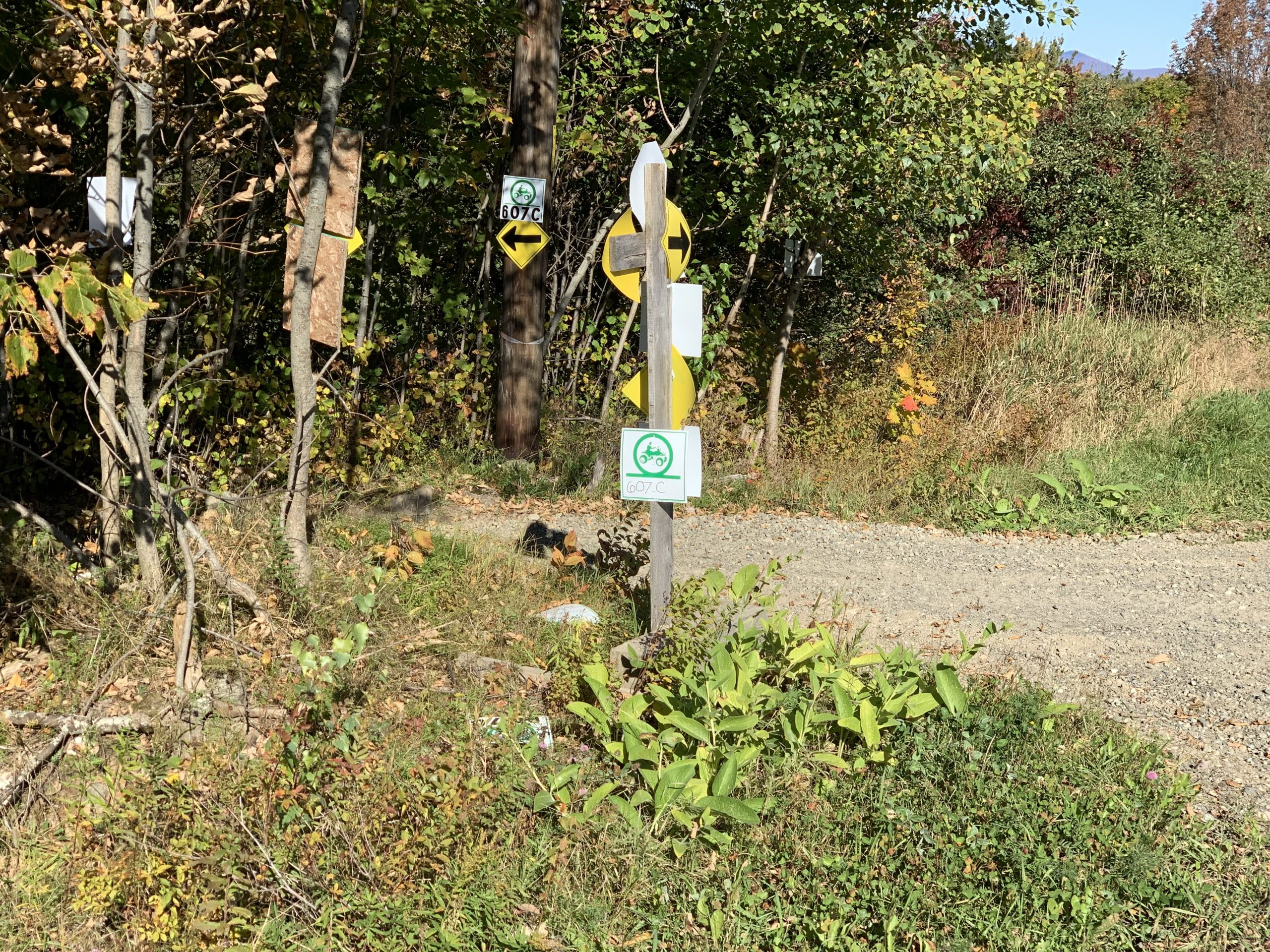
The next shows a the third, an open area approved by the landowner. In this case a potato field
End of the small forested area, available only by permission.