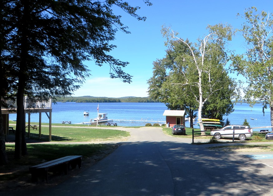
Pine Tree Camp on North Pond in Rome (2014)

Location Map for Rome
| Year | Population |
|---|---|
| 1970 | 360 |
| 1980 | 626 |
| 1990 | 758 |
| 2000 | 980 |
| 2010 | 1,010 |

Population Trend 1850-2010
| Geographic Data | |
|---|---|
| N. Latitude | 44:34:18 |
| W. Longitude | 69:53:05 |
| Maine House | District 76 |
| Maine Senate | District 3 |
| Congress | District 2 |
| Area sq. mi. | (total) 31.7 |
| Area sq. mi. | (land) 25.4 |
| Population/sq.mi. | (land) 39.8 |
County: Kennebec
Total=land+water; Land=land only |
|
 [ROME] is a town in Kennebec County, settled about 1780 and incorporated on March 7, 1804 from a portion of West Pond Plantation.
The originally much larger tract is now smaller having ceded land to Mount Vernon (1814), Vienna (1815, 1840), and Belgrade (1845, 1897).

From 1943 USGS Map
Named for the ancient city of Rome, one historian notes “it has seven times as many hills as the eternal city whose name it bears, and granite enough to build the old Roman capital.”
The town has substantial frontage on Long Pond (at right) and Great Pond in the Belgrade Lakes region, with many camping, boating, and other recreational opportunities. The town line is adjacent to the small village of Belgrade Lakes in the town of Belgrade.
 N44° 35' 6.4\" W69° 52' 1.0\"")
Rome Baptist Church (’12) @
 N44° 31' 55.27\" W69° 53' 15.29\"")
Home Near Belgrade (’12) @
In a way Rome is a tale of two towns: part on the ponds and part inland. On one side private developments with fine houses and water access.
On the other, no extensive main village, but a series of small settlement clusters along the main roads, a community center and town office in a former school. Rome has no public library of its own.
In the northeast, Rome has extensive frontage on North Pond, which is primarily in Smithfield. Situated west of Oakland, though not all roads lead to it, Rome is served by Maine Routes 8, 27, 137 and 225.
The signs below appear on Route 27, just north of Belgrade.
 N44° 33' 26.66\" W69° 54' 4.03\"")
Sign: Peninsular Drive, Private Road (2012) @
 N44° 33' 23.74\" W69° 54' 3.03\"")
Sign: Tracy Cove, Private Road (2012) @
 N44° 33' 31.14\" W69° 54' 6.47\"")
Sign: Long Pond Estates (2012) @
 N44° 34' 19.7\" W69° 54' 8.0\"")
Mount Philip Grange (2012) @
 N44° 34' 40.8\" W69° 53' 57.8\"")
Rome Fire Department (2012) @
 N44° 34' 39.3\" W69° 53' 58.5\"")
Community Center and Town Office (2012) @
Pine Tree Camp on North Pond is a place where children and adults with disabilities are able to participate in the recreational activities for which Maine is known. The barrier-free setting, ensures that swimming, fishing, kayaking, hiking, boating and even camping in a tent under the stars are completely accessible to all.
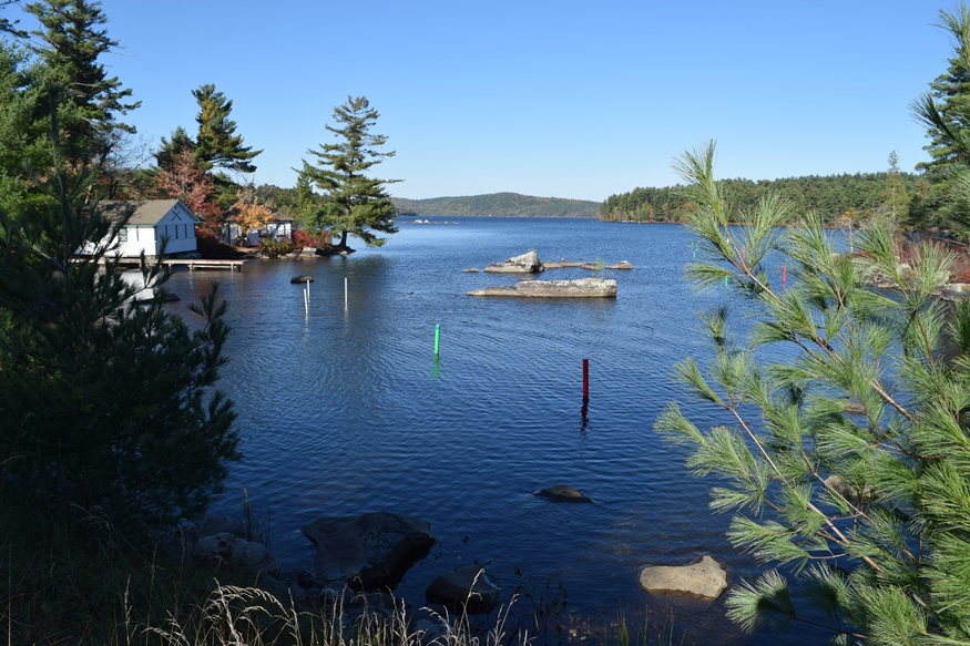
View of Long Pond in Rome, North from Castle Island Road (2018)
Form of Government: Town Meeting-Select Board.
Additional resources
Chadbourne, Ava Harriet. Maine Place Names and The Peopling of its Towns.
“Pine Tree Camp.” Pinetree Society. https://www.pinetreesociety.org/children-and-families/pine-tree-camp/ (accessed January 17, 2020)
Town of Rome. New York. H.W. Blake & Co. 1892. (Cataloger Note: Extracted from: Illustrated History of Kennebec County Maine, 1625-1799-1892. Editors Henry D. Kingsbury, Simeon L.Deyo)
University of New Hampshire, Dimond Library Historic USGS Maps Collection, Norridgewock, ME Quadrangle, USGS 15 Minute Series.