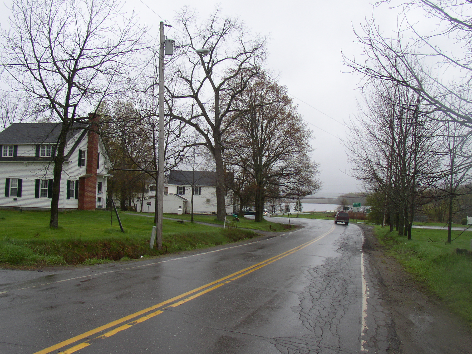
Route 7 in Plymouth with Plymouth Pond in distance

Location Map for Plymouth
| Year | Population |
|---|---|
| 1970 | 1,266 |
| 1980 | 1,368 |
| 1990 | 1,256 |
| 2000 | 1,257 |
| 2010 | 1,380 |
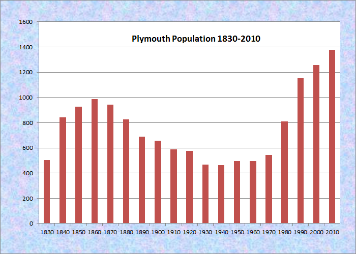
Population Trend 1830-2010
| Geographic Data | |
|---|---|
| N. Latitude | 44:46:53 |
| W. Longitude | 69:13:19 |
| Maine House | District 100 |
| Maine Senate | District 10 |
| Congress | District 2 |
| Area sq. mi. | (total) 31.3 |
| Area sq. mi. | (land) 29.9 |
| Population/sq.mi. | (land) 46.2 |
County: Penobscot
Total=land+water; Land=land only |
|
 N44° 47' 50.64\" W69° 13' 10.80\"")
[PLIM-ith] is a town in Penobscot County, incorporated on February 21, 1826 from township T5 R2 NWP and parts of Etna, and named for Plymouth, Massachusetts, which was named for Plymouth, England.
Just south of Newport off Interstate 95, this rural community is dotted with wetlands, the largest of which is Plymouth Bog. Martin Stream runs from Plymouth Pond to empty into Sebasticook Lake in Newport after joining East Brook. Judging from the dam, the stream supported power generation historically.
")
Plymouth Village Store at Plymouth Pond (2005)
")
Plymouth Grange Hall (2005)
In fact, George Varney in his Gazetteer of Maine in 1886 observed:
On [Martin] stream are five powers, all improved except one. The principal falls are at Plymouth Village, near the centre of the town. The manufactures consist of cloth, lumber, furniture, carriages, fumigators, leather, etc. [Improvements to the dams could generate] 486 horsepower, of 19,440 spindles for 10 hours a day, 312 days in the year.
 N44° 46' 6.84\" W69° 12' 35.64\"")
Town Office/Post Office (’05) @
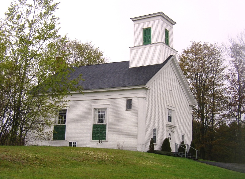
Emmanuel Baptist Church (2014)
At the time, Plymouth had as many as ten stores and two hotels, nine public schoolhouses, with a population in 1880 of 828.
As part of a settlement to clean up a Superfund site in the Plymouth Bog, the Environmental Protection Agency in 2010 secured funds to clean the oil hazards there and to insure that 700 acres along Martin Stream in the Bog be owned and managed by the Maine Department of Inland Fisheries and Wildlife as a natural resources and recreation area, open for snowmobiling, hunting, fishing and trapping.
 N44° 46' 7.86\" W69° 12' 45.66\"")
Plymouth Fire and Rescue (2014) @
 N44° 46' 3.12\" W69° 12' 36.54\"")
Plymouth Village Center (2014) @
The main village is on the northwestern shore of Plymouth Pond at the junctions of Maine Routes 7 and 69. Its population has remained remarkably stable, changing by one person from 1990 to 2000, and by only 9 in the thirty years from 1970 to 2000! However, in 2010 the town logged the larges growth spurt in recent times, adding nearly 10% to its 2000 population.
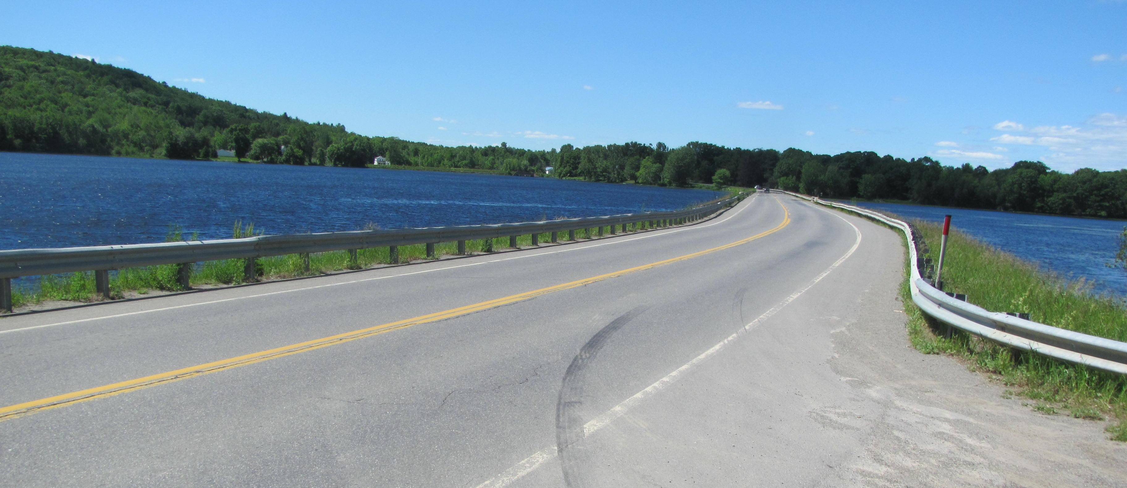
Bridge over Plymouth Pond (2016)
")
Dam at Plymouth Pond Outlet (2005)
")
Plymouth Pond (2005)
")
Dam at Plymouth Pond Outlet (2005)

Andrew J. Tozier, a Sergeant in Company I, 20th Maine Infantry entered the service from Plymouth during the Civil War. Born in Monmouth, he received the Congressional Medal of Honor for action at Gettysburg, Pennsylvania on 2 July 2, 1863. During the Vietnam War, Donald Skidgel, born in Caribou but a resident of Plymouth, received the Congressional Medal of Honor for action at Song Be.
")
Veterans Honor Roll (2005)
Form of Government: Town Meeting-Select Board.
Additional resources
Chadbourne, Ava Harriet. Maine Place Names and The Peopling of its Towns.
Varney, George J. A Gazetteer of the State of Maine. 1886. p. 451.