")
Porter-Parsonsfield Covered Bridge over the Ossipee River (2014)

Location Map for Parsonsfield
| Year | Population |
|---|---|
| 1970 | 971 |
| 1980 | 1,089 |
| 1990 | 1,472 |
| 2000 | 1,584 |
| 2010 | 2,041 |
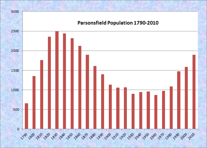
Population Trend 1790-2010
| Geographic Data | |
|---|---|
| N. Latitude | 43:44:05 |
| W. Longitude | 70:55:08 |
| Maine House | Dists 21,68 |
| Maine Senate | District 33 |
| Congress | District 1 |
| Area sq. mi. | (total) 60.0 |
| Area sq. mi. | (land) 59.0 |
| Population/sq.mi. | (land) 32.2 |
County: York
Total=land+water; Land=land only |
|
[PAR-sons-field] is a town incorporated on March 9, 1785 from land sold in 1661 by Sagamore Captain Sunday to the first white proprietors. Settlement began in the 1770’s; a church was built in 1790 followed by a parsonage in 1794.
 N43° 45' 40.66\" W70° 56' 21.08\"")
1792 Blazo School, corner Chase and North roads (’14) @
")
1792 Blazo School Interior (2014)
Thomas Parsons, a later proprietor, is the namesake for the community, first as Parsonstown, then Parsonsfield.
 N43° 45' 46.62\" W70° 56' 19.64\"")
Parsonsfield Seminary on North Road (2014) @
Parsonsfield Seminary’s Ricker Hall (2014)
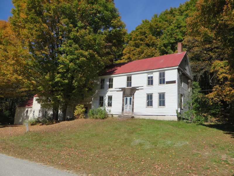
Farm on North Road in North Parsonsfield (2014)
")
Blazo-Leavitt House across from Ricker Hall (2014)
The town, a modest industrial center in 1839, contained seven grist mills, seven saw mills, a woolen factory and an oil mill.
Rufus McIntire, a member of Congress beginning in 1827, was a resident of the town. Another member of Congress and state legislator, Lorenzo de Medici, was born here in 1818. Parsonsfield is also the birthplace of James Ware Bradbury, a U.S. Senator from 1847 to 1853.
")
Parsonsfield Union Church (2014)
 N43° 43' 42.33\" W70° 55' 46.46\"")
The Old Town House near the Union Church (2014) @
Cemetery near the Old Town House (2014)
The images above are from the Merrill Hill Road, a place of early settlement. North Parsonsfield on the North Road, below, is yet another village in this historic town.
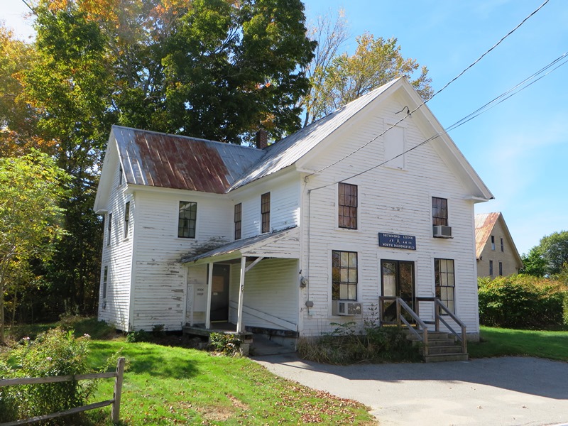
Drummond Masonic Lodge in the Old Library Building (2014)
 N43° 45' 25.01\" W70° 55' 17.28\"")
Houses on North Road in North Parsonsfield (2014) @
")
Barn on North Road (2014)
In about 1911, Dr. Francis Joseph Welch established a sanatorium, Maple Crest, to combat tuberculosis in East Parsonsfield, “where he could have the ideal conditions at hand to combat it.” According to Maine A History, Centennial Edition,
This well known and popular resort is located among the beautiful Limerick hills, the wild and picturesque outlines of which may be seen in every direction from the building. The view is in itself enough to stimulate the interest and mental activity so important to the cure of all diseases. [p. 218]
South Parsonsfield, a rural area with many stonewalls, is actually in the center of the township.
")
Horse Farm on the South Road (2014)
 N43° 41' 40.53\" W70° 53' 58.75\"")
South Parsonsfield Village (’14) @

Apple Harvest (c. 1950)
Kezar Falls, a village on the Ossipee River named for George Kezar, is the largest in the area at the junction of Maine Routes 25 and 160. The community is split between Parsonsfield and Porter across the river, and is governed and taxed separately by the two towns. It was home to Maine photographer George French.
 N43° 43' 58.42\" W70° 50' 35.18\"")
East Parsonsfield Post Office (2014) @
 N43° 45' 33.55\" W70° 55' 42.89\"")
Fred Morrill Municipal Building (2014) @
Form of Government: Town Meeting-Select Board.
Additional resources
Bradley, Simon. Account Book, 1849-1855. (Cataloger Note: A volume used as an account book and diary by Simon Bradley, who appears to have been a farmer in Parsonsfield, Maine. [It] begins in April 1849 and is a mixture of personal and business information. It records Bradley’s dreams; lists of animals trapped; goods bought and sold, mostly farm products; and work done by and for others. . . . also contains copies of some of Bradley’s correspondence both to family members and to business associates.)
Chadbourne, Ava Harriet. Maine Place Names and The Peopling of its Towns.
Dearborn, J. W. A History of the First Century of the Town of Parsonsfield, Maine. Incorporated Aug. 29, 1785, and celebrated with impressive ceremonies at North Parsonsfield, August 29, 1885. Portland, Me. B. Thurston & Company. 1888.
History of Parsonsfield, Maine, 1771-1888. Hampton, N.H. Published for the Ancient Landmarks Society of Parsonsfield by Peter E. Randall. [between 1960 and 1981]
Maine A History, Centennial Edition, Biographical. New York. The American Historical Society. 1919.
*Maine. Historic Preservation Commission. Augusta, Me. Text and photos from National Register of Historic Places: http://pdfhost.focus.nps.gov/docs/nrhp/text/xxxxxxxx.PDF and http://pdfhost.focus.nps.gov/docs/nrhp/photos/xxxxxxxx.PDF
Welch, Andrew, Homestead: https://npgallery.nps.gov/GetAsset/fa4d33f7-d61e-4b64-ab06-5a4d0b88878f/
Maine State Archives. George French Collection. (photo credit “Apple Harvest in Parsonsfield.”
The Ossipee Valley. Cornish, Limerick, Limington, Newfield, and Parsonsfield-Porter Historical Societies. Charleston, SC. Arcadia. 2005.
Varney, George J. A Gazetteer of the State of Maine. 1886. pp. 428-429.
National Register of Historic Places – Listings
Blazo-Leavitt House
[Maine Route 160] This handsome, beautifully finished Federal style house was built between 1812 and 1817 by Daniel Blazo, son of Amos Blazo, a shipbuilder and merchant from Portsmouth, New Hampshire, who moved to Parsonsfield in 1778. His father, another Amos Blazo, was a Huguenot who emigrated from Bordeaux, France, in 1738. One of the finest houses of the period in the region, this structure is noted for its woodwork probably made by ship’s carpenters left unemployed in Portsmouth by the Embargo then in effect.
A granddaughter of Daniel married John G. Leavitt, also from an old family, whose grandson, John Greenleaf Leavitt, a distinguished naturalist at Harvard University, was the last of the family to occupy the house.* {See photo above right]
Morison, Capt. James, House
Captain James Morison House (2014)
[Southeast of Parsonsfield village on South Road] The Morison House is a late colonial inland residence built by a distinguished Revolutionary soldier, containing well-preserved murals by Jonathan D. Poor.
By 1785, at the time of incorporation, 62 names appeared on the tax list, all but eleven had moved to the area since 1780. One recent arrival was Captain James Morison, of Nottingham, New Hampshire. Morison’s grandfather was been born in Scotland in the 1680s, his father in Ireland in 1725. A member of one of the first units to assemble for the siege of Boston, he fought at Bunker Hill and moved with the army to New York. Rising to a captaincy he participated in the New Jersey campaign of 1776. He was recognized for exceptional service at the Battle of Brandywine in 1777 where he was wounded and mustered out of the army.*
Like many another Revolutionary veteran he sought land in the newly opening townships in Maine and moved to Parsonsfield in the early 1780s where he built the house on South Road. He occupied this home with his wife and family until his death in 1840.*
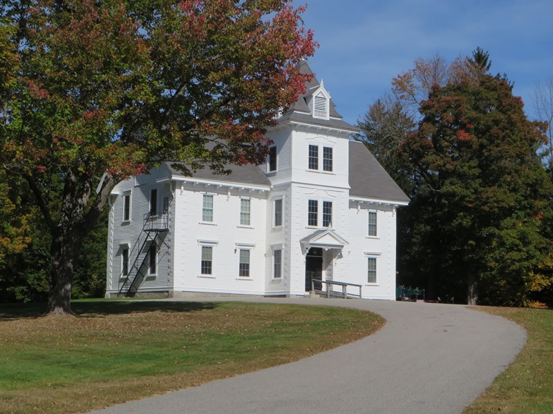
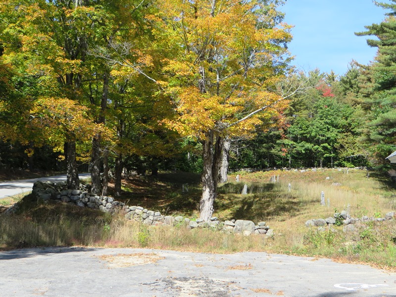
Old Town House
") [Merrill Hill Road, north of the junction with Middle Road] Parsonsfield, an overwhelmingly rural town, is comprised of several small villages. In Middle Road Village there are several Federal era houses, a one-room school house, two 19th-century stores, the Victorian church, and the 1834 Greek Revival Town House next to the ancient burying ground.
[Merrill Hill Road, north of the junction with Middle Road] Parsonsfield, an overwhelmingly rural town, is comprised of several small villages. In Middle Road Village there are several Federal era houses, a one-room school house, two 19th-century stores, the Victorian church, and the 1834 Greek Revival Town House next to the ancient burying ground.
Between 1771, (when Thomas Parsons settled here) and 1794, town meetings were held in the Parsons home, Job Colcord’s tavern, or other houses in the village center. After ten years of planning, a Meeting House was built on the western side of Merrill Hill Road, for use by the town and the Congregational Society. However by 1825, the two uses were no longer compatible. Over the next two years the town attempted recover the lot on which the Congregational Meeting House stood. Both the location and the choice of the Greek revival style may have led the residents to separate the town’s civic and religious entities, possibly reflecting the democratization of the general public.
Finally, the town purchased a lot south of the cemetery. William Molton, Jr., a local carpenter, built the structure. It was completed in September 1833, and the walls were painted red, the doors green, and the trimmings white similar to the school house in the vicinity. Seats were not installed until some time after 1834, and no mention is found about the sloping floor, or the interior use of space. Architecturally, the Old Town House is notable among its contemporaries for its distinct Greek Revival details, the preferred stylistic choice for many civic structures.*
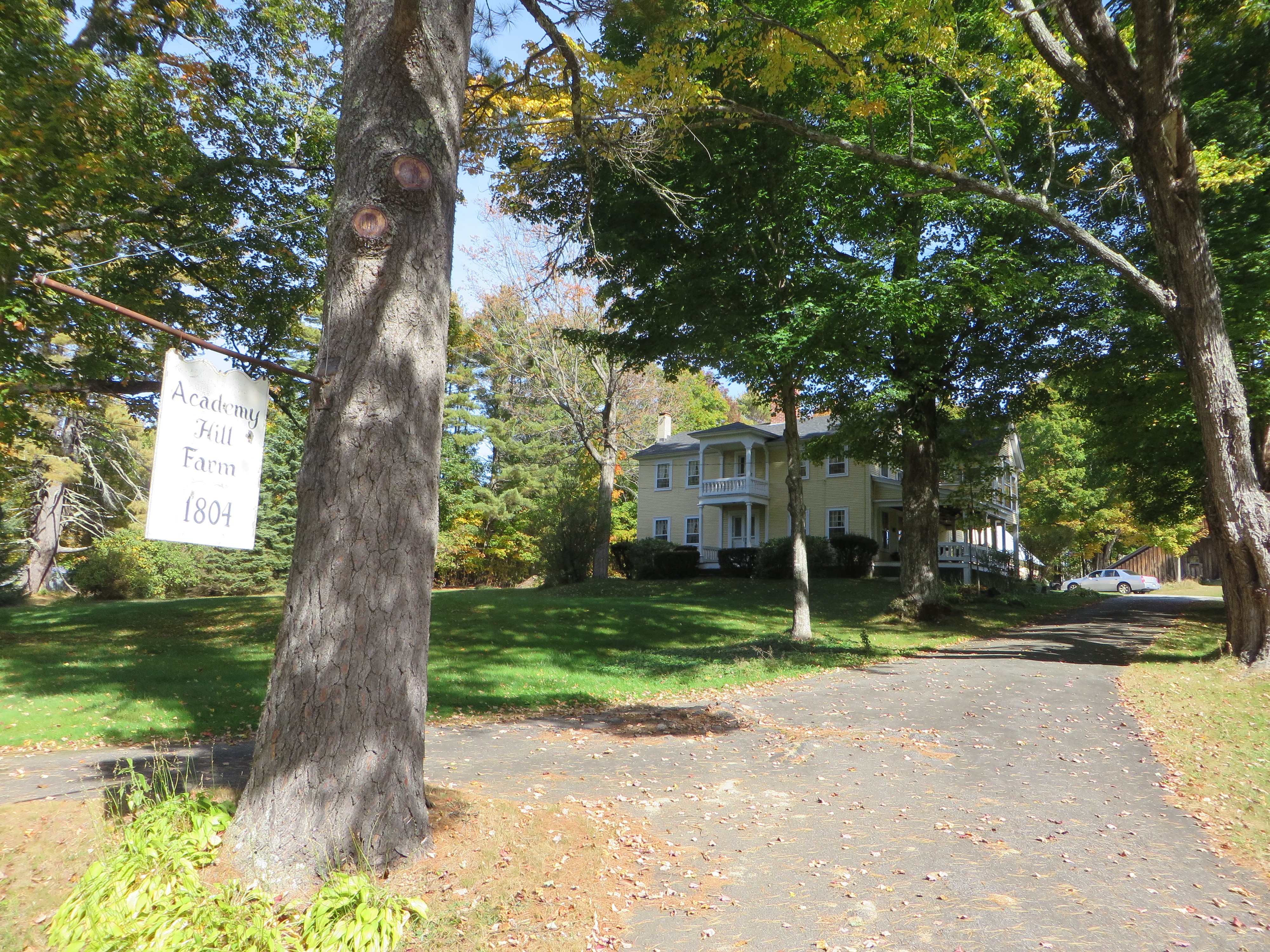
Parsonsfield Seminary
[Maine Route 160] Although the architectural merits of the Academy Building are substantial, the major feature of the Seminary is its history as an educational institution and its influence on the surrounding communities. In North Parsonsfield, a rural community a few miles from the New Hampshire/Maine border, the school was founded in 1832.
A strong sense of community was evident at the founding of the school by a group of prominent leaders. A similar sense of loyalty and determination to preserve “Par-Sem”, as it is familiarly known, has been great. The elementary school and the dormitory that closed as a high school in 1949 was a blow to the community. It was built set back from the Main Street, which was then a busy thoroughfare for freight moving from New Hampshire to Portland and Boston. Occasional droves of livestock passed, as well as fancy stage coaches.
Parsonsfield Seminary on North Road in North Parsonsfield (2014)
The founders were a group of ministers, including Elder John Buzzell, the first President of the Board of Trustees; a local physician, Dr. Moses Sweat, the Secretary; five local farmers; and three lawyers: Robert T. Blazo, Nathan Clifford, and Rufus Mclntire. One hundred and forty students attended the first session of the Seminary high school, at the time closely affiliated with the Free Will Baptist denomination. By 1862 there were still less than three hundred fifty high schools in the United States. The first seminary was destroyed by a fire in 1854 and the existing building, except for the North Wing, was built soon after. The Civil War and its aftermath forced the Trustees to close the school for short intervals during 1863-1868. In 1877, a gift instilled new hope for the school. Elisha Piper, a woodsman and farmer, bequeathed eleven thousand dollars to the town for the maintenance of a “Free High School”. Again in 1899, Parsonsfield Seminary’s future became more stable when Bartlett Doe, a successful businessman in San Francisco, returned to his home in Parsonsfield for a visit.
Attendance diminished during World Wars I and II, when the graduating classes averaged less than five and the dormitory was occasionally closed. The last high school graduation was in 1949. In 1952, the Parsonsfield Consolidated School was founded at Par-Sem when smaller schools were closed. Parsonsfield students were attending Maine School Administrative District 55 in 2016.* [See more photos above]
Parsons-Piper-Lord-Roy Farm
")
[309 Cramm Road] The Parsons-Piper-Lord-Roy Farm is a small property in southeastern Parsonsfield Maine with a continuous history of agricultural use. Built c. 1844 by members of the Enoch P. Parsons family, the house, ell, connected barn, equipment shed, and large barn have all worked in concert to support the farm’s residents even as the demography and the products of the farm changed. The most important evolution of the farm occurred in 1948 when the Roy family purchased the property and converted the dairy barn into a large scale poultry barn. It a good example of a traditional 19th century agricultural complex altered to reflect the new opportunities presented by commercial chicken farming in the mid-20th century.
")
")
In 1774 the founder of the town, Thomas Parsons acquired land in Parsonsfield. The land had been surveyed three years earlier, and 80 lots were allotted for development. Parsons had four years to attract and settle forty families on the land. Among the first was his son, Thomas Parsons Jr. who received 1000 acres, including Lot 58 in the fourth range, on which he placed his homestead. He had three children before being felled in a woods accident in 1788. The property descended to his children. In 1837, Parsons, Jr.’s granddaughter Hannah married Daniel Piper, and they joined her parents and brother at the farm. The house and barns were reportedly built in 1844 This date fits with the style of the house (Greek Revival with Gothic Revival elements), the size, orientation, construction methods of the large barn, and the trim details. Various descendants of the early families occupied the farm. The Roy family continued the agricultural activities at the farm, not as a general, self-sufficient family farm, but as a commercial enterprise focused on poultry farming. Starting in the 1930s raising poultry on intensive levels benefited from advances in agricultural science. The last of the Parsons lineage to live in the house were Lida Lord and her brother George, who occupied the farm until their death in 1934 and 1944 respectively.* [Christi A. Mitchell photos]
Welch, Andrew, Homestead
")
[1286 Middle Road] The Andrew Welch homestead (also known as the Colcord Tavern) is a significant example of the popular architectural tradition that existed on the settlement frontier of Southern Maine in the decades following the American Revolution. Andrew and his wife Eliza’s daughter Betsy was born in Parsonsfield in 1806, as were their son Isaac in 1808 and two other children in 1809 and 1811. In 1806 Andrew purchased the first of two lots in the North Parsonsfield area. A few years later he shifted his focus to the valley below Cedar Mountain where he purchased first 50 acres from Joseph Page in 1808, and then 55 acres from Samuel Dalton in 1814.
")
The Welch homestead probably included the former Job Colcord Tavern. Colcord was one of the original eleven settlers of Parsonsfield, in what was to become the center of Parsonsfield Village by 1785, setting up a tavern shortly thereafter. Starting in 1797, Colcord began partitioning off his lot to the neighbors. In 1817 Cyrus B. Welch, the youngest son of the Welch family was born. In this year the town tax rolls indicate that Andrew Welch was one of the residents with the highest taxed estates in Parsonsfield, thus one of the most wealthy. He was probably one of the first men in town to purchase a chaise and build his carriage house when they first showed up in town around 1820. Over the next several decades the Welch family and children continued to acquire substantial real estate and wealth.* [Christi A. Mitchell photos]
Dalton, Benjamin and Abigail, House, Address Restricted North Parsonsfield
Lived in Kezar Falls as a child around 1947-49. RFD#1 Went to a 4 room school house by school bus. Also walked to a farm to get our milk. Would like to see a photo of that time. I am now 78 years old