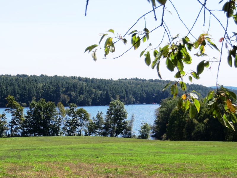
Field Overlooking Thompson Lake with Cottages on the Distant Shore in Oxford (2012)

Location Map for Oxford
| Year | Population |
|---|---|
| 1970 | 1,892 |
| 1980 | 3,143 |
| 1990 | 3,705 |
| 2000 | 3960 |
| 2010 | 4,110 |
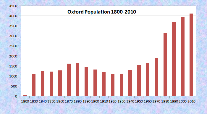
Population Trend 1800-2010
| Geographic Data | |
|---|---|
| N. Latitude | 44:31:00 |
| W. Longitude | 70:42:00 |
| Maine House | District 72 |
| Maine Senate | District 19 |
| Congress | District 2 |
| Area sq. mi. | (total) 41.9 |
| Area sq. mi. | (land) 38.7 |
| Population/sqmi | (land) 106.3 |
County: Oxford
Total=land+water; Land=land only |
|
[OX-frd] is a town in Oxford County, settled in 1794 and incorporated on February 27, 1829 from a portion of Hebron.
It then annexed land from Otisfield (1830) and Paris (1838).
 N44° 8' 18.56\" W70° 28' 15.84\"")
Center Meetinghouse (’12) @
 N44° 8' 17.84\" W70° 28' 16.63\"")
Meetinghouse Cemetery @
In the 19th century Oxford was home to John J. Perry, a lawyer who practiced in the town, and a member of the U.S. Congress and the state legislature.
 N44° 8' 20.62\" W70° 29' 17.09\"")
Memorial Park (2012) @
 N44° 8' 21.92\" W70° 29' 16.76\"")
Veterans Memorial (2012) @
[click images throughout the Encyclopedia to enlarge and clarify]
By 1886, the Grand Trunk Railroad was passing through the middle of the town and several manufacturing plants were in full swing.
As the Gazetteer of Maine observed in that year, in addition to the village of Oxford Depot,
The other centres of business are Welchville and Oxford Village, both of which have post-offices.
At the latter, situated at the outlet of Thompson Pond, are a stave-mill, a fours-mill and the woolen-mills of the Robinson Manufacturing Co., (having three buildings and nine sets of machinery, end employing 150 operatives) and a shovel handle factory, employing 10 men.
At Welchville, on the Little Androscoggin, are the woolen-mill of the Harper Manufacturing Co., having four sets of machinery, and employing 50 persons; and the mill of the Mousam Manufacturing Co., making leather board, and employing 15 men. . . . .
Hay is the largest crop, and a due number of cattle is raised. Both the villages and the rural districts have the indications of thriftiness, and afford many pleasant scenes to the eye of the traveler.
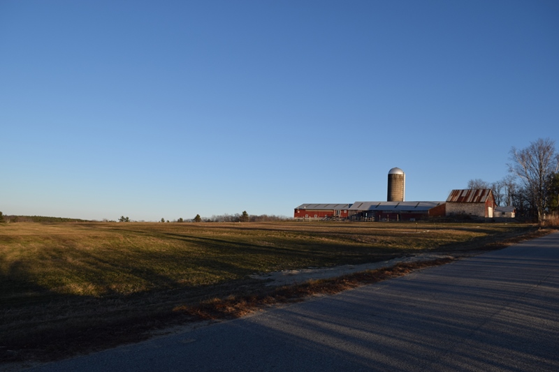
Farm with Barns and Cropland on the Sam Roe Hill Road in Oxford (2019)
These scenes still survive four or five miles north of Oxford village; and on the nearby East Oxford Road, strictly in Paris.
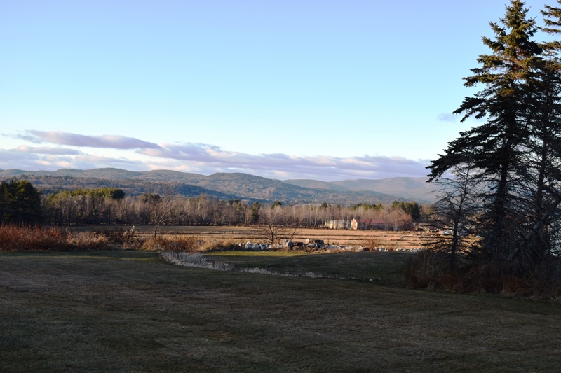
Oxford Hills from East Oxford Road (2019)
 N44° 6' 54.78\" W70° 26' 41.64\"")
The Oxford Casino (2012) @
 N44° 6' 55.32\" W70° 26' 41.76\"")
The Oxford Casino (2012) @
 N44° 8' 4.72\" W70° 29' 41.07\"")
Oxford Elementary School @
Routes 26 (the commercial strip) and 121 serve the community. The Oxford Casino is located on Route 26 in the south of town at N44° 6′ 55.3″ W70° 26′ 41.8″, less than 15 miles from the Lewiston-Auburn area. Several modular home providers are located on the strip.
")
Commercial strip in Oxford (2003)
")
One of Several Modular Home Locations (2003)
 N44° 7' 58.39\" W70° 29' 44.03\"")
Oxford Town Office (’12) @
Oxford village, at the north end of Thompson Lake, hosts the town office, post office, and a small veterans memorial park. The Oxford Congregational Church was established fourteen years before statehood in 1806 and is listed on the National Register of Historic Places.
 N44° 7' 55.95\" W70° 29' 42.74\"")
Oxford Post Office (2012) @
")
Covered Bridge (c. 1935)
")
Congregational Church (2003)
Though famous for the auto racing at Oxford Plains Speedway just off Route 26, the nearby Androscoggin River passes several sizable ponds and Thompson Lake abuts the main village.
")
Oxford Plains Speedway (2003)
The Oxford County Regional Airport is on Oxford Plains at the end of Airport Road.
N44° 9′ 17.59″ W70° 28′ 56.88″ It is owned and operated by Oxford County government.
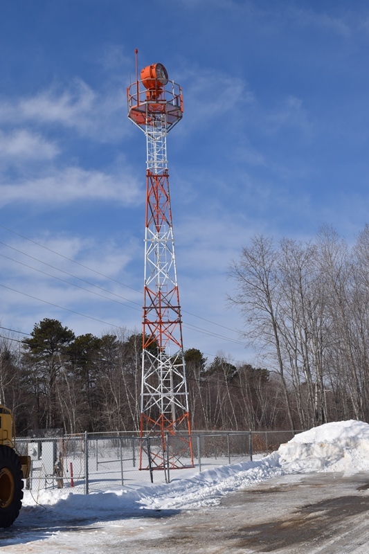
Beacon Tower at the Airport (2019)

Fuel Tanks at the Airport (2019)
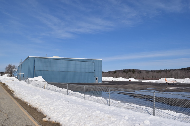
Large Building at the Airport (2019)
Form of Government: Town Meeting-Select Board-Manager.
Additional resources
Barnes, Diane. The Oxford Hills: Greenwood, Norway, Oxford, Paris, West Paris and Woodstock. Dover, N.H. Arcadia Publishing. c1995.
Boynton, Ernest H., 1864-1946. Diaries and Papers, 1883-1927. (Cataloger Note: Ernest H. Boynton, son of Robert and Lucy Boynton, was born in 1864 and died in 1946. His father’s estate was the largest in Oxford, Maine, in 1870. They lived in the part of Oxford known as Welchville. Ernest was a station agent for the Grand Trunk Railway and during the years he wrote his diaries he lived in Oxford, Yarmouthville, Auburn, and Lewiston, Maine; [and in New Hampshire and Massachusetts])
King, Marquis Fayette. Annals of Oxford, Maine. Somersworth, NH. New England History Press in collaboration with the Oxford Historical Society. 1987.
*Maine. Historic Preservation Commission. Augusta, Me. Text and photos from National Register of Historic Places: http://pdfhost.focus.nps.gov/docs/nrhp/text/xxxxxxxx.PDF and http://pdfhost.focus.nps.gov/docs/nrhp/photos/xxxxxxxx.PDF
Center Meetinghouse and Common: https://npgallery.nps.gov/pdfhost/docs/NRHP/Text/94000606.pdf
Oxford Congregational Church and Cemetery: https://npgallery.nps.gov/pdfhost/docs/NRHP/Text/94000637.pdf
The Oxford Inventory: A Guide to Local Research in the Oxford Hills. Norway, Me. 1997.
Varney, George J. A Gazetteer of the State of Maine. 1886. pp. 420-421.
Waterman, Charles E. Historic Highway: Road Hard Surfaced this Year: Welchville and Oxford History Revealed. Norway, Me. Norway Advertiser. 1931. [Maine State Library]
National Register of Historic Places – Listings
Center Meetinghouse and Common
[476 Main Street] The 1830 Center Meetinghouse is a building type that served both religious and governmental needs in a rural Maine community. Its particular blend of Federal and Gothic Revival style architectural features is unusual. The meetinghouse is on a location established in the original gift of land for the Town Common.
The area that forms the Town of Oxford was first settled in the closing years of the Revolution by immigrants from Massachusetts. Industrial development of the local water powers was aided by the investments of Cambridge, Massachusetts land speculator Andrew Craigie, after whom one of the settlements, Craigie’s Mills, was named. Shortly after the town’s incorporation in 1829, the heirs of Andrew Craigie offered to erect a meeting house. In May 1829, a site selection committee reported on their identification of a suitable three acre lot, after which approval was given to acquire and clear it. The meeting house was built the following year. The intent of the donors was that the building was to be used by any denomination. To avoid conflicts, the town voted in 1832 that the Congregationalists were to have use of it the first Sunday of each month, followed by the Baptists, the Universalists, and the Methodists. The meeting house has also served as a site for town meetings.
")
")
Architecturally, the Center Meeting House has a very traditional form with its rectangular gable roofed configuration, interior gallery, and box pews. At present, the meeting house stands on a 1.35 acre parcel representing the remainder of the original Common lot that was not developed as a cemetery.*
Oxford Congregational Church and Cemetery
")
[King Street, east side, 0.2 miles north of junction with Maine Route 121] The 1843 Oxford Congregational Church is a notable structure with distinctive Greek Revival and Gothic Revival details. It is noteworthy for the decorative trompe L’eoil♦ and stenciled finish on the sanctuary end wall and the nave ceiling. The Church was organized in 1826 with six members. The following year, an agreement was made with the Baptists to share their meeting house. By 1836, however, the congregation had grown to the point that their first resident pastor was settled and a parsonage built.
In 1840 the Congregationalists lost use of the meeting house when the Baptist revival greatly expanded its membership. For the next three years the Congregational society met in the upper floor of the village schoolhouse. Construction of a new church began in 1842 with the dedication taking place June 29, 1843. In addition to its architectural history, the church is distinguished by the partially restored painting that embellishes the interior. The initial decoration in the trompe L’eoil style is believed to have been carried out about 1880
The Oxford Congregational Church had a change in taste when, in 1913, the Monmouth architect/artist Harry Cochrane was engaged to stencil the interior. Cochrane apparently retained the existing decoration, but worked it into his own scheme which further embellished the sanctuary and the lower curved portion of the ceiling. A third episode of decoration occurred in 1945 when R. J. Morin of Auburn introduced additional stencil patterns and figures.*
♦a painting or design intended to create the illusion of a three-dimensional object