Lake Umbagog National Wildlife Refuge, established in 1992 spans the Maine-New Hampshire border. 5,000 of the total of 17,500 acres lie in Maine in Upton. A Magalloway River trail leads off Maine Route 16. In addition, about 20 miles of logging trails are open to hikers.
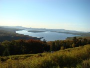
Richardson Public Reserved Land, Adamstown and Richardsontown Townships. Located in the Rangeley Lakes Region, the 22,000-acre area includes 21 miles of shoreline on Richardson and Mooselookmeguntic Lakes[upper left, click to enlarge], as well as frontage on several small ponds. Located between Upper Richardson Lake and Mooselookmeguntic Lake. Access to the southern portion of Richardsontown is by water, with launch sites at Oquossoc in Rangeley and at South Arm in Township C. Route 16 passes through the northern portion.
Riley and Grafton Township Public Reserved Lands. This area includes a portion of the Appalachian Trail, which winds through Mahoosuc Notch, Mahoosuc Mountain and leads into Grafton Notch State Park.
Step Falls Preserve, Newry. The first preserve of the Maine Chapter of the Nature Conservancy; 24 acres of cascades and pools which drop 200′ in a quarter-mile. Mountain views. On Rt. 26.
Sucker Brook, Lovell. Protects a half-mile stretch of the brook, including Moose Pond where moose are frequently spotted. A diverse preserve, changing from pond to swamp to upland forest, its home to a variety of plant and animal life including a colony of beavers, cardinal flowers and watercress, water lilies, speckled alder, sweet gale and button bush. Managed by The Nature Conservancy. Off Horseshoe Pond Road, near Kezar Pond.
Virginia Lake and Shirley Valley, Stoneham, Lovell. The largest undeveloped lake in the White Mountain region, popular with fishermen, boaters and cross country skiers, connected to extensive regional trail network. Owned and managed by the U.S. Forest Service, White Mt. National Forest.


