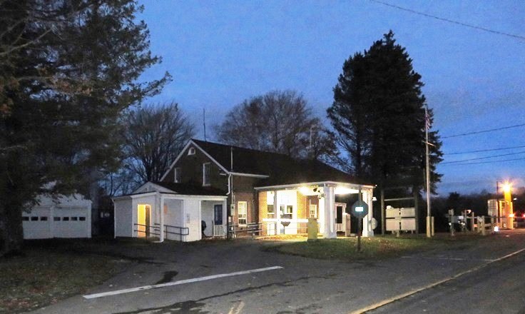
Customs Facilities on the Boundary Road in Orient (2014)

Location Map for Orient
| Year | Population |
|---|---|
| 1970 | 83 |
| 1980 | 77 |
| 1990 | 157 |
| 2000 | 145 |
| 2010 | 147 |
| Geographic Data | |
|---|---|
| N. Latitude | 45:49:04 |
| W. Longitude | 67:51:34 |
| Maine House | District 144 |
| Maine Senate | District 2 |
| Congress | District 2 |
| Area sq. mi. | (total) 37.9 |
| Area sq. mi. | (land) 35.8 |
| Population/sq.mi. | (land) 4.1 |
County: Aroostook
Total=land+water; Land=land only |
|
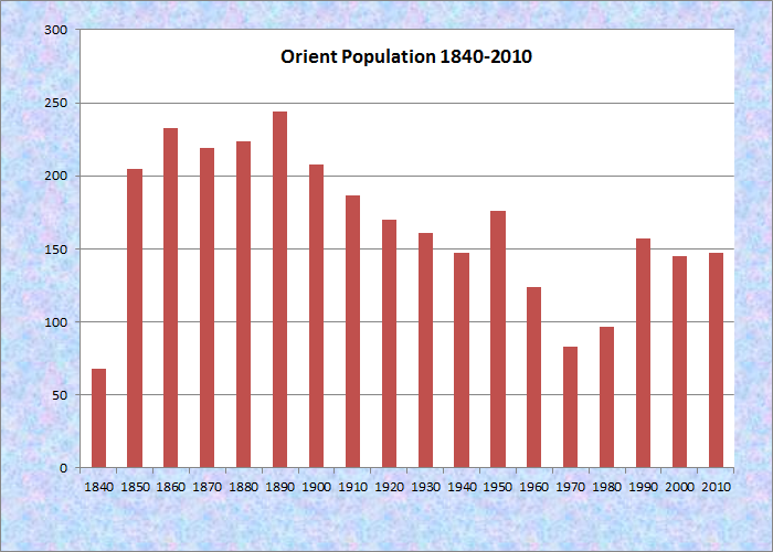
Population Trend 1840-2010
 N45° 46' 55.32\" W67° 54' 17.70\"") [OR-ee-ent] is a town in Aroostook County, formally organized as a town from the township T9 R1, Monroe Gore and Orient Gore on April 9, 1856.
[OR-ee-ent] is a town in Aroostook County, formally organized as a town from the township T9 R1, Monroe Gore and Orient Gore on April 9, 1856.
The name derives from its eastern location adjoining New Brunswick. Its eastern point lunges into Grand Lake and North Lake on the Canadian border, accessible by the Boundary Road.
 N45° 49' 1.13\" W67° 46' 55.41\"")
Customs on the Boundary Road in Orient (2014) @
 N45° 49' 0.96\" W67° 46' 55.14\"")
Grand Lake at the Border (2014) @
 N45° 49' 0.90\" W67° 46' 54.78\"")
U.S. Customs on the Boundary Road in Orient (2014) @
 N45° 49' 0.84\" W67° 46' 54.72\"")
Canada Customs on the Boundary Road (2014) @
The town’s web site describes the community as follows:
Being home to East Grand Lake, North Lake, Deering Lake, and Longley Lake makes Orient a sportsman;s and vacation paradise. There are fishing, hunting, boating, ATV trails, and idyllic forests to hike. In winter, Orient is a destination for snow sledding and ice fishing. The wildlife habitats with deer, moose, raccoons, fox, bear, and other species as well as a large variety of birds and waterfowl satisfy the sportsman, shutterbug, and vacationer.
Orient is a rural community involved in farming, forestry, and landscaping. A small year round population grows during vacation, hunting, and fishing seasons to include those already enlightened to the natural beauty of the area.
 N45° 45' 59.72\" W67° 55' 52.31\"")
Selden Baptist Church on the Selden Road (2014) @
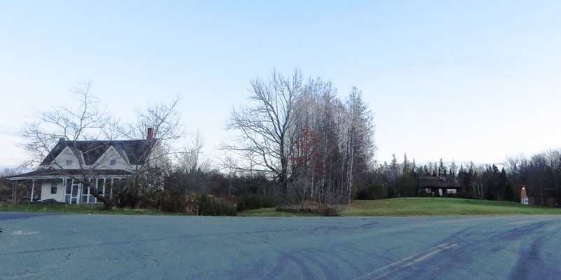
Houses at Danforth and Selden Roads (2014)
U.S. Route 1 runs north-south through the middle of the township.
Orient village is just east of Route 1 on the Boundary Road.
Sunset Park and other camping areas are attractive vacation locations.
A State rest stop is on U.S. Route 1 near Amity, three miles north of Orient Village.
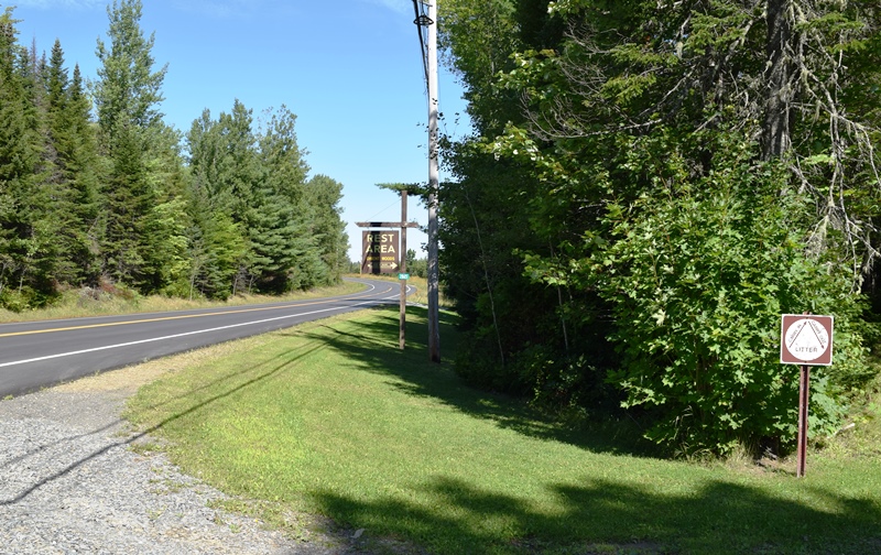
“Orient Woods” on U.S. Route 1, with toilet facilities (2019)
 N45° 48' 50.14\" W67° 50' 19.64\"")
Orient Town Office (2014) @
")
Honor Roll at Town Office (’14)

U.S. Route 1 in Orient @
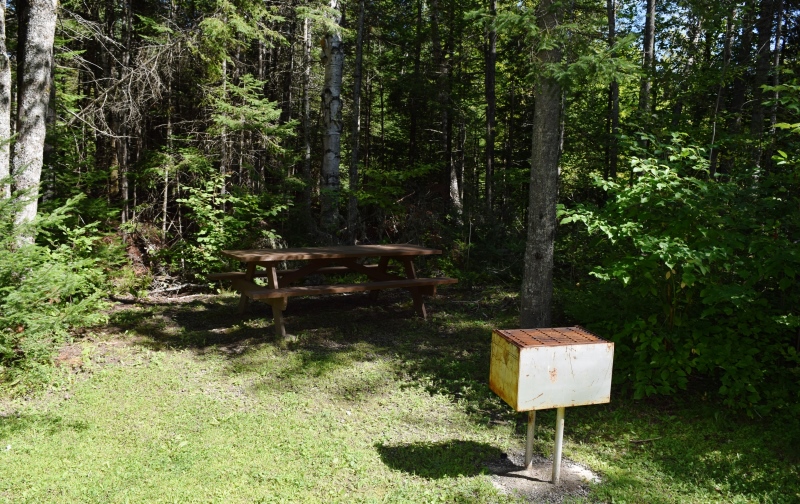
Picnic Area at Orient Woods Rest Stop on U.S. Route 1 (2019)
Just north of Danforth in southernmost Aroostook County, Orient’s population peaked at 244 in 1890.
Form of Government: Town Meeting-Select Board.
Additional resources
Bubar, A.S. Daybook, 1899-1901. (Cataloger Note: A daybook used by A.S. Bubar to record the names of customers and their purchases at an unidentified business in Orient, Maine, possibly a general store. Items purchased include beans, tea, fish, pork, lard, corn, etc. The volume also gives information about logging in the area, recording costs of cutting, hauling, and driving logs, stumpage totals, etc.)
Orient, Town of. The Town of Orient Welcomes You.” http://www.townoforient.org/ (accessed March 30, 2014)
*National Park Service. U.S. Inspection State– Orient, Maine” https://www.nps.gov/nr/feature/places/14000557.htm; and https://www.nps.gov/nr/feature/places/pdfs/14000557.pdf (accessed March 5, 2017)
National Register of Historic Places – Listings
U.S. Inspection Station–Orient, Maine
[[Boundary Line Road] This U.S. Inspection Station retains all aspects of historic integrity despite some alterations and meets the requirements for listing in the National Register of Historic Places with significance in the year 1937. It retains all of its original program elements, and well demonstrates the historic characteristics of a 3-bay Inspection Station.
The 1937 Station retains the attributes necessary to convey that it was one of the first set of purpose-built U.S. Border Inspection Stations that were planned, designed and built by the U.S. Government to improve land border security. It was sited alongside a border highway at one of the locations considered in 1928 by H.A. Benner of the Bureau of Customs and J.L. Hughes of the Bureau of Immigration. Its construction was, therefore, in direct response to a chain of events including the imposition of head taxes and country quotas on immigration in 1917 and 1921, smuggling arising from the prohibition of alcohol in 1919, and the increase in usage of the automobile and improved roads in the 1920s.
The exterior and interior of the station still convey the historical design, workmanship, and materials of the facility’s original construction. The Colonial Revival design system was employed throughout the facility through a combination of brick or clapboard exterior wall surfaces, symmetrical design, steep gable roofs, multi-light double-hung sash windows, flat arches, and Colonial style columns.*