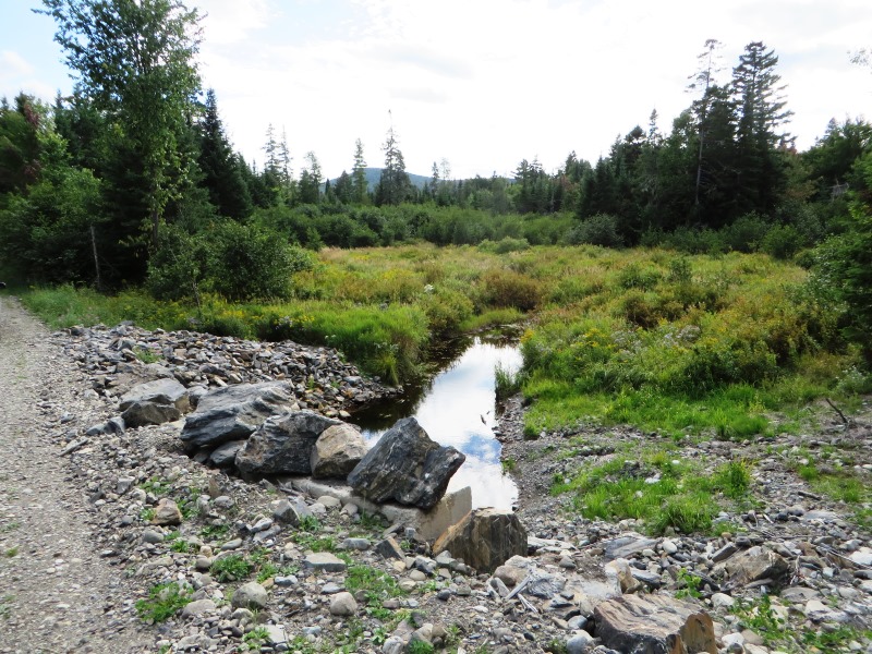
North Branch of Trout Brook on the Tote Road (2014)
Wholly within Baxter State Park in its northwest, the township is also known as T5 R10 WELS. The Park’s Nesourdnahunk Campground is off the Tote Road in the north.
Located just south of the present “Tote Road,” it contains five mountains over 1,700 feet. Trout Brook and its tributaries flow through here.
Dwelley Pond is the only one within Nesourdnahunk. The Dwelley Pond Trail follows the old Tote Road north to south from near Burnt Mountain to near Strickland Mountain. Rusting culverts and occasional wide paths recall its role as the main park road decades ago.
A 1961 survey by the Maine Department of Inland Fisheries and Wildlife seems quaint nearly 50 years later:
Fishes: Brook trout (squaretail), Minnows, Creek chub, Blacknose dace.
Physical Characteristics: Area – 19 acres Maximum depth – 4 feet. Temperatures Surface – 63° F. 4 feet – 63° F.
Dwelley Pond is a small, extremely shallow body of water. [Thanks to a beaver family, the pond is much deeper now and probably covers more area.] The bottom is a thick layer of soft muck, and most of the shoreline is a quaking bog. The pond lies adjacent to the gravel road in Baxter State Park [now the Dwelley Pond Trail], and there is a handy parking space [no longer] at a picnic site within a few hundred feet of the water.
Many large springs supply cold water to this pond. You can see the water literally “boiling” up out of the silt in one especially large spring near the road. There is a large population of 6- to 9-inch trout in Dwelley Pond. The many springs, a small tributary, and the outlet furnish ample spawning area to keep the pond well stocked.
In addition to the trout, there are two species of minnows present. The creek chubs grow quite large, and they often become abundant. Dace remain small, and they usually don’t become numerous enough to compete with trout. The general 5-fish bag limit of Baxter State Park adequately protects the trout in this small pond.
 N46° 5' 13.17\" W69° 1' 34.28\"")
North Entrance to the Trail @
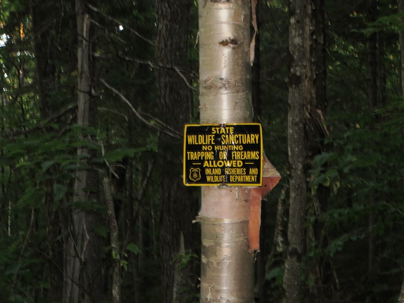
“Wildlife Sanctuary” Sign
 N46° 2' 43.45\" W69° 3' 28.48\"")
South Entrance to the Trail @
Additional resources