
Mt. Abram Township Topographic Map

Detail of Mt. Abram Township Topographic Map
The township is immediately south of Carrabassett Valley, host to the next northerly section of the Appalachian Trail. Mount Abram Township is dominated by Mount Abraham, with the AT passing through the northwest corner.
This four mile section is inaccessible by road except at the Redington Township line. An unimproved road beginning in East Madrid, and possibly gated or barricaded, follows the line north to a dead end just beyond the trail crossing.

Sugarloaf Mountain (2007)

Sugarloaf Mountain (2007)
“Back” of Sugarloaf Mountain in Carrabassett Valley, behind the ski area, is a landmark on the trail.
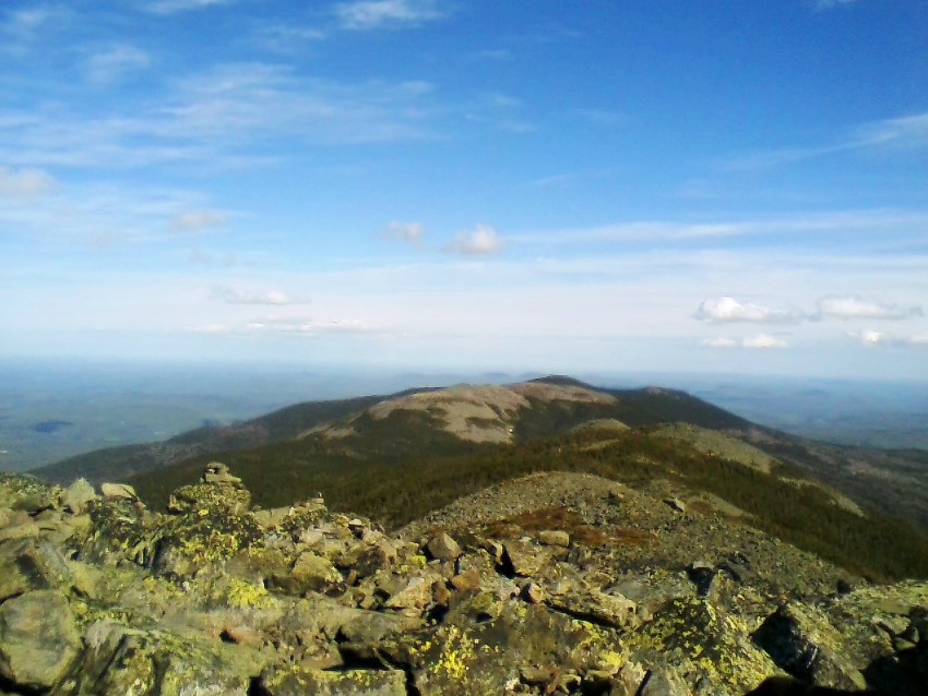
Hikers scale Lone Mountain for the first mile at the western edge of the township, then skirt the western edge of Mount Abraham. A shelter is located on the trail about three miles from the Redington line on Spaulding Mountain.

Rock with the AT Commemorative Plaque (2007)
")
Scenic Mountain View from the Trail (2007)
Commemorative plaque above notes that the Appalachian Trail was not completed until August 14, 1937. The plaque itself does not mark the actual spot where the final link was made, with the help of the Civilian Conservation Corps. According to Steve Clark, who created the plaque, “It was the only bolder that was large enough for a plaque and one that would not be lost over time.”
A bit farther north the link was accomplished, making what is now Carrabassett Valley the location of the final section of the completed AT.
The yellow dots on the topographic maps track the AT as it was recorded on the 1932 topographic map of the Phillips, ME Quadrangle, which includes Mt. Abram Township.

Plaque Commemorating the Completion of the Appalachian Trail in 1937 (2007)
Photos courtesy of Brady G. Williams 2007 and 2019.
Additional resources
Clark, Stephen. Baxter Park and Katahdin. Compiled and published by Stephen Clark from U.S.G.S. base maps. 1977. [University of Maine, Raymond H. Fogler Library, Special Collections]
Clark, Stephen. Katahdin: A Guide to Baxter Park & Katahdin. Shapleigh, Me. Clark Books. 2009.
Topographic maps were created from the following University of New Hampshire Dimond Library, Documents Department & Data Center, Historic USGS Maps of New England & New York, accessed 1/10/2008: Stratton, ME Quadrangle (1956), http://docs.unh.edu/nhtopos/Stratton.htm; and Historic USGS Maps of Phillips, Maine (1932), http://docs.unh.edu/towns/PhillipsMaineMapList.htm.
![]() <= South Appalachian Trail – click a boot North
<= South Appalachian Trail – click a boot North ![]() =>
=>
Where is the closest access point along the AT if were in Wiscasset Maine?
About 100 miles northwest to Grafton Township, via Bath, Augusta, Rumford . . . . Best is to set your GPS: Latitude: 44.61256
Longitude:-70.96043 (Double check, not sure this is reliable)