Dam and Spillway near the old Sawmill (2003)

Location Map for Lyman
| Year | Population |
|---|---|
| 1970 | 864 |
| 1980 | 2,509 |
| 1990 | 3,390 |
| 2000 | 3,795 |
| 2010 | 4,344 |
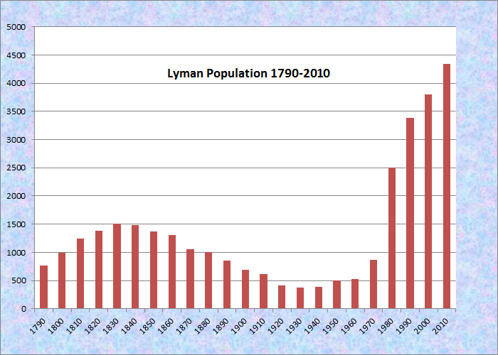
Population Trend 1790-2010
| Geographic Data | |
|---|---|
| N. Latitude | 43:29:59 |
| W. Longitude | 70:38:31 |
| Maine House | Dis 10,17 |
| Maine Senate | District 32 |
| Congress | District 1 |
| Area sq. mi. | (total) 39.5 |
| Area sq. mi. | (land) 38.9 |
| Population/sqmi | (land) 111.7 |
County: York
Total=land+water; Land=land only |
|
")
[LII-man] is a town in York County, first settled in 1767 and incorporated on March 11, 1778 under the name Coxhall.
The name was changed to Lyman on February 20, 1803.
The title to the town was derived from a deed purchased from the Sagamore Fluellen in 1660.
")
Gravestone Dated 1820 (2003)
Though earlier it was also called called Swansfield, it was finally named after Theodore Lyman of York, a successful businessman and Boston merchant who amassed a substantial fortune.
 N43° 30' 20.53\" W70° 35' 6.09\"")
Lyman Town Hall (2014) @
Its early settlement is sadly commemorated in a small old cemetery just off Route 111 where the headstone declares the death of a two-year old child in the year Maine became a state.
 N43° 26' 52.15\" W70° 35' 36.60\"")
1847 Alewive Free Baptist Meetinghouse (2014) @
")
Small Taylor Cemetery near the Meetinghouse (2014)
Goodwins Mills is a village straddling the town lines of Lyman and Dayton.
The village has held the name since 1782 when the first saw and grist mills were there. Lyman’s United Methodist Church was established in 1840.
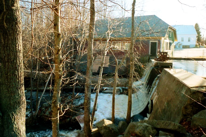
On the Goodwins Mills Road (Route 35), a dam and mill pond on Swan Pond Brook retains the structure of an old sawmill, now renovated.
")
Pond on Swan Pond Brook (2014)
 N43° 30' 34.00\" W70° 34' 51.18\"")
Site of an Old Saw Mill (2014) @
")
Lyman Elementary School (’14)
")
Cousens Memorial School (’14)
")
Large Barn and House (2014)
Dotted with ponds, the area is a rapidly growing rural commuter community served by Maine Route 111 (providing easy access to Sanford and the Biddeford–Saco areas) and Route 35.
The images below are in or near Goodwins Mills Village.
")
United Methodist Church (2014)
")
Community Library (2014)
 N43° 30' 25.97\" W70° 34' 56.33\"")
Village “Main Street” (2014) @
Form of Government:
National Register of Historic Places – Listings
Foss, Levi, House
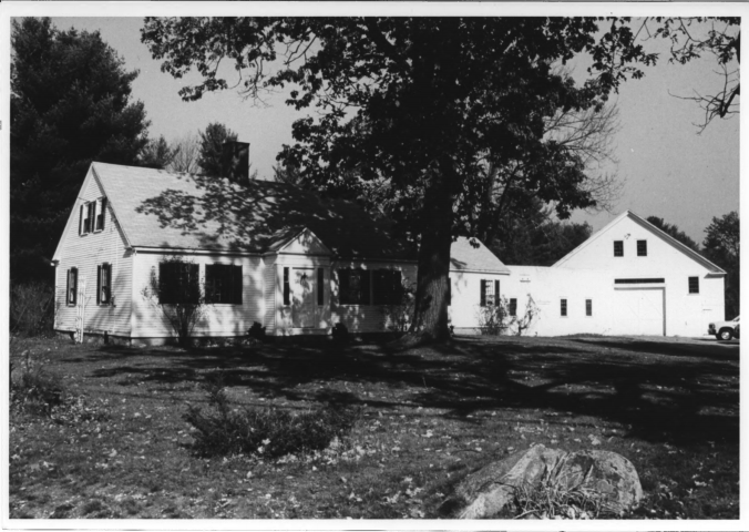
Levi Foss House with Attached Barn
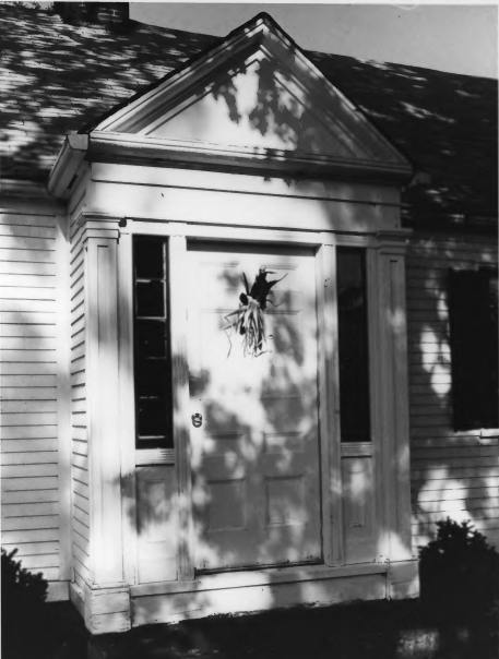
The pedimented entry of the Levi Foss House
[Maine Route 35, in Goodwins Mills shared by Dayton and Lyman] The Levi Foss House (c. 1815) is a fine example of an early 19th century extended farmhouse. While it was built during the period when Federal architectural features were popular, within a very short time after its construction the interior was remodeled in a very high style Greek Revival. Also unusual in a Cape is the pedimented front entry (triangular shape, placed above the horizontal structure supported by columns).
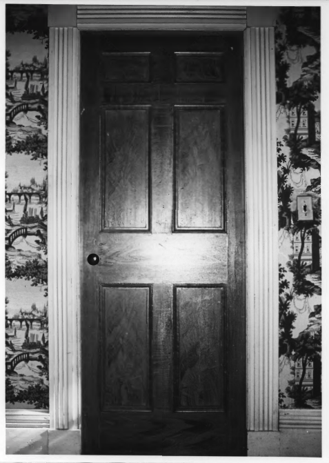
Levi Foss House interior 1
Except for the addition of modern conveniences the house seems to have undergone little change in the past 150 years (as of 1983 survey) and has been freshened by interior paint and paper which have been applied by the then owners in their careful
and proper restoration. (See more in Dayton)
Frank A. Beard photos (1983)
Levi Foss House interior 2
Additional resources
“NPGallery Digital Asset Search.”
https://npgallery.nps.gov/NRHP/GetAsset/50240267-5012-4588-89a1-1cbd5b3fec82
(accessed March 10, 2020)