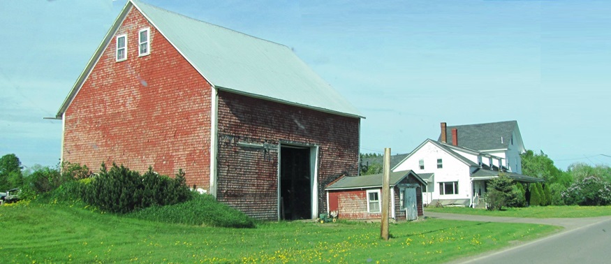
Classic barn and farmhouse on the Ludlow Road in Ludlow (2012)

Location Map for Ludlow
| Year | Population |
|---|---|
| 1970 | 259 |
| 1980 | 403 |
| 1990 | 430 |
| 2000 | 402 |
| 2010 | 404 |
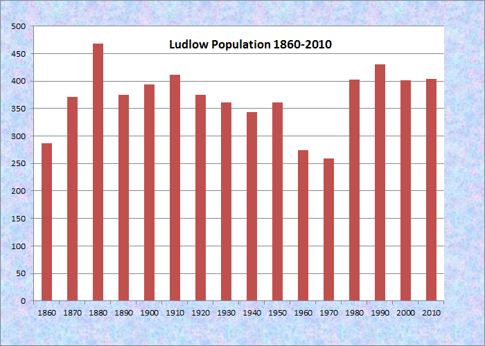
Population Trend 1860-2010
| Geographic Data | |
|---|---|
| N. Latitude | 46:09:34 |
| W. Longitude | 67:58:39 |
| Maine House | District 145 |
| Maine Senate | District 2 |
| Congress | District 2 |
| Area sq. mi. | (total) 22.0 |
| Area sq. mi. | (land) 22.0 |
| Population/sq.mi. | (land) 18.4 |
County: Aroostook
Total=land+water; Land=land only |
|
[LUD-low] is a town in Aroostook County, incorporated on March 21, 1864 from Belfast Academy Grant Plantation, itself organized in 1840.
General John Cummings, agent for the trustees of Belfast Academy and probably the first white settler, arrived on October 8, 1826.
In the 1880’s Ludlow had two sawmills in operation. Its primary economic activity was in farming: mostly oats, wheat, and potatoes.
")
Old School, then the Town Office (2003)
")
Old School, then the Town Office (2003)
Ludlow is a “half-township” New Limerick occupies the other half of the original township just south of Ludlow and just west of the northern portion of Houlton.
")
Farmhouse and Barn (2003)
")
Field of Soy Beans (2003)
Ludlow is an agricultural community in the heart of southern Aroostook potato county. The soybean field above is an example of the continuous, historic attempts to diversify the county’s farm economy.
")
Tilled Field on the Ludlow Road (2012)
")
Ludlow Town Hall on the Ludlow Road (2012)
The town office was located in an old schoolhouse, which also housed the Head Start program.
In 2012 a new Town Office served the town.