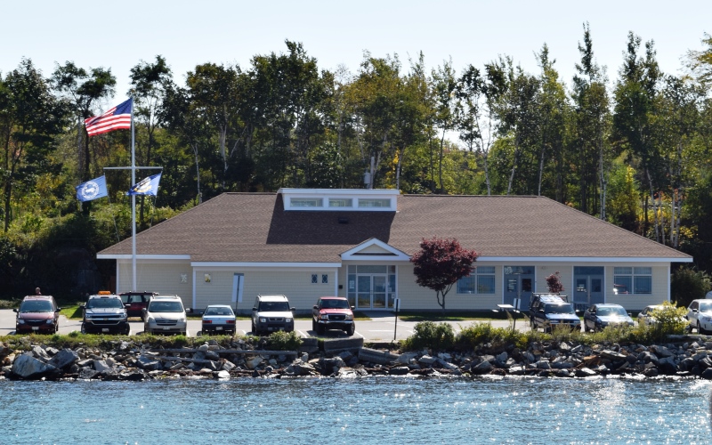
Town of Long Island Community Center (2018)

Location Map for Long Island
| Year | Population |
|---|---|
| 1970 | n.a. |
| 1980 | n.a. |
| 1990 | 201 |
| 2000 | 202 |
| 2010 | 230 |
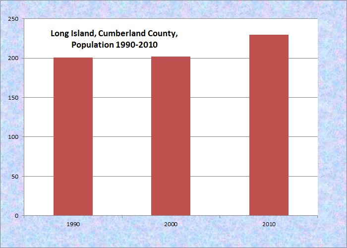
Population Trend 1990-2010
| Geographic Data | |
|---|---|
| N. Latitude | 43:41:20 |
| W. Longitude | 70:09:00 |
| Maine House | District 47 |
| Maine Senate | District 25 |
| Congress | District 1 |
| Area sq. mi. | (total) 10.4 |
| Area sq. mi. | (land) 1.4 |
| Population/sqmi | (land) 164.3 |
County: Cumberland
Total=land+water; Land=land only |
|
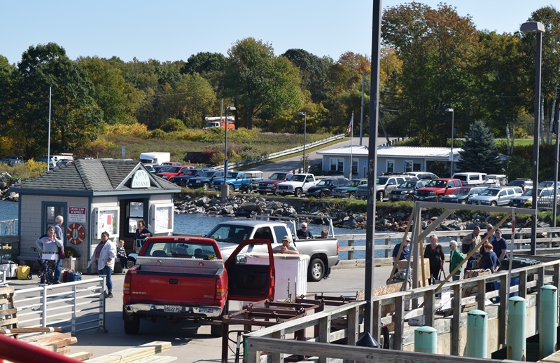
West shore near the Ferry landing (2018)
[long I-LAND] is a town in Cumberland County incorporated ion April 3, 1992 from an island in Casco Bay once a part of the City of Portland. Like other Casco Bay islands, Long Island was originally inhabited by Native Americans until settlers arrived in the 1600’s. Colonel Ezekiel Cushing purchased the island in 1732 and is credited with being the first westerner to settle and build a house on Long Island. He died in 1765 and willed the island to his nine surviving children. Soon after, other settlers arrived to make a livelihood out of farming, fishing, and catching lobsters.
During World War II, the Island served as a fueling depot for the U.S. Navy. Supply stations and army buildings were built to add to Casco Bay’s defense in the event of an attack. Many of the buildings still stand along the shore.
Israel B. Lunt (1796-1861) and his brother Amos, were early settlers on Long Island, arriving around 1822. Other family members soon followed and the Lunts were instrumental in establishing the community.
According to cataloger notes to his Financial Records,
Israel Lunt started a business of shipping wood, dried fish, and paving stones to various places on the Maine coast and to Boston. He also established a store on the island and owned a wharf and interest in several schooners. Lunt purchased the whole island in 1835 and employed many island residents in hauling fish to dry, unloading supplies and working on his vessels.
On July 1, 1993 the Town of Long Island became the first new town in Maine since 1925. Since then its small resident population has continued to grow. As with many Maine coastal communities, its summer population doubles. Its neighbor to the northwest, Chebeague Island, is yet another new town as the Portland islands in Casco Bay seek their independence and lower rates of property taxation.
The town has several beaches, harbors, a fresh water marsh, and a 125 acre conservation area complete. Long Island’s school includes grades kindergarten through fifth grade.
In addition to the post office, there is one year-round store, and a store and a gift shop open seasonally. A “guest house” is also open all year.
The village is at the southwestern end of the island and includes the town office, community center, library, and school. The town includes Vail Island and several smaller islands. It is accessible by the Maine State Ferry Service from its terminal in Portland.
Ferry landing from Portland; Town Office in background (2018)
This “Long Island” should not be confused with Long Island in Blue Hill Bay, which is part of the town of Blue hill, nor the town of Frenchboro on Long Island south of Mount Desert Island.

Form of Government: Town Meeting-Select Board.
Additional resources
Gray, Kenneth V. A Short Career on a Long Island, written for the Long Island Society in the year 2000. Long Island, Me. Long Island Maine Historical Society. 2000.
“History of Long Island.” https://www.cascobaylines.com/islands/long-island-maine/ (accessed October 12, 2018)
Ricker, Roberta Gomez. West by North, A Quarter North. South Portland, Me. R. Ricker. 2004. c2003.