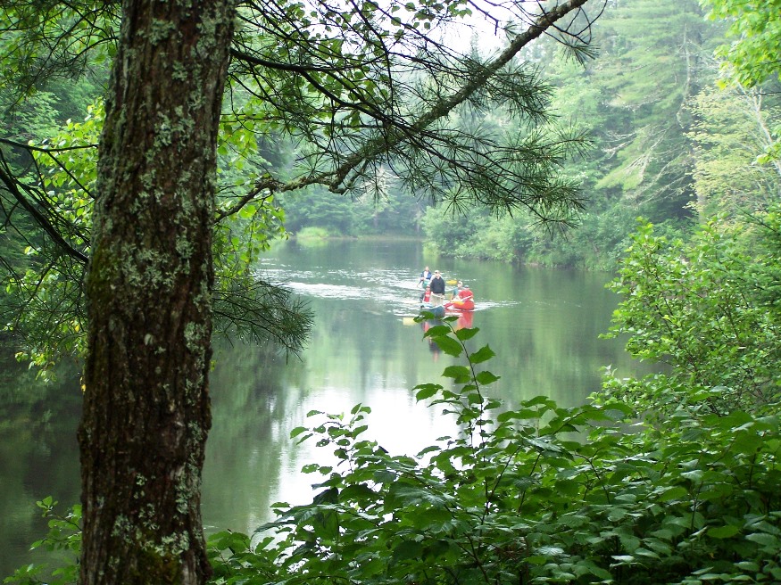
A party of canoeists in the Moose River in Holeb Township (2006)

Location Map for Holeb Township
| Geographic Data | |
|---|---|
| N. Latitude | 44:30:48 |
| W. Latitude | 69:26:08 |
| Maine House | District 55 |
| Maine Senate | District 25 |
| Congress | District 2 |
| Area sq. mi. | (total) 39.5 |
| Area sq. mi.* | (land) 38.9 |
| Population/sq.mi. | (land) 52.5 |
County: Somerset
Total=land+water; Land=land only*Total area calculated from METWP24 GIS data layer at http://megis.maine.gov/catalog/catalog.asp; land area is estimated by subtracting from the total the area of the following ponds: Holeb (9/10); Barrett, Big Fish, and McKenney as indicated at http://www.pearl.maine.edu. |
|
")
Sign Alerting Canoeists to a Site (2006)
")
Holeb Falls (2006)
[HOLE-ub] is an unorganized township in Somerset County, also known as T6 R1 NBKP (North of Bingham’s Kennebec Purchase). It has never been an organized town or plantation.
As with its neighbor, Attean, Holeb Township’s history is one of logging and recreational fishing.
Holeb was and is a place for harvesting forest products. Amos A. Graffe had logging crews and camps here and in nearby Skinner Township in the 19th century.
In 2006, Orion Timberlands, LLC won the bid for stumpage rights to 19,000 acres in the township with the expectation of harvesting 45,000 cords of wood over the five-year contract period.
")
Holeb Pond and Attean Mountain (2006)
")
Moose River at the Junction with Holeb Stream (2006)
The sign below reminds visitors to the State’s Holeb Management Unit of terms of use in the public lands. Most of the shores on Attean and Holeb Ponds, and a significant length of the Moose River including Holeb Falls, lie within the reserved land.
")
Area Use Rules Posted at Holeb Pond (2006)
Primitive campsites, well-spaced, are available along the river. Signs appear alerting canoeists to the sites.
With 19,651 acres of public reserved land, Holeb has a recreational use dominated by the Moose River Bow Trip, long popular among canoeists and fishermen. (The “bow” is the imagined shape of the trip from Attean Pond, via a portage to Holeb Pond, then to the Moose River and back to Attean Pond.)
")
Camel Rips (2006)
Camel Rips are the first, and least challenging, of several sets of rapids that are relatively friendly to amateurs. Portages are helpful at several points and, at Holeb Falls, essential. West Branch Moose River is a short tributary of the South Branch Moose River in Franklin County. Its source is on Caribou Mountain in Merrill Strip Township. Maine, 2,000 feet ,from the Canada/United States border, which runs along the Height of land between the watersheds of the Kennebec River in Maine and the Chaudire River in Quebec. From there, the river runs 5.9 miles northeast to its confluence with Moose River’s South Branch in Skinner. .Distance: 8.2 miles.
")
Starting the Bow River Trip at Holeb Pond (2006)
")
Campsite Near Camel Rips (2006)
Additional resources
Holeb is also within the “Unorganized Territory of Northwest Somerset County” This territory collects data about Holeb and other nearby Townships, most likely including Forsyth Township just to the West. In 2021 it reported a total POPULATION: of 58 persons; 58 population in households; 43 in families. HOUSING UNITS:654; 26 owner occupied, 4 renter occupied, 622 vacant. average home value 141,000. INCOME: Average annual income $44,6543. HOUSEHOLDS: Total: 21,001; average household size, 2.31; Family households, 13,352; average family, 3.
“Current Projects.” Maine Public Reserve Land (Holeb). http://www.oriontimber.com/projects/mprl.php (accessed December 20, 2011)
Maine Geological Survey. “The Geology of the Moose River ‘Bow Trip’ – Northwestern Maine.” http://www.maine.gov/doc/nrimc/mgs/explore/bedrock/sites/oct07.htm (accessed December 20, 2011)
Graffte, Amos A., 1871-1945. Amos and Octavia Moulton Graffte Papers, 1890-1974. [University of Maine, Raymond H. Fogler Library, Special Collections]
The History of Moose River Valley: Jackman, Moose River, . . . Holeb, Skinner and Lowelltown. Jackman, Maine. Jackman Bicentennial Book Committee. 1976.
National Register of Historic Places – Listings
Birch Island House
")
[Birch Island] Built about 1870, the Birch Island House is a two-story frame building, the centerpiece of a remote private sporting camp, apparently established by a group of wealthy New Yorkers. It is the most significant remnant of the compound that consisted of several outbuildings and a number of individual camps. Little is known about the people who founded this enclave or about its history. Several factors may account for the mystery: the island’s remote location, its apparent restricted use, and unlike the popular and Rangeley or Moosehead lakes regions, Holeb Pond was a very isolated spot.
Prior to the opening of the Canadian Pacific Railroad (whose line skirts the southern edge of Holeb Pond) in the late 1890s, access could have been by way of the Canada Road up to Jackman and then a trek of some nine miles by canoe and foot. The difficulty of accessibility aside, the apparently private nature of the camp would serve to obscure its existence. It is thought that the Birch Island Sporting Camps, as the compound had become known by the first decade of the 20th century, continued to belong to a private association until the 1950s. Its heyday had probably long since passed, particularly with the onset of the Great Depression. For the next thirty years, the camps appear to have been largely abandoned. In 1986, the property was acquired by a Massachusetts company, subdivided, with the existing individual camps becoming separately owned.
In the 1990s the Birch Island House was rehabilitated with the replacement of missing or deteriorated features based on historic photographs. The House seems to have been both a social hall and dining area as well as a lodging facility.* [David Murphy photo]