Great Pond in Great Pond Plantation (2013)

Location Map for Great Pond Plantation
| Year | Population |
|---|---|
| 1970 | 41 |
| 1980 | 45 |
| 1990 | 59 |
| 2000 | 47 |
| 2010 | 58 |

Population Trend 1960-2010
| Geographic Data | |
|---|---|
| N. Latitude | 44:57:51 |
| W. Longitude | 68:18:43 |
| Maine House | District 137 |
| Maine Senate | District 8 |
| Congress | District 2 |
| Area sq. mi. | (total) 39.0 |
| Area sq. mi. | (land) 36.9 |
| Population/sq.mi. | (land) 1.6 |
County: Hancock
Total=land+water; Land=land only |
|
 This is a plantation in Hancock County, organized for election purposes on October 26, 1840 from township T33, MD, BPP.
Its organization was reconfirmed on March 5, 1895. It was formally incorporated as a plantation on April 1, 1981.
The main village is small and in the southern part of the township about a mile south of Great Pond, at the junction of the Great Pond Road and Alligator Road. The town office, an old church, and a few houses are there.
 N44° 56' 15.11\" W68° 16' 51.05\"")
Town Office in the Village (2013) @
 @ N44° 56' 15.01\"")
Free Baptist Church of Great Pond at Alligator Rd (2013) @
 N44° 56' 14.60\" W68° 16' 50.74\"")
Well-kept House in the Village (2013)
 N44° 56' 14.81\" W68° 16' 51.08\"")
Mountain View to the West in the Village (2013) @
On March 17, 1921, the Maine Legislature approved “An Act to Incorporate the Great Pond Railway Company.” The corporation was authorized to construct and operate a railroad of standard gauge, about sixteen miles in length, for the transport of freight and forest products only, commencing at and connecting with the Maine Central Railroad at some convenient point in the town of Milford . . . and extending in an easterly direction by the most feasible route, about sixteen miles in an easterly direction to some point in Plantation Number thirty-three, also called Great Pond Plantation.
Modern maps do not show such a railroad, but the Act makes clear the value of forest products in the area.
For years “Stud Mill Road” has run east-west through Great Pond Plantation from Washington County, other unorganized townships in Hancock County, to the Costigan stud mill in Milford.
The Upper Village is between the main village and the Lake.
 N44° 56' 35.43\" W68° 16' 57.89\"")
Fire Station in the Upper Village (2013) @
 N44° 56' 47.02\" W68° 16' 56.17\"")
Cemetery in the Upper Village (2013) @
In addition to Great Pond, the plantation is home to Riff, King, Long, and Little ponds.
The Union River, the outlet from Great Pond, flows southward through Ellsworth to Union River Bay.
An easement acquiring Maine Public Reserved Land status to 21,910 acres at Great Pond was pending in 2010.
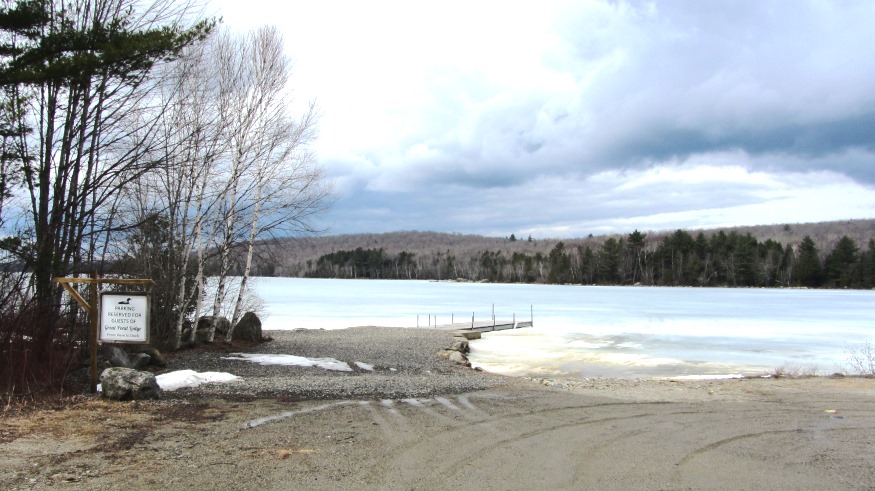
Currently the U.S. Navy operates a recreation center (Outdoor Adventure Center) on the eastern end of the Pond, where the Great Pond Road ends.
 N44° 57' 10.06\" W68° 16' 55.08\"")
Navy Outdoor Center (2013) @
 N44° 57' 10.75\" W68° 16' 55.28\"")
Navy Outdoor Center (2013) @
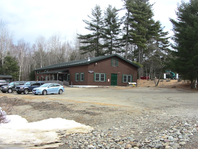
Navy Outdoor Center (2013) @
Form of Government: Town Meeting-Select Board.
Additional resources
An Act to Incorporate the Great Pond Railway Company. State of Maine. Private and Special Laws. Chapter 57 (1921)
“Great Pond Historic Hall Restoration Project.” http://www.emainehosting.com/GPChurch/Standard_View/beginning.htm (accessed July 23, 2015)
Maine Department of Conservation. Bureau of Parks and Lands. 2010 ANNUAL REPORT for Public Reserved, Non-Reserved, and Submerged Lands to the JOINT STANDING COMMITTEE on AGRICULTURE, CONSERVATION, AND FORESTRY. http://www.maine.gov/doc/parks/pdf/2010landsannualreport.pdf (Accessed December 10, 2011)
National Register of Historic Places – Listings
Photos, and edited text are from nominations to the National Register of Historic Places researched by Maine. Historic Preservation Commission.
Full text and photos are at https://npgallery.nps.gov/nrhp
Free/First Baptist Church of Great Pond, c. 1890
 N44° 56' 12.84\" W68° 16' 50.34\"")
Free Baptist Church near the Town Office (left) at Alligator Road (2013) @
The only architecturally significant public or civic building built in the town, it served as a church until about 1938. The interior has been little altered since construction about 1890-1895, lacking even basic modernizations such as electricity and plumbing. The floors are oak planking, the walls are plastered, and the ceiling consists of decorative pressed tin panels.
After settlement of Great Pond in the early 1800s by Joshua Williams, Revolutionary War veteran, the frontier settlement became a lumbering village. Residents held church sessions in private homes. In 1890, the Ladies Circle of Township 33 (now the town of Great Pond) organized to build a suitable place of worship. They called on the community to make donations and to build the Free Will Baptist Church. The church lot was donated by James Collar and Ella Garland. It was used as a place of worship for the community for decades.
Through the 20th century the church was maintained as a historic building by the descendants of the Williams family, who believed they owned it. In July 2004 at their annual family reunion, the Williams family discussed removing it so that it would not to be a hazard to the community, but it turned out that the property did not belong to the Williams family, nor to the Town of Great Pond.
In 2006 Hancock County Superior Court found the church property “wasting for lack of custody” and transferred ownership to the “Friends of the Free Baptist Church of Great Pond.”