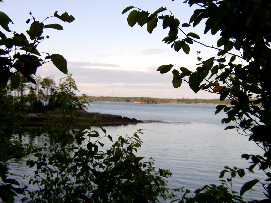
Cobscook Bay from the State Park in Edmunds Township (2004)

Location Map, Edmunds TWP
Edmunds was incorporated as a town on February 7, 1828, and annexed some land from adjoining Trescott in 1899.
However, during the depths of the Great Depression, it surrendered its organized status after over 100 years as a town.
 As did several Maine towns during the Depression, it became a township on November 27, 1937.
This township in Washington County is home to Cobscook Bay State Park.
That bay defines most of the township’s eastern boundary.
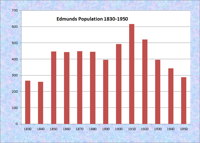
Population Trend 1830-2010
In addition, the Moosehorn National Wildlife Refuge (Edmunds Division) dominates the landscape in its southern portion.
Great Works Wildlife Management Area surrounds Great Works Pond in the west portion of the township.
According to the Bureau of US census, Edmunds is part of an unorganized territory with a total area 252 square miles. The territory (East Central Washington) comprises the six towns of T19 ED BPP, Berry, Marion, Edmunds, and Trescott. As of the census of 2000 (no 2010 data was available), there were 768 people, 315 households in the six-town census area. In 2000 the average population in the six townships was 128 people.
Edmunds is clearly a very small town. Even with a small population, Edmunds hosts Edmunds Consolidated School at 21 Harrison. According to https://www.niche.com/k12/edmunds-consolidated-school-edmunds-township-me/ Edmunds Consolidated School is an above average, public school has 63 students in grades PK, K-8 with a student-teacher ratio of 9 to 1.* The school is only one of three in Maine’s unorganized townships. The others are in Connor Township, and Kingman Township.
For a small community, Edmunds has several improved (paved) roads: Bunker Road off U.S. Route 1, Harrison Road, on which the school is located, and River Road which parallels the Dennys River.** U.S. Route 1 turns North in the town of Whiting, toward Cobscook Bay State Park.
Additional resources
*Niche.com was accessed on May 18, 2021. The Encyclopedia has no confirmation if its assessment.
** Thanks to Mark Azzara for pointing out errors in the original article.
The photos below were taken in 2004 in the Cobscook Bay State Park.
")
Cobscook Bay from the State Park in Edmunds TWP (2004)
")
Cobscook Bay from the State Park in Edmunds TWP (2004)
")
Cobscook Bay State Park in Edmunds Township (2004)
")
Shelter at Cobscook Bay State Park in Edmunds Township (2004)