Tremont

Bass Harbor Light with the Gott Islands across the Water (2003)

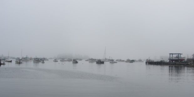
Tremont’s Bass Harbor is the terminal for the Swan’s Island ferry and the Frenchboro ferry. See photos. Located on Mount Desert Island, it also hosts a much photographed lighthouse on its rocky shore and two nature preserves. Tremont’s cove-rich shoreline abuts Blue Hill Bay, which includes the town’s Tinker and Hardwood islands, among others.

Trenton

Union River Bay from Bayside Road at Low Tide (2013)

South on Route 230 (Bayside Road) from Ellsworth, on the west shore of town, one notes the very modest houses on the inland side and the more substantial houses and cottages set back from the road on the Union Bay side. Route 3, the “Bar Harbor Road,” on the east side has a completely different character, featuring attractions for tourists bound for Acadia National Park, and the Hancock County – Bar Harbor Airport.

Troy

Classic Barn in Troy (2006)

Maine Route 220 joins U.S. Route 202/Maine Route 9 at Green’s Corner near the shore of Unity Pond. Carleton Pond, Bog, and Stream are accessible from Route 220 in the north end of town. The 1840 Troy Union Meeting House is a classic example of a type of meeting house or church in Maine in the four decades prior to the Civil War.

Turner

Sunset view from Lower Street (2004)

Turner (see photos and video) lies directly north of Auburn on Maine Route 4, and is served by routes 117 in the south and 219 in the north. South Turner is a smaller village near the Auburn city line. Bounded by the Androscoggin River on the east, Turner has its share of ponds, including Bear Pond and its amusement park.

Union

Union (see photos) became the subject of Ben Ames Williams’ historical novel Come Spring, which chronicles the early settlement of the town through the lives of the Robbins family, whose home is now that of the Vose Library and the Union Historical Society. Most of the 591-acre Crawford Pond and the 523-acre Seven Tree Pond are shared with Warren to the south.

Unity

is home to Unity College, a small liberal arts institution in a rural setting where the Common Ground Country Fair is held each fall. See photos. The main village is at the south end of the 2,528-acre Unity Pond, also known as Lake Winnecook.

Upton

This small community borders New Hampshire and Umbagog Lake that straddles the two states and is the source of the Androscoggin River. However, the river runs south through New Hampshire before entering Maine in Gilead. Upton is far from other sizable Maine towns on Maine Route 26 as it ends at the New Hampshire border.

Van Buren

Located across the St. John River from St. Leonard, New Brunswick, the town is at the junction of U.S. Routes 1 and 1A. See photos. Its economic development message is “Gateway to the St. John Valley.” Named for the eighth U.S. President, Martin Van Buren, the area was a haven for Acadians escaping the British oppression of 1755. In 1791 they settled near Keegan, a village just north of the main settlement. A model “Acadian Village” is near Keegan village.

Vanceboro

Sunset over Small Stream in Vanceboro (2013)

At the easternend of Maine Route 6, Vanceboro lies across the river from St. Croix, New Brunswick where 24-hour per day customs stations manage border crossings. See photos. A hill in the village overlooks the main street. With the large houses, the veterans hall and memorial, it appears to have been an important neighborhood in the history of Vanceboro. The local school of recent vintage is located there. Trains from Maine pass through Vanceboro to Canada.

Vassalboro

has sufficient space to support farming as well as serving as a residential area for people working in Augusta and Waterville. See video and photos. Benedict Arnold stopped here to obtain a canoe on his way to Quebec. Site of Oak Grove Seminary in 1844, then Oak Grove Coburn school in 1970, then the Maine Criminal Justice Academy in 2001.

Veazie

Veazie Dam on the Penobscot River (2003)

At only 3.4 square miles in area, Veazie is one of the smallest municipalities in the state. U.S. Route 2 is also its Main Street. Created in 1853, it was named, and likely created, for General Samuel Veazie who owned the saw mills and most of the property in the new town. Mills and a power station took advantage of the Penobscot River here.

Verona Island

is located on an island in the Penobscot River between the towns of Prospect and Bucksport. The Island is bounded by the Main and the Eastern Channels of the Penobscot. The Eastern is supplemented with the outlet of the Orland River. The old Waldo-Hancock Suspension Bridge provided the link from the Town of Prospect as U.S. Route 1 and Maine Route 3 pass through the town to Bucksport, then “Downeast” to Bar Harbor and Calais. The bridge was replaced by the new Penobscot Narrows Bridge in 2007.

Vienna

Castle Island Area in Vienna at Long Pond from the Castle Island Road (2012)

Year Population 1970 205 1980 454 1990 417 2000 527 2010 570 Geographic Data N. Latitude 44:33:17 W. Longitude 70:00:08 Maine House District 76 Maine Senate District 17 Congress District 1 Area sq. mi. (total)25.4 Area sq. mi. (land) 24.2 Population/sq.mi. (land) 23.6 County: Kennebec Total=land+water; Land=land only Castle Island Area in Vienna at Long…

Vinalhaven Island

Carver

The island town is home to two nature preserves, both managed by the Nature Conservancy. See photos. Granite quarrying was an important industry in the 19th and early 20th centuries, both on the main island and on nearby Hurricane Island, which is in the town of Vinalhaven. Now a community of summer residents and Maine residents, it is accessible by the State Ferry Service, which provides transportation, for passengers and vehicles, to and from Rockland.

Wade

Town of Wade on the North Side of the Aroostook River in South Wade (2015)

Once known as Garden Creek Plantation and Dunntown, Wade is just northwest of Presque Isle on the Aroostook River. North Wade is a small settlement on Maine Route 228 in the northeast corner of the township. The Aroostook River in Wade is part of one of Maine’s “Focus Areas of Statewide Ecological Significance.”

Waite

Logging Equipment and Trucking Company in Waite (2013)

Year Population 1970 70 1980 130 1990 119 2000 105 2010 101 Geographic Data N. Latitude 45:23:00 W. Longitude 67:38:00 Maine House District 141 Maine Senate District 6 Congress District 2 Area sq. mi. (total) 43.2 Area sq. mi. (land) 43.1 Population/sq.mi. (land) 2.3 County: Washington Total=land+water; Land=land only [WATE] is a town in Washington…

Waldo

Working Farm on the Waldo Station Road (2005)

Located just northwest of Belfast, the town (see photos) is served by Maine Routes 7, 131, 137 and 203. The Belfast and Moosehead Lake Railway passes through to its terminus in Belfast. The Railway runs summer service between Unity Station and Belfast for sightseeing and “just for fun.”

Wales

Rolling Hills in Rural Wales (2002)

The early settlers arrived in about 1773, some of whom came from Wales in Britain. See photos.The gentle hills in the town reflect the landscape of the old country. With access to Sabattus Pond, the town is within easy reach of Lewiston-Auburn via Maine Route 132, and of Gardiner by way of Routes 9 and 126.