Location Map Bowtown TWP

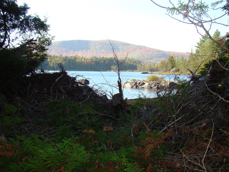
Pierce Pond Stream in Bowtown
Bowtown Township is bound by the Kennebec River on the east for six miles, across the river from The Forks, and by the Dead River on the north. Dead River Mountain and Otter Pond Mountain reside within the township.
Known as T1 R4 BKP WKR township, it was organized as a plantation November 2, 1840. Apparently optimistic estimates of a population explosion did not pan out.
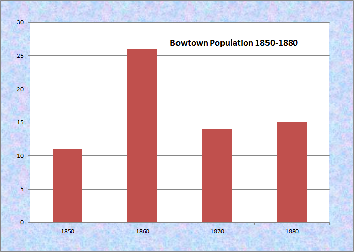
Population Trend 1850-1880
After the peak population of 25 in 1860 slid to 15 in 1880, Bowtown reverted to township status sometime before the 1890 U.S. census and has remained so since.
It has four small ponds (King, Moose, North Otter, and Otter), and several streams that join the Kennebec at various intervals.
Bowtown is directly north of Carrying Place Township, host to the next northerly section of the Appalachian Trail. The mile and a half portion of the trail, easily missed from the narrow rough road, barely remains inside the southern boundary of the township before it follows Pierce Pond Stream south into Carrying Place Township.

The Trail from Pierce Pond

AT Directional Signs

The Trail to the Kennebec

Otter Pond Stream . . .

Two Views of Otter Pond Stream

Crossing a Stream
Stream crossing and Otter Pond Stream photos courtesy of Brady G. Williams 2007.
![]() <= South Appalachian Trail – click a boot North
<= South Appalachian Trail – click a boot North ![]() =>
=>
Are they building a camp on north otter pond
yes we are rebuilding the sporting camps that have been in existence since 1902