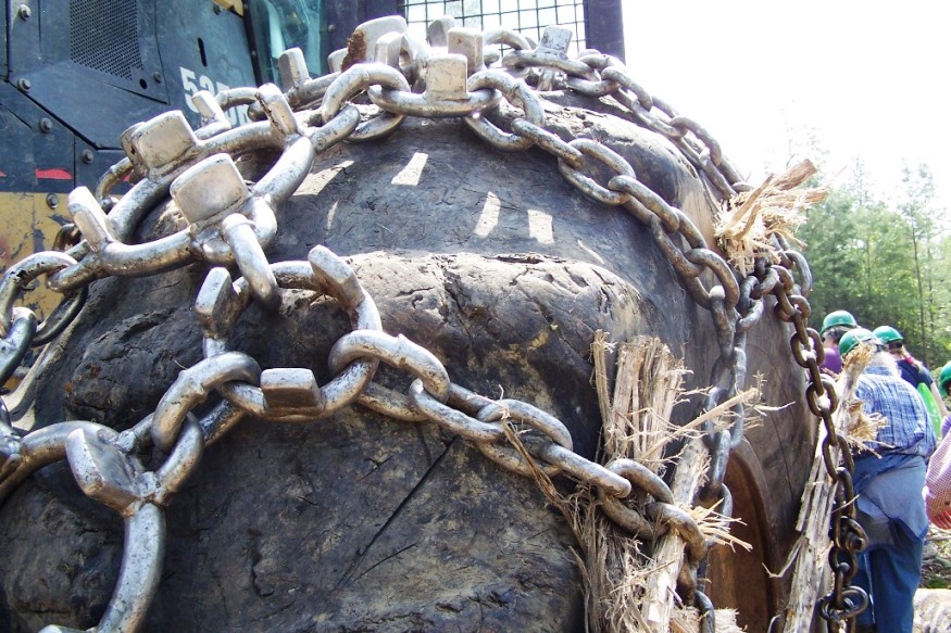
Skidder with baloon tires and chains at logging operation on Plum Creek land in Bowerbank (2010)

Location Map for Bowerbank
| Year | Population |
|---|---|
| 1970 | 29 |
| 1980 | 27 |
| 1990 | 72 |
| 2000 | 123 |
| 2010 | 116 |
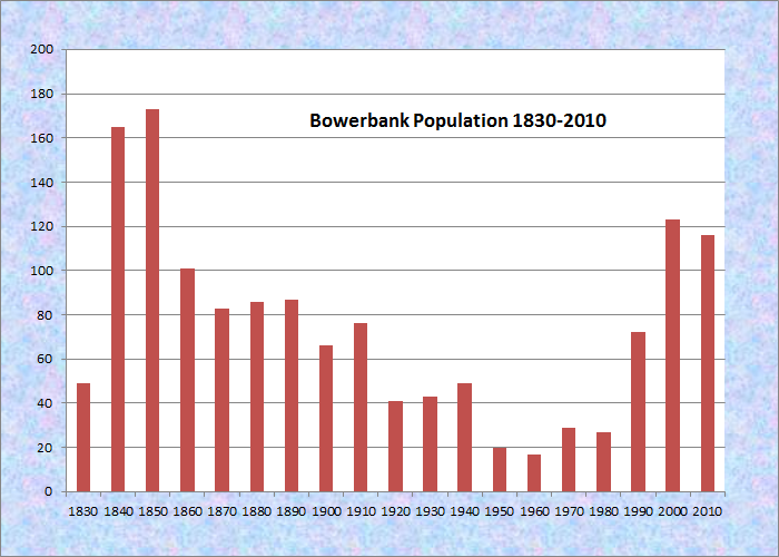
Population Trend 1830-2010
| Geographic Data | |
|---|---|
| N. Latitude | 45:18:50 |
| W. Longitude | 69:15:26 |
| Maine House | District 119 |
| Maine Senate | District 4 |
| Congress | District 2 |
| Area sq. mi. | (total) 47.3 |
| Area sq. mi. | (land) 41.7 |
| Population/sq.mi. | (land) 52.5 |
County: Piscataquis
Total=land+water; Land=land only |
|
[BOW-ehr-bank] is a town in Piscataquis County, incorporated on March 4, 1839 from the townshipT7 R8 NWP and named for a London merchant, the first owner.*
It surrendered its incorporation on February 16, 1869, and was incorporated again on February 28, 1907. Its annexation of land in 1927 from Sebec completed its boundary configuration.
")
Timber Harvest Buffer Zone Map (2013)
The Maine Forest Service map at right outlines in pink the 250-foot buffer around water bodies in which timber harvesting is restricted.1
Bowerbank village is at the lower right on the map along the Bowerbank Road. (click to enlarge map)
The large waterbody is Sebec Lake. Newell Cove is near the village.
Here are some observations of George Varney in his 1886 Gazetteer:
About one-third of its soil is suitable for cultivation, and some parts have proved highly productive. Mill Brook, the principal stream, has a saw mill and a grist mill.
Mr. Bowerbank, a London merchant, was the first owner of the township who took effective steps to procure its settlement. The first actual settler was a Mr. Robinson, who put up a framed house and barn in 1825, and married and moved in in 1826. William Newell, a blacksmith from Hallowell, was next . . . .
Bowerbank village, accessible from Sebec, has substantial frontage on Sebec Lake.
The Montreal, Maine, and Atlantic Railway tracks span the northern portion of the township, eventually arriving at Brownville Junction.
")
Skidder Hauling Logs to the Roadside (2010)
The large Maine landowner Plum Creek has substantial ownership in Bowerbank.
Harvesting the forests with modern machinery is a spectacular sight, as the video below attests. See another logging video.
Form of Government: Town Meeting-Select Board.
More Videos!
Additional resources
*See Glossary, source number 7.
1 Maine. Department of Agriculture and Conservation. Maine Forest Service. “Statewide Standards for Timber Harvesting in the Shoreland Area Map” for Bowerbank. http://www.maine.gov/dacf/mfs/policy_management/water_resources/sws/maps/tabloid/SWS_tabloid__Bowerbank.pdf (accessed March 5, 2014)
Varney, George J. A Gazetteer of the State of Maine. 1886. p. 126.