[T8 R10 NWP] is located immediately east of Greenville, accessible from that town’s East Road, then the K1 Road which travels through the township to Gulf Hagas. The K1 road is private and travelers must stop at the North Maine Woods Hedgehog checkpoint on the way to Little Lyford Ponds and Katahdin Iron Works. See Bowdoin College Grant East Township.


In 2003 the Appalachian Mountain Club bought nearly 37,000 acres in the area, including the northern reaches of township. The AMC now owns all or portions of Baker, Elephant and Indian mountains here. AMC has part of the land in timber production to support logging and the local forest products economy. In July of 2010 a group of teachers toured AMC’s forest management area, meeting one of the well-known Pelletier brothers in the process.

Rudy Pelletier Explains Harvesting Operations


Trees Marked for Harvesting

Huge Log Mover-Loader

Observing the Process

Go-anywhere Log Hauler
")
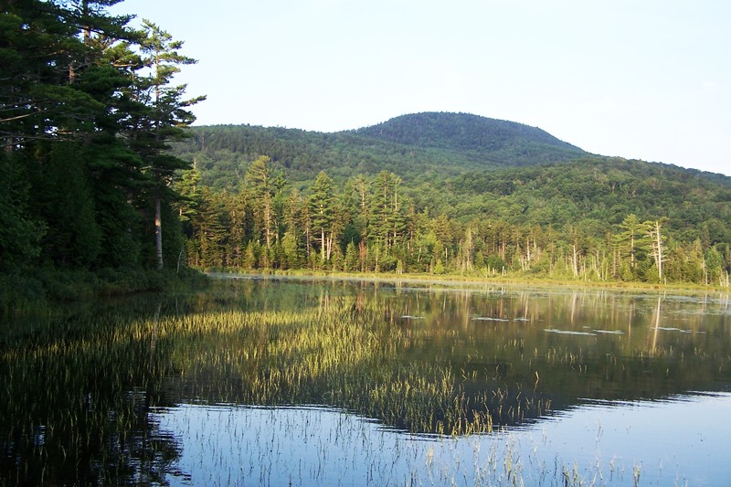
Elephant Mountain from the Access Road (2011)
Elephant Mountain, in the northwest of the township, is the site of the January 24, 1963 crash of a B-52 bomber based at Westover Air Force Base in Massachusetts. The site has been preserved as a memorial to the nine member crew, seven of whom died in the crash.
The site is accessible on unimproved roads from Greenville beginning on the Elephant Mountain Trail off the Lily Bay Road, or from Beaver Cove on the Prong Pond Road off the Lily Bay Road. Both join at the boundary of Greenville and the Township forming the single access road to the site. It is reasonably well marked with directional signs, though a GPS unit would be helpful.
 N45° 31' 29.0\" W69° 28' 59.1\"")
Directional sign to the Crash Site (2011) @
 N45° 31' 29.0\" W69° 28' 59.1\"")
Kiosk with Directional and Informational Signs (2011) @
 N45° 31' 40.6\" W69° 26' 4.3\"")
Entrance to the Crash Site on Elephant Mountain (2011)
 N45° 31' 40.6\" W69° 26' 4.3\"")
Strategic Air Command Sign (2011) @
 N45° 31' 34.6\" W69° 26' 0.4\"")
Debris and Memorial (2011) @
 N45° 31' 34.6\" W69° 26' 0.4\"")
Landing Wheels at the Crash Site (2011)
Visitors are urged not to remove or relocate items of debris. The vegetation at the site is returning to its natural state after being leveled by the crash.
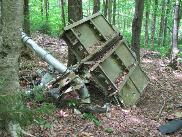
Debris at the 1963 B-52 crash site on Elephant Mountain
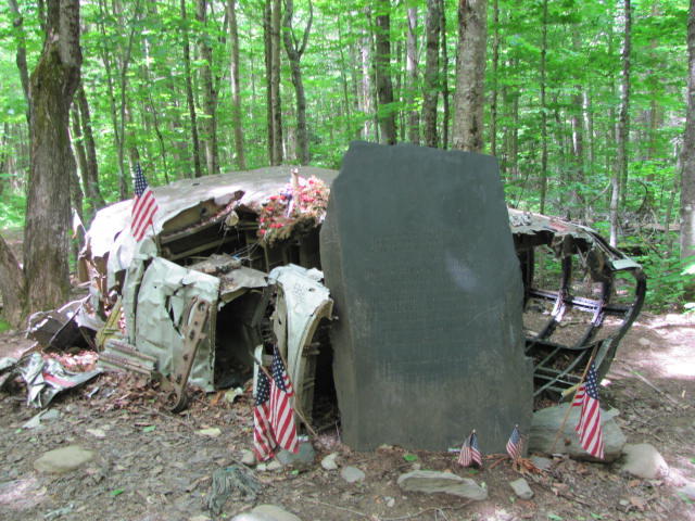
Stone memorial for the crew members who died in the 1963 B-52 crash on Elephant Mountain