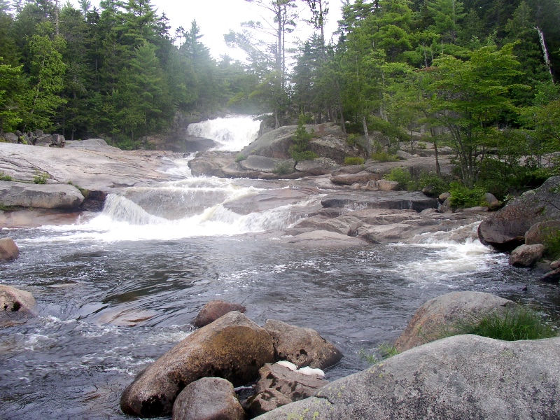
Big Niagara Falls on Nesowadnehunk Stream in T3 R10 WELS in Baxter Park (2004)

Location Map for Baxter State Park
At night, he saw the stars in the sky in their fixed positions and the crescent of the moon floating like a boat in the blue. He saw trees, stars, animals, clouds, rainbows, rocks, herbs, flowers, stream and river, the glistening dew in the bushes in the morning, distant high mountains which were blue and pale, birds sang and bees, wind silverishly blew through the rice-field. – Siddartha, Hermann Hesse
The Park is a 202,733 acre area operated and maintained for the use and enjoyment of the people of Maine in accordance with the wishes of its donor Percival P. Baxter. It is the largest acreage east of the Mississippi River devoted solely to wilderness uses. The park hosts the final ten miles of the northern end of the Appalachian Trail.
A three-member Authority and a Director govern the Park, administered separately from other state parks. The members of the Baxter Park Authority are the Attorney General, the Director of the Bureau of Forestry, and the Commissioner of Inland Fisheries and Wildlife. They make policy based not only on the Director’s recommendations and public requests, but on guidelines set forth by Percival Baxter.
While some of his intentions are clear, others are not. A substantial literature of Baxter’s writings and statements, along with interpretations offered by others, are often consulted, especially in controversial situations. The Authority, in its annual report, has quoted Baxter’s desire that the park ” . . . shall forever be retained and used for state forest, public park and public recreational purposes . . . shall forever be kept and remain in the natural wild state . . . shall forever be kept and remain as a sanctuary for beasts and birds.”
")
South Entrance Gate (2001)
The Park hosts approximately 80,000 people each summer and nearly 2,000 during the winter season. With an average stay of just under three days, the summer total of visitor-days had been over 100,000 but has declined in recent years. The number of visitor-days is limited to minimize the human impact on the park. Ten campgrounds are located within the Park, along with numerous out-lying sites offering basic overnight facilities.

Relief Map of Baxter State Park
Mount Katahdin is the centerpiece attracting most visitors with hiking trails leading to the summit from the major Campgrounds.
")
Youngsters on a Hike (c. 1940)
During the 1930’s, the Civilian Conservation Corps workers from Camp Millinocket worked on access roads in the Mount Katahdin region, including a gravel road from Lake Ambejejus northward between the Togue Ponds and Windy Pitch on the east side of Katahdin.
Baxter Park operates on fees from visitors and income from a trust fund. No state or federal taxes support its operations.
")
Plaque, at Chimney Pond, Commemorating Baxter’s Gift of the Park (2001)
After failing to convince the legislature to buy the area surrounding Mount Katahdin during his two terms as governor, Baxter purchased 6,690 acres around the mountain in 1930. He gave this land to the people on the condition that it “be forever left in its natural wild state, forever to be kept as a sanctuary for wild beasts and birds, and forever to be used for public forest, public park, and public recreational purposes.” Until his death in 1969, Baxter purchased and deeded to the state the remaining tracts of land which make up the park today with the exception of a recently acquired parcel of approximately 1,000 acres.
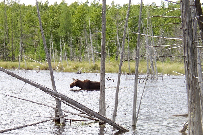
Moose in Stump Pond in Baxter State Park (2004)
More Videos!
Additional resources
")
Painted Rock Near the Park Entrance (1999)
Clark, Stephen. Baxter Park and Katahdin. Compiled and published by Stephen Clark from U.S.G.S. base maps. 1977. [University of Maine, Raymond H. Fogler Library, Special Collections]
Clark, Stephen. Katahdin: A Guide to Baxter Park & Katahdin. Shapleigh, Me. Clark Books. 2009.
Hakola. John W. Legacy of a Lifetime: The Story of Baxter State Park. Woolwich, Me. TBW Books. c1981.
Scee, Trudy Irene. In the Deeds We Trust: Baxter State Park, 1970-1994. Standish, Me. Tower Publishing. 1999.
Villani, Robert. Forever Wild: Maine’s Magnificent Baxter State Park. Camden, Me. Down East Books. c1991.
Whitcomb, Howard R. Governor Baxter’s Magnificent Obsession: a Documentary History of Baxter State Park 1931-2006. Bangor, Me. Friends of Baxter State Park. 2008.
I am interested in a list of the directors of BSP
Check the Baxter Park Headquarters site: http://www.baxterstateparkauthority.com/about/BSPadvisory.htm