 N44° 41' 16.65\" W70° 28' 6.90\"")
Mount Blue and Webb Lake in Weld (2017)

Location Map for Avon
| Year | Population |
|---|---|
| 1970 | 495 |
| 1980 | 475 |
| 1990 | 559 |
| 2000 | 504 |
| 2010 | 461 |
| Geographic Data | |
|---|---|
| N. Latitude | 44:46:08 |
| W. Longitude | 70:18:50 |
| Maine House | District 112 |
| Maine Senate | District 17 |
| Congress | District 2 |
| Area sq. mi. | (total) 41.5 |
| Area sq. mi. | (land) 41.3 |
| Population/sq.mi. | (land) 11.2 |
County: Franklin
Total=land+water; Land=land only |
|
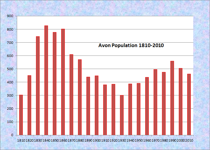
Population Trend 1810-2010
 N44° 48' 53.14\" W70° 20' 32.15\"")
[AA-von] is a town in Franklin County, named for the river in England and incorporated on February 22, 1802 from Township 02 AP. In 1853 it ceded land to the nearby town of Strong.
Settled soon after the American Revolution, the first to arrive were Captains Joshua Soule and Perkins Allen. In 1886 Avon had two saw mills and eleven public schools, supported by an 1880 census population 0f 571 residents.
3,187-foot Mount Blue is located in the southwest corner of the town in Mount Blue State Park, the major portion of which is in the adjoining town of Weld. The Fly Rod Crosby Trail, still in development in 2017, crosses Route 4 near the Sandy River.
")
Town Facilities Area (2017)
Commenting on the geology of Maine in his 1886 Gazetteer, George Varney observed
. . . the familiar rocks of mounts Abraham and Blue are recognized among the boulders of Kennebec county. . . . We can usually trace them for one hundred and fifty miles from their source. In the east part of Avon is a boulder of granite which measures 30 by 20 by 15 feet, equal to 9,000 cubic feet, and 643 tons in weight. It was probably derived from the Mount Abraham range of mountains, several miles north.
")
Municipal Building (2017)
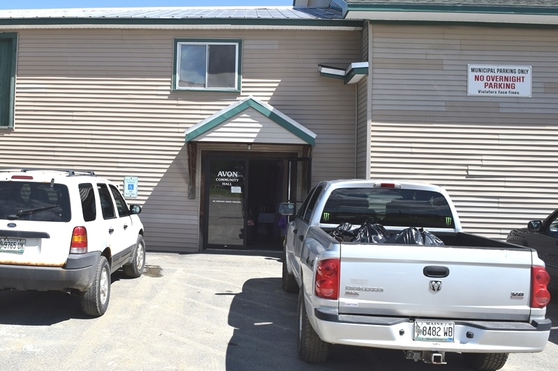
Avon Community Hall (2017)
")
Lindbergh Airport (2017)
")
Lindbergh Airport (2017)
Lindbergh Airport is near the Municipal Building at N44° 48′ 50.33″ W70° 20′ 36.67″. Avon’s settlement is scattered along the Sandy River between Phillips and Strong, with State routes 4 and 149 on each side of the river. The narrow gauge Sandy River and Rangeley Lakes Railroad once passed through, following the river valley, from Farmington to Phillips and beyond.
A section of Sandy River canoe trips passes through the town.
")
The Sandy River along Route 4 in Avon (2005)
 N44° 48' 55.3\" W70° 20' 13.8\"")
Sandy River in Avon (2013) @
 N44° 48' 17.9\" W70° 18' 45.3\"")
Sandy River in Avon (2013) @
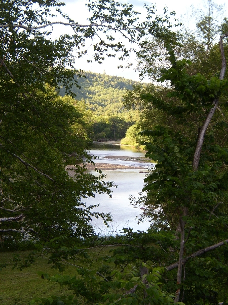
The Sandy River along Route 4 in Avon (2005)
")
A Riot of Lupine in Avon (2005)
Form of Government: Town Meeting-Select Board.
Additional resources
Historical Records Survey (Maine). Inventory of the town and city archives of Maine: no. 4 Franklin County, vols. I & II, Avon and Berlin. Portland, Me. The Project. 1939.
Varney, George J. A Gazetteer of the State of Maine. 1886. p. 22, 93.