
The Counties and Baxter Park
the rooftop of Maine –John Steinbeck
 Maine’s northernmost county, known as “the County” to its residents, is the state’s largest in area. It was established on May 1, 1839, in the midst of the dispute known as the “Aroostook War,” and 187 years after the creation of the first Maine County, York. See an 1899 map of the county area in the Map Cabinet.
Aroostook County is almost twice the size of the states of Rhode Island and Delaware together, and larger than the state of Connecticut. It is two-thirds the size of New Hampshire and of Vermont.
")
Aroostook County Courthouse, Houlton (Erik Jorgensen photo)
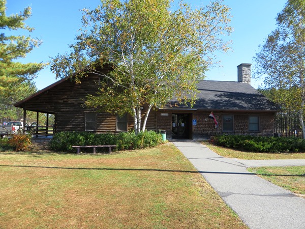
Maine Visitors Center in Houlton (2014)
Houlton is the county seat, or shire town, where county government resides, including the sheriff’s office, the county jail, other county offices and the historic courthouse. The county Registry of Deeds maintains offices in Houlton and in the northern town of Fort Kent. It is also the site of a State of Maine Visitors Center where Canadian tourists and others traveling north through the county find information about the state and “The County.”
Presque Isle, the largest city, hosts a branch of the University of Maine and is a major commercial center. It is also the center of a model of the Solar System created by the University of Maine at Presque Isle, with local construction to create scale models of the sun and its planets.
After a trip north on Interstate I 95, one exits to Houlton, the home to the “dwarf planet” Pluto at the Houlton Information Center. Most of the remainder of the physical scale models follow U.S. Route 1 and U.S. Route 1A. For guidance on driving the solar system
See The Maine Solar System Model

Farms in Sherman along the Golden Ridge Road
Famed for its potato growing, the County’s premiere crop has declined steadily, as has its population. Nevertheless, agriculture still dominates the County’s economy and its culture. Farm stands are frequent along U.S. Routes 1 and 1A, the major north-south highways.

Farm stand on U.S. Route 1
The large tracts of land with both forests and open spaces have attracted snowmobile enthusiasts each winter as thousands ply the hundreds of miles of trails leading all across the County and connecting to state-wide routes. The fall attracts sports looking for deer, moose and bear; spring and summer brings fishermen for the county’s many lakes, pond, brooks, streams and rivers.
Three historic granite monuments once, used to calibrate land surveying equipment, were discovered in 2022 in 2022 in Southern Aroostook . Known as the Aroostook County Meridian Line. Ther were set in a straight line about 25 feet apart to calibrate compasses. The monuments were established in 1869 under Maine Law. Three other such monuments have been found monuments are in Ellsworth, Orrington and Belfast. A notice on a utility pole in Sherman (Southern Aroostook) refers to a”nearby Surver Marker.”
| People QuickFacts | Aroostook County | Maine | |
|---|---|---|---|
| Population, 2009 estimate | 71,488 | 1,318,301 | |
| Population, percent change, April 1, 2000 to July 1, 2009 | -3.3% | 3.4% | |
| Population estimates base (April 1) 2000 | 73,940 | 1,274,915 | |
| Persons under 5 years old, percent, 2009 | 5.0% | 5.4% | |
| Persons under 18 years old, percent, 2009 | 20.1% | 20.6% | |
| Persons 65 years old and over, percent, 2009 | 18.4% | 15.6% | |
| Female persons, percent, 2009 | 51.2% | 51.2% | |
| White persons, percent, 2009 (a) | 96.1% | 96.1% | |
| Black persons, percent, 2009 (a) | 0.7% | 1.2% | |
| American Indian and Alaska Native persons, percent, 2009 (a) | 1.5% | 0.6% | |
| Asians percent, 2009 (a) | 0.7% | 1.0% | |
| Native Hawaiian and Other Pacific Islander, percent, 2009 (a) | Z | Z | |
| Persons reporting two or more races, percent, 2009 | 0.9% | 1.1% | |
| Persons of Hispanic or Latino origin, percent, 2009 (b) | 1.3% | 1.4% | |
| White persons not Hispanic, percent, 2009 | 95.0% | 94.9% | |
| Living in same house in 1995 and 2000, pct 5 yrs old & over | 67.8% | 59.6% | |
| Foreign born persons, percent, 2000 | 5.8% | 2.9% | |
| Language other than English spoken at home, age 5+, 2000 | 24.1% | 7.8% | |
| High school graduates, age 25+, 2000 | 76.9% | 85.4% | |
| Bachelor’s degree or higher, age 25+, 2000 | 14.6% | 22.9% | |
| Persons with a disability, age 5+, 2000 | 17,438 | 237,910 | |
| Mean time to get to work (minutes), workers age 16+, 2000 | 18.3 | 22.7 | |
| Housing units, 2009 | 39,586 | 704,578 | |
| Homeownership rate, 2000 | 73.0% | 71.6% | |
| Housing units in multi-unit structures, percent, 2000 | 18.2% | 20.3% | |
| Median value of owner-occupied housing units, 2000 | $60,200 | $98,700 | |
| Households, 2000 | 30,356 | 518,200 | |
| Persons per household, 2000 | 2.36 | 2.39 | |
| Median household income, 2008 | $36,107 | $46,419 | |
| Per capita money income, 1999 | $15,033 | $19,533 | |
| Persons below poverty level, 2008 | 15.2% | 12.6% | |
| Business QuickFacts | Aroostook County | Maine | |
|---|---|---|---|
| Private nonfarm establishments, 2008 | 2,124 | 41,7551 | |
| Private nonfarm employment, 2008 | 24,182 | 509,0931 | |
| Private nonfarm employment, percent change 2000-2008 | -3.4% | 3.5%1 | |
| Nonemployer establishments, 2008 | 4,613 | 113,522 | |
| Total number of firms, 2002 | 6,054 | 135,410 | |
| Black-owned firms, percent, 2002 | F | 0.2% | |
| American Indian and Alaska Native owned firms, percent, 2002 | F | 0.5% | |
| Asian-owned firms, percent, 2002 | F | 0.6% | |
| Hispanic-owned forms | F | 0.5% | |
| Women-owned firms, percent, 2002 | 15.0% | 24.0% | |
| Manufacturers shipments, 2002 ($1000) | 1,095,667 | 13,851,915 | |
| Wholesale trade sales, 2002 ($1000) | 239,166 | 10,371,084 | |
| Retail sales 2002 ($1000) | 729,225 | 16,053,515 | |
| Retail sales per capita, 2002 | $9,969 | $12,370 | |
| Accommodation and foodservices sales, 2002 ($1000) | 54,698 | 2,045,841 | |
| Building permits, 2009 | 132 | 3,1211 | |
| Federal spending, 2008 | 771,985 | 11,974,3611 | |
| Geography QuickFacts | Aroostook County | Maine | |
|---|---|---|---|
| Land area, 2000 (square miles) | 6,671.54 | 30,861.55 | |
| Persons per square mile, 2000 | 11.1 | 41.3 | |
| FIPS Code | 003 | 23 | |
| Metropolitan or Micropolitan Statistical Area | None |
U.S. Census Table Notes: F=fewer than 100 firms; S=supressed, data does not meet publication standards.Z=greater than zero, but less than 1/2 percent.
Source: http://quickfacts.census.gov/qfd/states/23/23003.html (accessed February 23, 2011)
Additional resources
Aroostook County, 1920s. (moving image)
Assignment in Aroostook. (moving image)
Aroostook County, One Hundred Years Old. Houlton, Me. Houlton Pioneer Times. 1939.
Aroostook Reflections. Edited by Oscar Nelder. Presque Isle, Me. Polar Star Associates. 1980.
Grant, Rena V. Three Men from Aroostook: The Story of the Hardison Family. Berkeley, CA. Brazelton-Hanscom. c1963.
Made in Maine: Aroostook County. [moving imahe recording] Lewiston, Me. Maine Public Broadcasting. c1999.
Maine. Dept. of Economic Development. Aroostook County, Maine: Industrial Fact Book. Augusta. 1960. 1965.
Maine Men and Women in Southern California: a volume regarding the lives of Maine men and women of note and substantial achievement, as well as those of a younger generation whose careers are certain, yet still in the making. Edited by Florence Collins Porter, Helen Brown Trask. Los Angeles, California. Kingsley, Mason & Collins, 1913.
Steinbeck, John. Travels with Charley, p. 63.
The Aroostook Scene. Presque Isle. Polar Star Associates. 1978.
The Sesquicentennial Souvenir Booklet Celebrating the 150th birthday, 1839-1989: Aroostook County, Maine. Presque Isle, Me. The Friends. 1989.
True North: Aroostook County. [moving image recording] Lewiston, Me. Maine Public Broadcasting. c1999.
Turner, Philip B. Affie: A Story About the People Who Were the Aroostook Federation of Farmers. Madawaska, Me. St. John Valley Times. The Author. c1983.
Wilson, Charles Morrow. Aroostook: Our Last Frontier: Maine’s Picturesque Potato Empire. Brattleboro, Vt. Stephen Daye Press. c1937.