
Location Map for Abbot
| Year | Population |
|---|---|
| 1970 | 453 |
| 1980 | 576 |
| 1990 | 677 |
| 2000 | 630 |
| 2010 | 630 |
| Geographic Data | |
|---|---|
| N. Latitude | 45:10:48 |
| W. Latitude | 69:28:05 |
| Maine House | District 119 |
| Maine Senate | District 4 |
| Congressional | District 2 |
| Area sq. mi. | (total) 35.5 |
| Area sq. mi. | (land) 34.7 |
| Population/sq.mi. | (land) 18.1 |
County: Piscataquis
Total=land+water; Land=land only |
|

Population Trend 1830-2010

Sign: “Welcome to Abbot. Maine’s #1 Town”
[AB-bot] is a town in Piscataquis County, incorporated on January 31, 1827.
It was one of several tracts granted to Bowdoin College in 1794 and was named for the College’s treasurer, John Abbott. (The final “t” in the town’s name seems to have been lost over the years.)
 N45° 10' 60.00\" W69° 27' 6.00\"")
Abbot Civil War Memorial and Knights of Pythias Hall, now historical museum (2011) @
By 1874 the railroad had connected the town to Bangor, boosting its economy.
In the 1870’s the town was prospering with two railway stations [photos below]and that rail link to Bangor. Two covered bridges spanned the Piscataquis River.
Five generations of Abbotts managed the Amos Abbott Company Mill in nearby Dexter,” according to Brunelle, p. 67.
")
Kingsbury Stream at Abbot Village (2002 photo)
")
Water Power on Kingsbury Stream (1949) *
Abraham Moore was the legendary original settler in 1805, selling his farm in Norridgewock for 800 acres of wild land. In 1806 he planted a crop and built a log house and moved his family to the house in 1807.
Then known as Moorestown, by 1810 it had 45 residents. Moore erected a sawmill on the Piscataquis River in its northwest corner. By 1830 the populated swelled to over 400 and peaked at nearly 800 in 1860.
As did many towns, it lost residents after the Civil War as the American West beckoned settlers. Thereafter the drift was generally downward until a rebound in the 1960s was recorded in the 1970 U.S. Census.
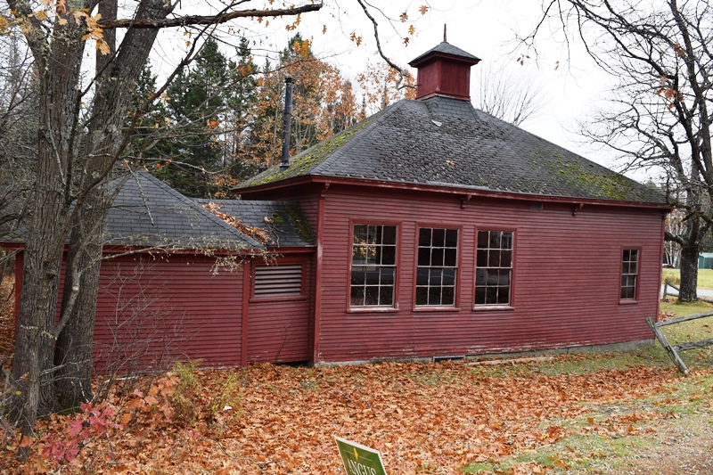
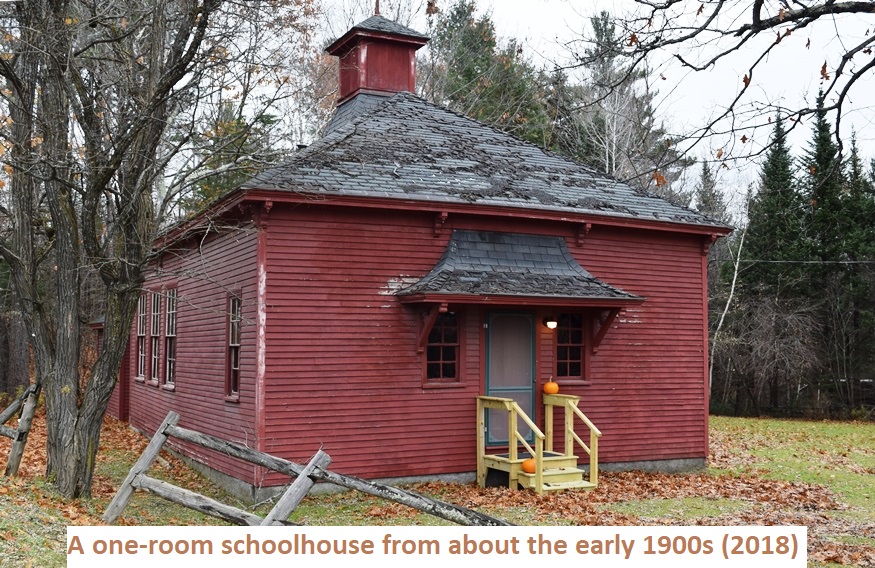
A one-room schoolhouse dating from about the early 1900s. (2018)

A one-room schoolhouse dating from about the early 1900s. (2018)
Washington School building above (named for Martha, not George!) was used for a school until the 1950’s and since has been a 4-H club house, and town voting place.
According to A Gazetteer of the State of Maine, in 1881: “At Abbot village there are a lumber, excelsior and spool mills, a grist mill, a furniture and pump factory and a brick yard. There are also one or more lumber mills in other parts of town.”
ABBOT VILLAGE
")
Abbot Village Post Office (2002)
")
Maine House/Home Furnishing (2010)
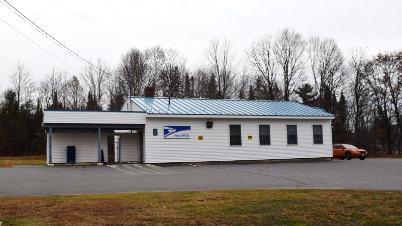
Abbot Post Office (2018)
The village is the only densely populated location in the town of Abbot. It straddles Kingsbury Stream, which merges with the nearby the Piscataquis River. At the junction of Maine route 16 and combined routes 6 and 15, it hosts the only U.S. Post Office in the town.
Form of Government: Town Meeting-Select Board.
")
Abbot Free Evangelic Church (2010)

1842 House in Abbot Village
Abbot township contains three modest ponds. Piper Pond in the northwest corner is the largest at 420 acres with a maximum depth of 55 feet, with a two-mile length north to south. The shoreline is highly developed with private camps, accessible over a paved road, with a public launching site on the north end. Brook trout and splake are the primary fisheries.
")
At 27 acres Greenleaf Pond features brook trout, yellow perch, and chain pickerel. Greenleaf Pond, located just to the east of Abbot Village, is surrounded by hardwood forest. Most of the shoreline consists of gravel and rocks, with only a few sandy areas.
Finally, there is the two-acre Drummond Pond, a kids friendly fishing place. Usually stocked just before the ice forms in the fall. Just off 33 Main Road (Route 6) in Abbot Village.
Videos!
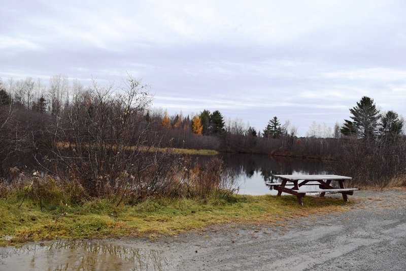
Drummond Pond in Abbot off Main Road (2018)
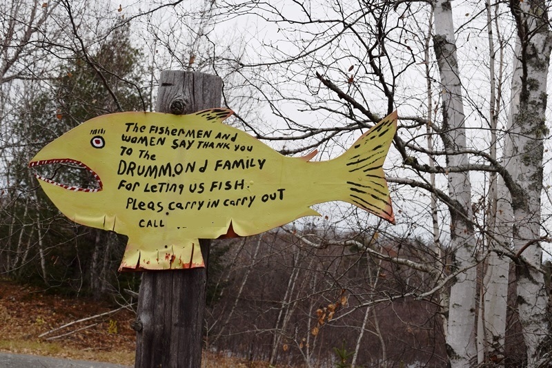
Thank you sign at Drummond Pond (2018)
Additional resources
Centeseptquinary History of Abbot, Maine 1827-2002. Greenville, Me. Moosehead Communications. 2003.
Bennett, Wayne E. Abbot Maine Civil War Sailor Allen Woods Remembered: The Long Search for a Forgotten Son of the State of Maine. Abbot, Me. Abbot Historical Society. 2008. [Mr. Bennett is also the source for background on the Washington School.]
Bennett, Wayne E. Abbot, Maine in the Civil War. Guilford, Me. W. E. Bennett. 2001.
Brunelle, Jim. Maine Almanac.
*Eaton, Franklin Mill Dam on Kingsbury Stream (1949) Image courtesy of Special Collections, Raymond H. Fogler Library, DigitalCommons@UMaine,
https://digitalcommons.library.umaine.edu/spec_photos/2741
Maine. Department of Inland Fisheries and Wildlife.
Drummond Pond. https://www.maine.gov/ifw/news-events/single-release.html?id=610888 (2013)
“Greenleaf Pond.” www11.maine.gov/…/lake-survey-maps/piscataquis/greenleaf_pond.pdf (1969 survey)
“Piper Pond. ” http://www11.maine.gov/ifw/docs/lake-survey-maps/piscataquis/piper_pond.pdf (1988 survey)
Varney, George J. A Gazetteer of the State of Maine. 1881. p. 63-64. (source of 1810 population data)